Elevation: 7,780 ft
Prominence: 300
This peak is not in the book. There are a lot of options to reach this summit set out below. Margo Mandella is the author of the original entry which she climbed while making a three peak loop. I added a route starting on Pine Creek Pass. Livingston Douglas added a new route and access point as part of a two peak adventure. Livingston points out that the actual high point is the northeast summit, which he measured at a full 15 feet higher than the cairned summit on the main ridge crest. Updated January 2023
Squirrel Mountain by Margo Mandella
Squirrel Mountain is located on the southeast side of the Big Hole Mountains. The summit is located just off the boundary of Teton County and Bonneville County on the Teton County side. USGS Fourth of July Peak
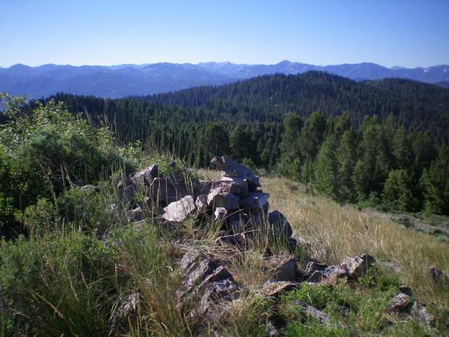
The summit of Squirrel Mountain. Steve Mandella Photo
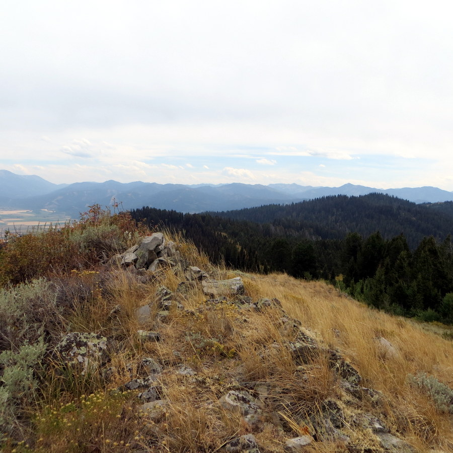
The summit is not particularly distinct and you could easily walk by it or convince yourself that there is a different high point several yards away. However, it is the location shown in the photo.
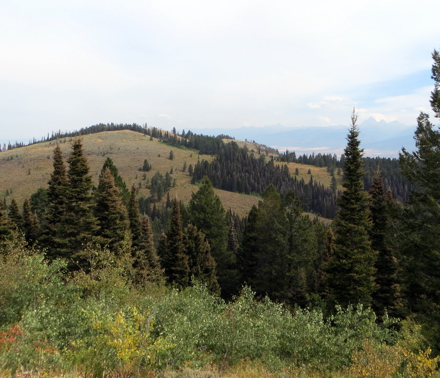
We climbed Peak 7834, Peak 7906, and Squirrel Mountain, in that order, as a loop from the east via Drake Creek, as shown in the GPS track below. However, the Grove Creek trail, a little farther north of Drake Creek, provides more direct access to Squirrel Mountain if that is your only destination.
Squirrel Mountain From Grove Creek
From Victor, Idaho, travel west on ID-31 to W 9000 South. Turn north on South 4500 West and continue to Grove Creek Road. Use FST-546, which will become FST-237, to begin your hike.

Squirrel Mountain from Peak 7906. Steve Mandella photo.
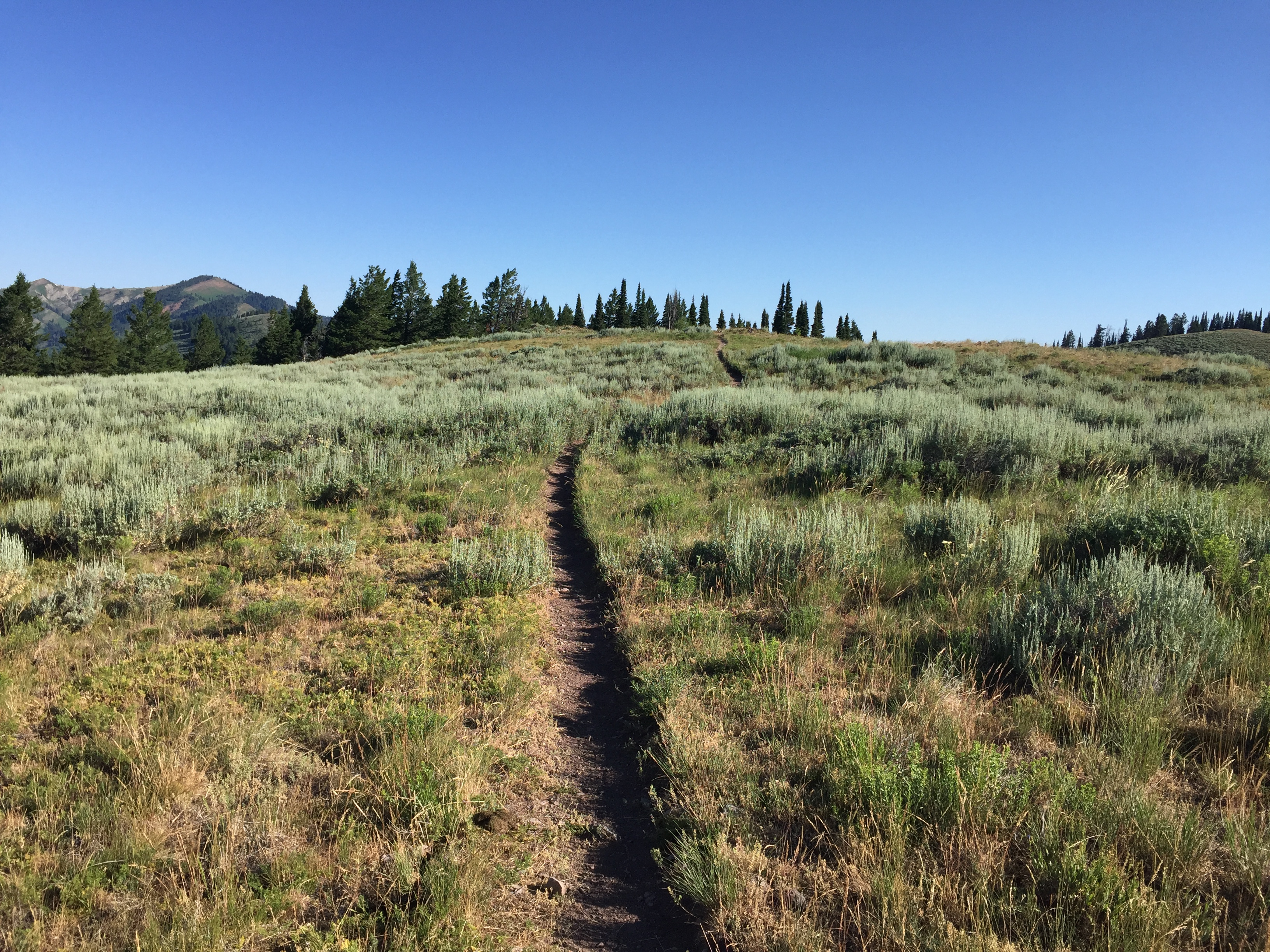
Ascend the trail westward until you encounter the Big Hole Crest Trail/FST-217 which runs north and south. Turn north and follow the trail to its intersection at a saddle with the Corral Crest Trail/FST-076/FST-240.
Here you will see a false trail that begins an ascent to a hill on the East Side of a fence. Avoid this spur and stay on FST-217, which traverses the hill and stays left of the fence. Proceed upward until you see what appears to be the high point (shown in the photo). The summit shown in the photo lies east of the fence. There is no cairn or register. These trails are well-used and popular.
3-Peak Loop, Class 2
Our 3-peak route, shown in the GPS track below, I don’t fully recommend, but I am providing the information, with tips, to help you plan a better version of this loop.
From Victor, Idaho, travel west on ID-31 to W 9000 South. Turn on W 9000 South and continue westward until you can travel no farther and park. Use FST-548 and hike westward as it turns into FST-238 until you reach the Big Hole Crest Trail/FST-217. Turn north and follow the trail to the top of the next hill. Here, you will see a short trail to the west that takes you to the cairn for the summit of Peak 7834.
Get back on FST-217 and continue to the north as the trail descends to a saddle where you will reach a junction of the Big Hole Crest Trail/FST-217 [which continues north to Squirrel Mountain] with the Corral Crest Trail/FST-076/FST-240 which goes west toward Peak 7906. We proceeded to Peak 7906 first and then to Squirrel Mountain but, instead, I will describe what we should have done and save you from some serious, steep bushwhacking.
Continue on the Big Hole Crest Trail/FST-217 to the summit of Squirrel Mountain, as described in the previous section. Then drop off the west slope of Squirrel Mountain toward Peak 7906 until you reach the base of Squirrel Mountain. You should intersect a primitive pack trail (FST-240). Take this trail to the southeast until you reach an intersection, then turn southwest on FST-076/FST-240. Remember this intersection, as you will return to it after reaching the summit of Peak 7906.
Continue southwest as you parallel the peak’s base. As you hike the trail, continue to assess the terrain and vegetation on the peak until you reach the base of a ridge that is fairly clear of vegetation and begin hiking off trail. As you gain elevation, the summit comes into view and you can use it to help navigate around some densely-vegetated and forested sections that are common in these lower-elevation peaks.
After summitting Peak 7906, drop back down to FST-076/FST-240 and backtrack (northeast) until you return to the intersection mentioned in the previous paragraph. Now, turn southeast and begin a steep ascent that takes you back to the intersection of the Corral Crest Trail and the Big Hole Crest Trail. Continue back on FST-217 to FST-238 and the Drake Creek trailhead. Note: It is probably not much shorter, but the three-peak loop can be done from the Grove Creek trailhead. There are some nice views of the Teton Mountains and the Teton Valley from all three of these peaks.
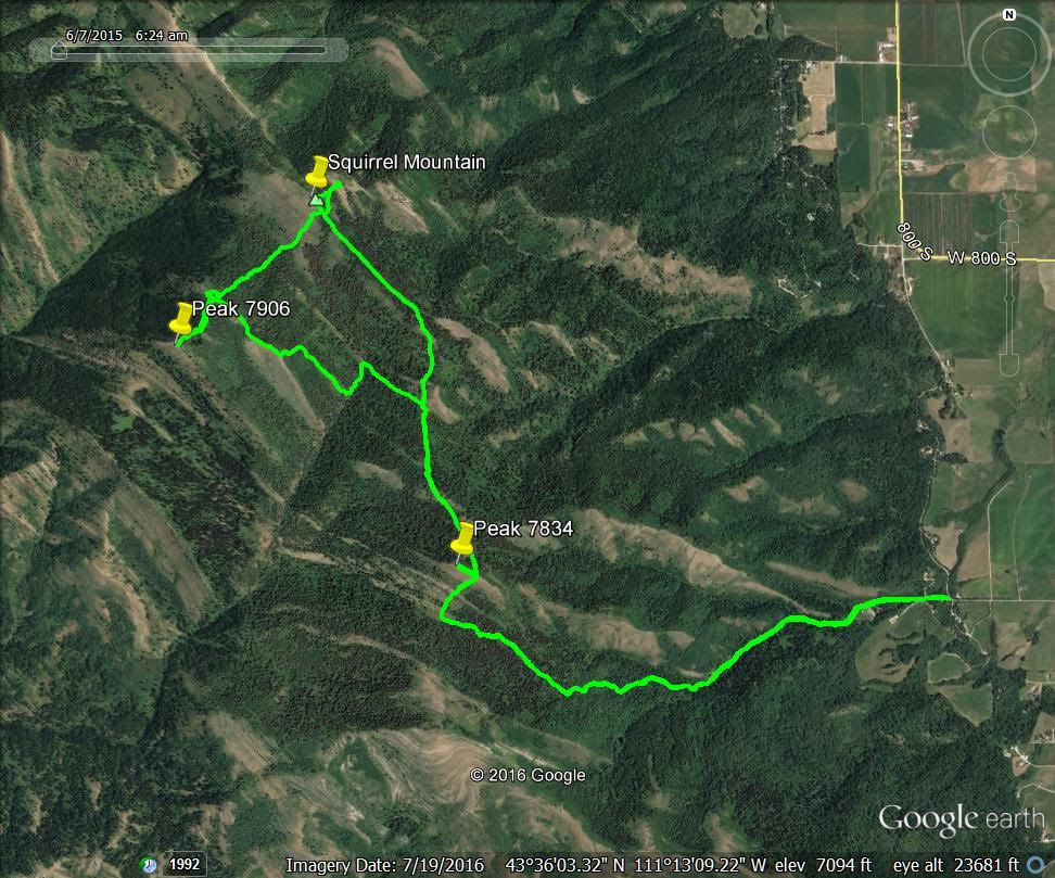
The loop route for Squirrel Mountain, Peak 7834 and Peak 7906. Steve Mandella GPS track
Squirrel Mountain from Pine Creek Pass, Class 1+ by Tom Lopez
Access this route from ID-31 at Pine Creek Pass. There is a large parking lot on the East Side of the highway. A good but unsigned trail leaves the pass on the West Side of the highway. This trail connects with other trails that run over to Peak 7800, Peak 7834 and [farther to] Squirrel Mountain.
The actual summit lies just north of the trail. Leave the trail, cross a fence and top out. The ascent over the 2 intervening peaks gains 1,397 vertical feet and loses 442 vertical feet in 3.6 miles, one-way. The trail was in good shape for the entire distance (July 2017).
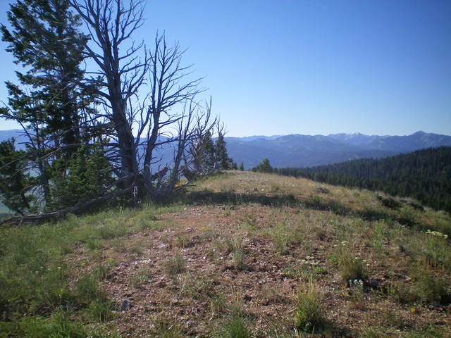
Approaching Peak 7800 from Pine Creek Pass.
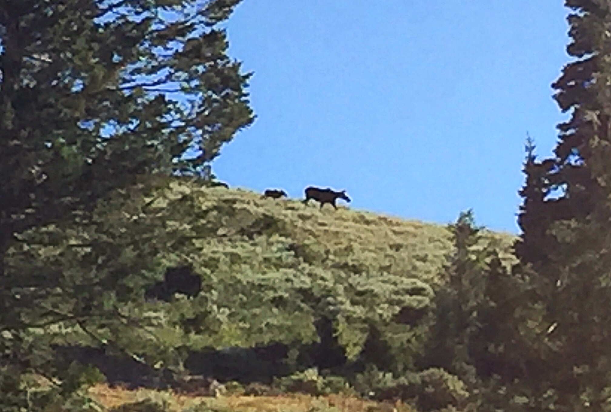
A moose just off the summit of Peak 7834 following the trail from Pine Creek Pass.
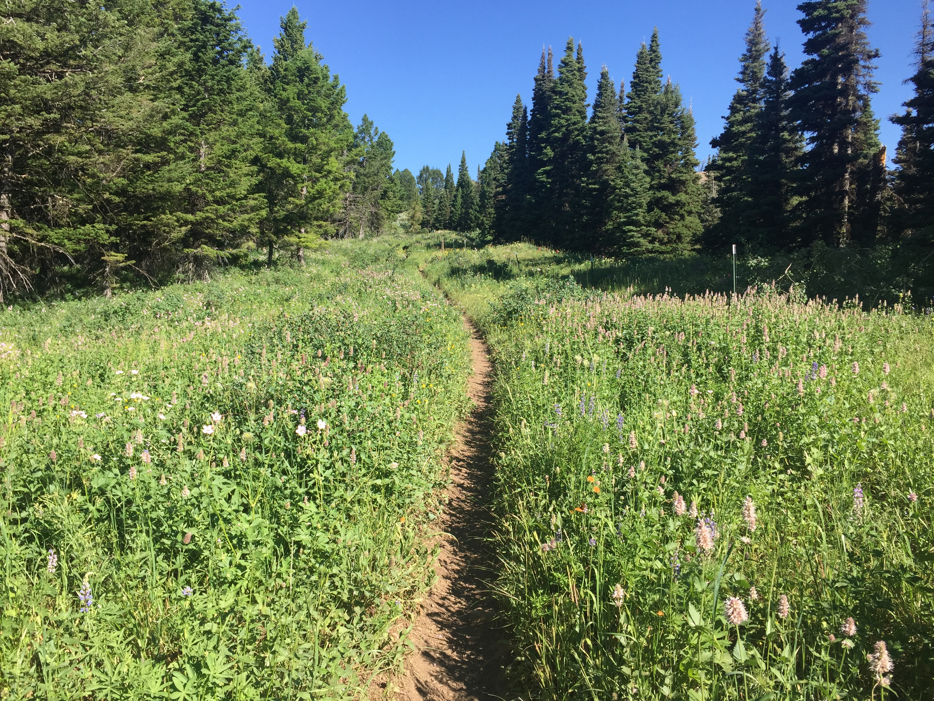
The Big Hole Mountain ridge trails are deluxe cross country.
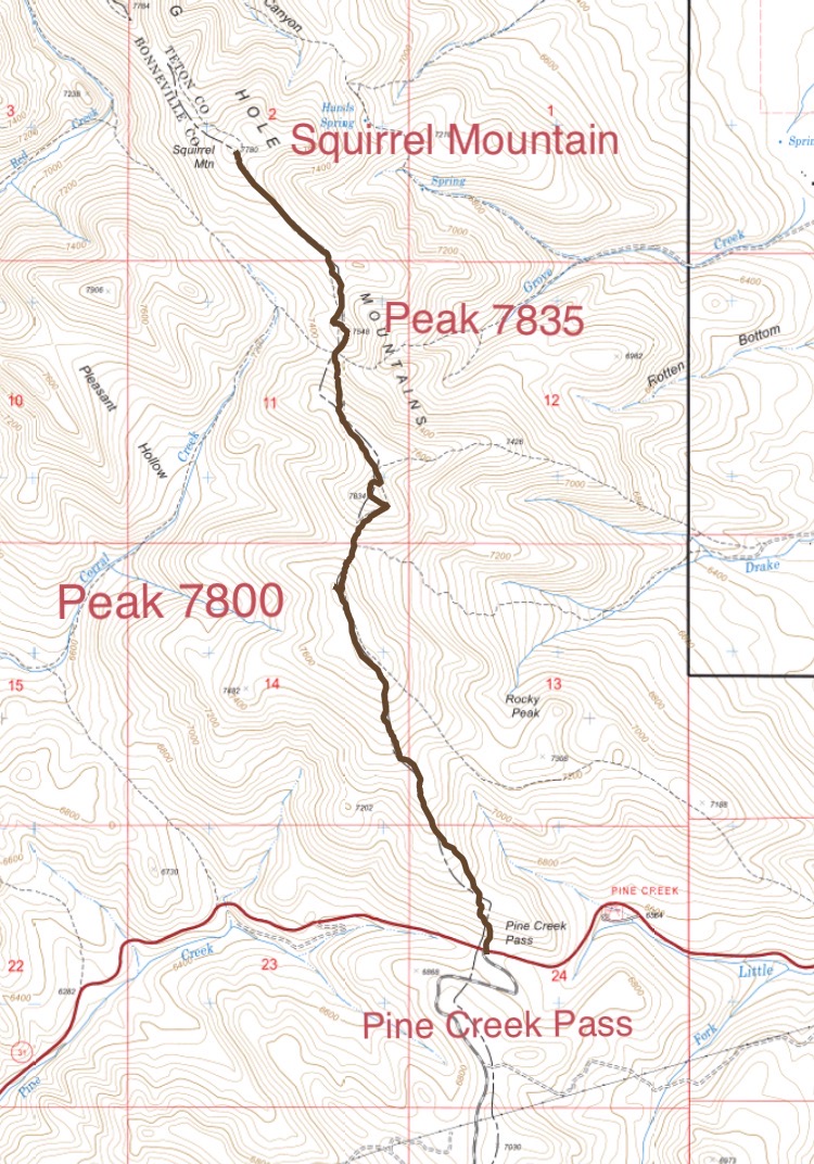
Tom’s GPS track to Squirrel Mountain.
Northeast and Southwest Face Routes By Livingston Douglas
Squirrel Mountain is located on a long north-south ridge that runs all the way south to Pine Creek Pass. It is mostly a trail hike but requires a short scramble off-trail to reach the cairned southwest summit on the main ridge crest. The actual high point is the northeast summit, which measures at a full 15 feet higher. It requires a short bushwhack to get there. This is the first leg of a 2-peak journey that includes Squirrel Mountain and Peak 7906.
The true/northeast summit hump of Squirrel Mountain. Livingston Douglas Photo
Access
Drake Creek Road/FSR-548 is located just west of Victor at a sharp bend in ID-31. It is signed as W9000S Road and is located along ID-31 exactly 3.1 miles east of Pine Creek Pass and 17.0 miles east of Swan Valley. Turn west onto Drake Creek Road and drive 1.3 miles (go straight at a junction at 0.6 miles) to reach the small parking area at the trailhead for the Drake Creek Trail/FST-238. Park here (6,440 feet).
Map Errors
First, the USGS map shows two trails coming up from Drake Creek Road to the main ridge crest. However, the east shoulder trail (the northern of the two trails) no longer exists. Drake Creek Trail/FST-238 follows the southern of the two trails shown on the USGS topo map. Second, the USGS map fails to show FST-230 heading south on (or near) the ridge crest from FST-238. There is a trail (official or not) that runs from FST-238 all the way south to Pine Creek Pass. It is not shown on the USGS map. Third, the ridge trail skirts the west side of the southwest summit of Squirrel Mountain, not the east side as the USGS map indicates.
Northeast Face, Class 2
The Climb
From the trailhead, hike west up the gradual then steep Drake Creek Trail for 1.5 miles to the main north-south ridge crest that connects Squirrel Mountain to Pine Creek Pass. There is a “T” junction here with FST-230 which heads south and FST-217 which heads north. Go north on FST-217, with several ups and downs, as it follows the ridge crest (or close to it) to skirt the southwest side of the official/southwest summit of Squirrel Mountain. Leave the trail and bushwhack northeast a short distance through sagebrush to reach the rocky, small summit. The southwest summit is on the main ridge crest and has a summit cairn.
But is this the true summit? The map contours suggest that that northeast summit may be higher but you cannot see the northeast summit due to pine trees in between the two summits. From the southwest summit, descend northeast for 45 vertical feet in open scrub/scree to a minor saddle. From the saddle, scramble northeast up through a short, easy patch of pine forest to reach the open, northeast summit. Yes, it is a significant 15 vertical feet higher, according to my altimeter. There is no cairn atop the northeast summit and no other markers (e.g., benchmark, triangulation posts/wiring) atop either summit.
The true/northeast summit hump of Squirrel Mountain. Livingston Douglas Photo
The summit cairn atop the [lower] southwest summit of Squirrel Mountain. Livingston Douglas Photo
Southwest Face, Class 2
Return to the southwest summit of Squirrel Mountain. Descend southwest then south-ish in somewhat-annoying sagebrush to reach the thick pine forest near the hidden connecting saddle with Peak 7906. FST-240 crosses through this saddle. This concludes the first leg of today’s 2-peak adventure. Peak 7906 is up next.
Additional Resources
Mountain Range: Big Hole and Snake River Mountains
Year Climbed: 2017
Longitude: -111.23359 Latitude: 43.61249