Elevation: 8,037 ft
Prominence: 497

This peak is not in the book. Margo Mandella and Livingston Douglas each wrote reports on this peak which are set out below. Livingston’s report also includes valuable information on map errors as well as more detailed access and route descriptions. Both reports will get you to the summit. Updated November 2020
Peak 8037 is located southeast of Pocatello, almost two miles northeast of Scout Mountain in the Bannock Range. There are two Peak 8037s in this general area. The other one is often referred to as Goodenough Peak. USGS Scout Mountain
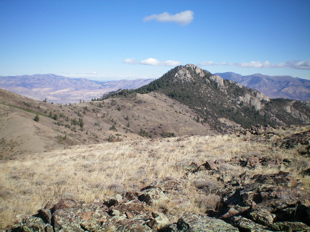
Peak 8037 as viewed from the southwest. What a magnificent piece of rock! Livingston Douglas Photo
Walker Creek Canyon Route by Margo Mandella
The summit can be reached in combination with Scout Mountain in a long day or more directly on its own from Walker Creek Canyon.
Walker Creek Canyon Approach, Class 2+
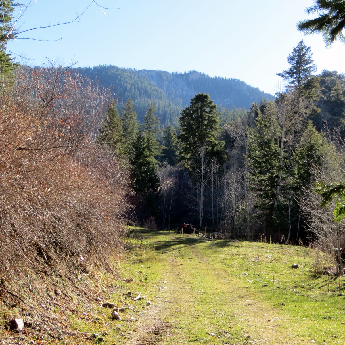
The start of the Peak 8037 climb. Steve Mandella Photo
Take Marsh Creek road south of Pocatello until you reach Walker Creek Road, which starts out paved and then turns to gravel. Travel west on Walker Creek Road and take it as far as it goes until it ends at a parking area. If the road is not muddy, a 2WD vehicle will suffice. The climb starts at a gate by the creek and follows a jeep trail.
There is a private landowner whose property you need to hike around on the jeep trail. The owner has installed warning signs and cameras but we found the placement of a key sign at a fork by his property a little misleading. Basically, stay left at the fork. The trail switchbacks around the property as it ascends toward the saddle. When you get above the property, there will be another warning sign and camera.
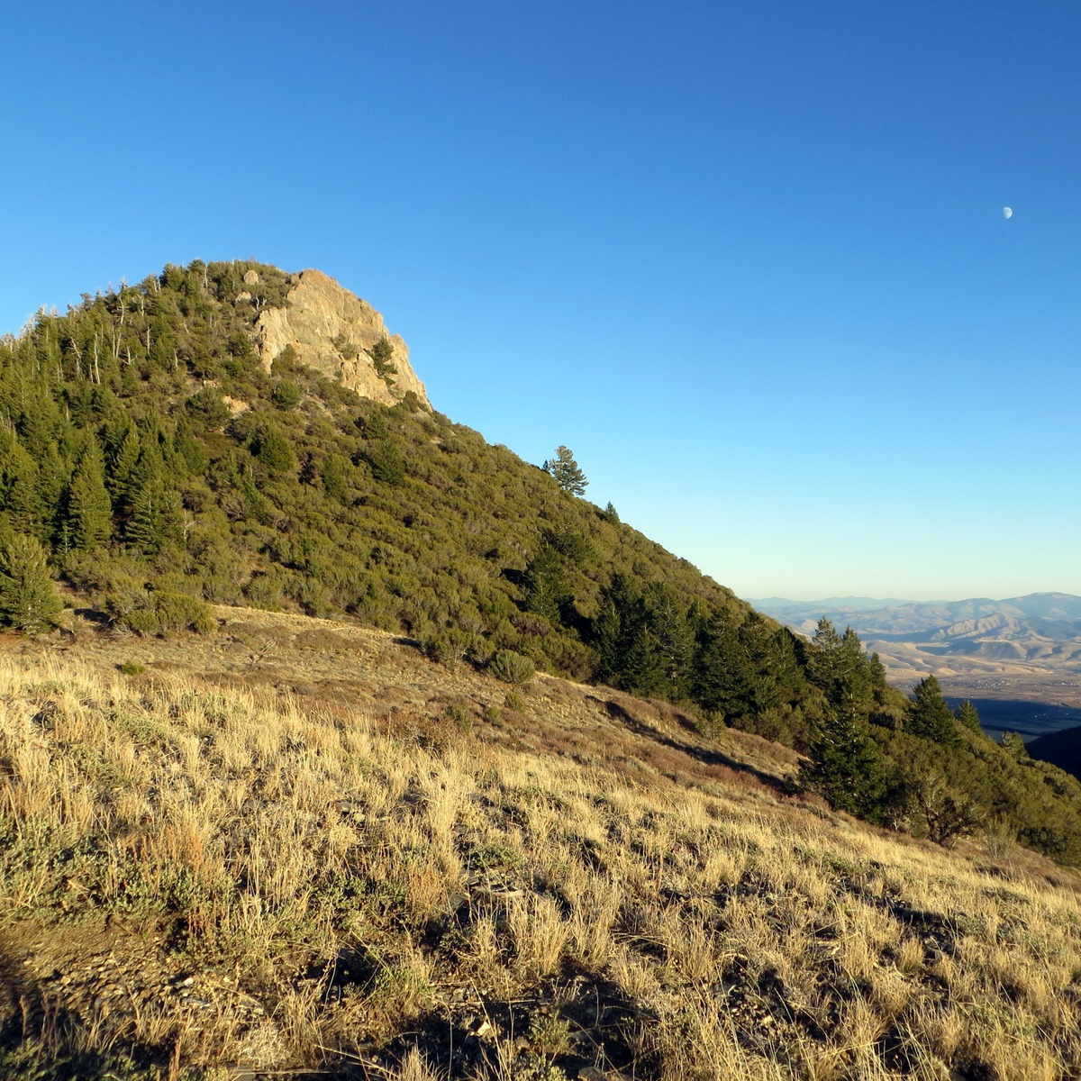
The summit block of Peak 8037. Steve Mandella Photo
Continue up the trail which begins to narrow. Keeping an eye on the saddle area, follow the trail until it is necessary to go off-trail and head directly toward the saddle. When you reach the saddle, you will see the summit block of Peak 8037 to the east with its distinct, rocky south face.
The summit block is the technical section of the climb. Approaching the block from the west (i.e., directly from the saddle) is easiest but it is still very steep, rocky and loose. Staying on the north side as you get close to the top should keep you at Class 2+ and result in no technical climbing but a little scrambling is still necessary to reach the actual summit. We didn’t stay to the north and, instead, ended up cornering around the southwest side of the block which resulted in an unexpected, short, exposed scramble (a couple of Class 3 moves) back to the north side.
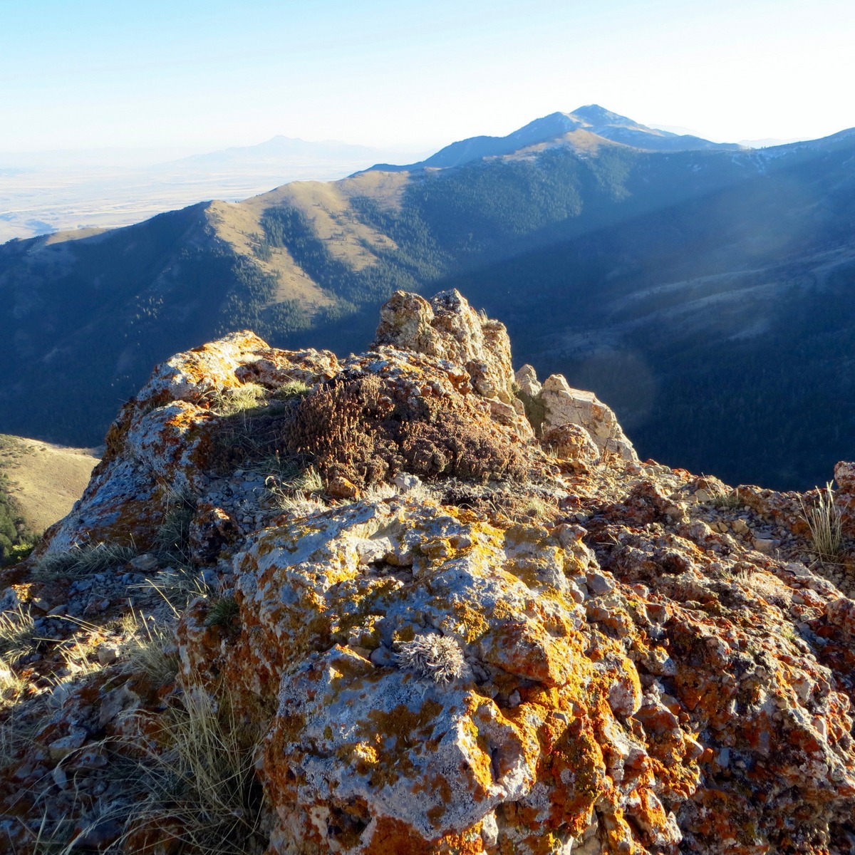
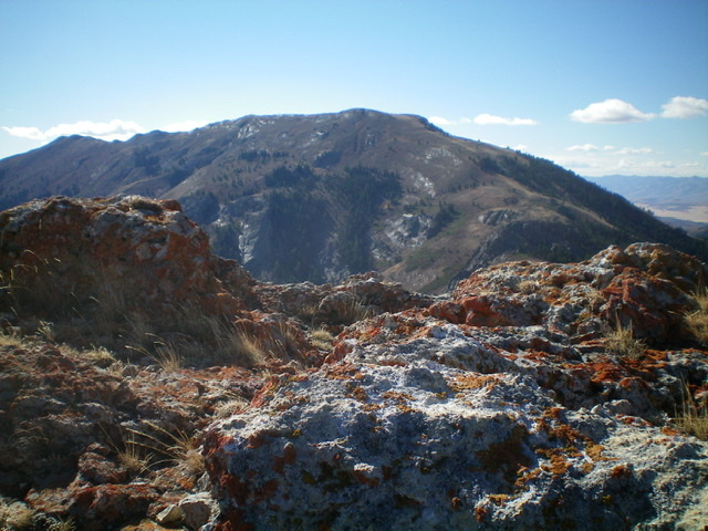
The summit of Peak 8037 with a view of Goodenough Peak in front of Old Tom Mountain. Steve Mandella Photo
Views from the summit include nearby peaks Scout Mountain, Goodenough Peak and Old Tom Mountain to the south and the peaks of the Portneuf Range to the east.
Our Route
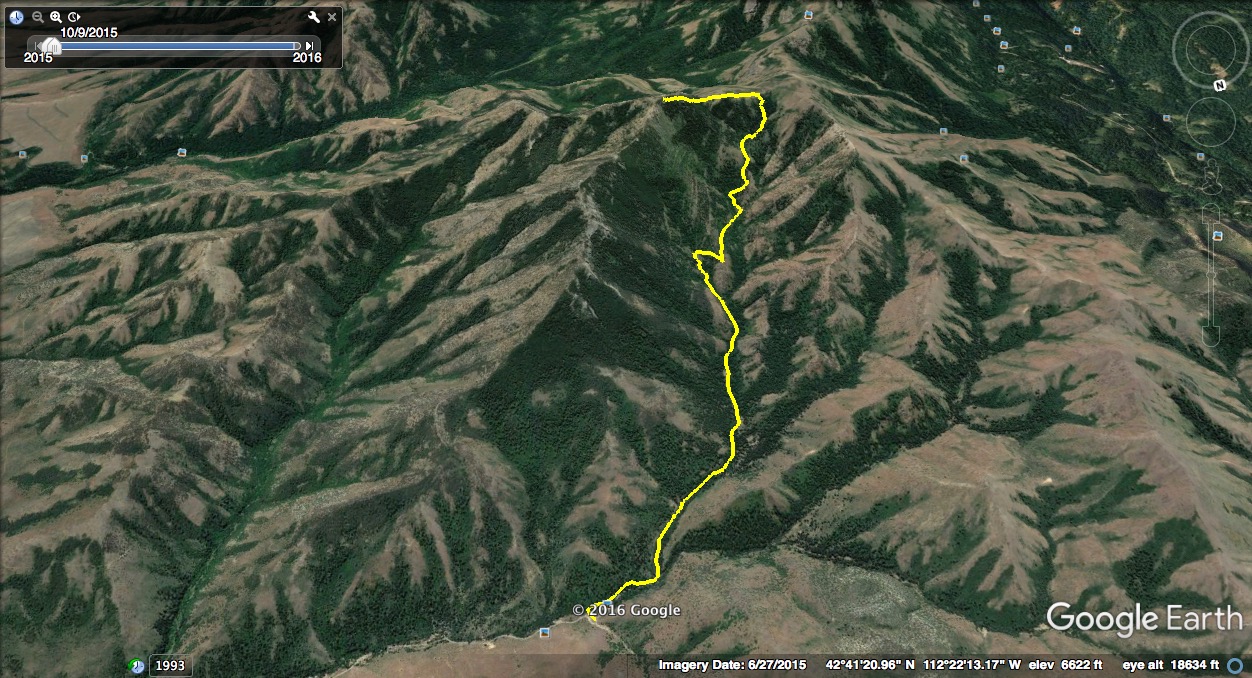
The route up Peak 8037 from Walker Creek Canyon. Margo Mandella GPS track
West Ridge and Alternative Approach by Livingston Douglas
Access
From its junction with Portneuf Road, drive south on the Bannock Highway for 4.5 miles. Turn left/east onto East Fork Mink Creek Road (signed) and drive 2.9 miles to a sharp right turn and an unsigned spur road on the left. Turn left onto the spur road and drive 0.3 miles to the trailhead for the Crestline Trail/FST-148. Park here (5,815 feet).
Map Errors
Both the Caribou-Targhee National Forest/Westside Ranger District Map, the USGS topo map, and the DeLorme trail map incorrectly show FST-115 connecting with the Crestline Trail/FST-148 just north of Point 7837 and just below a saddle. The section of FST-115 that went from FST-148 to the saddle below the west ridge of Peak 8037 is GONE and is posted as a “closed area” on FST-148. There are remnants of the trail remaining in the closed area from FST-148 up to the ridge saddle and that trail section is part of the Class 2 approach that is discussed. The aforementioned map error threw me off and made me improvise a way to reach Peak 8037 from the Crestline Trail/FST-148 and that is the Class 3 approach that is discussed. Read on.
The “Trail and Point 7837” Approach, Class 3
Both of these trail approaches start at the trailhead for the Crestline Trail/FST-148 and end at the saddle at the base of the west ridge of Peak 8037. This is the more difficult approach of the two. From the trailhead, hike up the Crestline Trail to a saddle just southwest of Point 7837. Leave the trail and bushwhack briefly northeast to reach the rocky base of Point 7837. Scramble up steep, knobby, conglomerate ridge rock to reach the top of Point 7837 (Class 3). Descend northeast on the right/east side of Point 7837’s ridge crest on a shoulder then left/west down a gully to reach the gentle saddle at the base of the northeast ridge of Point 7837.
From the saddle, hike briefly up the ridgeline to a flat ridge area and look for a use trail that contours northeast to reach the saddle at the base of the west ridge of Peak 8037, which is clearly visible from here. You can bushwhack through the willows and sagebrush if you can’t find the use trail, but it is worth the effort to find it and minimize your difficulty in traversing to that critical saddle.
The “Trail and Old Trail” Approach, Class 2
From the trailhead, hike up the Crestline Trail to just below the saddle that sits underneath the northeast face of Point 7837. There are remnants of the old “Crestline-Walker Creek Connector Trail”/FST-115 here and a few “closed area” signs that you will see. Bushwhack left/southeast up to the saddle using the old trail if you can find it (and you probably can). It is a pretty short, easy bushwhack anyway.
From the saddle, hike briefly up the ridgeline to a flat ridge area and look for a use trail that contours northeast to reach the saddle at the base of the west ridge of Peak 8037, which is clearly visible from here. You can bushwhack through the willows and sagebrush if you can’t find the use trail, but it is worth the effort to find it and minimize your difficulty in traversing to that critical saddle.
West Ridge, Class 3
The Climb
From the 7,620-foot saddle at the base of the west ridge (and at the head of the Walker Creek drainage), follow a good cattle trail east through scrub up over a hump then down 20 vertical feet or so to a minor saddle of scrub. Now the steep, intimidating rock of Peak 8037 is directly in front of you (see photo). Scramble up the ridge, staying just to the left/north of the rocky cliffs on the ridgeline proper. Climb steeply up through a miserable combination of mountain mahogany, brush, and loose gravel. Stay close to the base of the ridge crest towers/cliffs to make the best progress.
Once atop this massive block of rock, you find that you are NOT on the summit. It sits back to the east another 150 yards or so and it looks almost impossible (see photo). Bash your way along a clogged ridgeline to reach the final summit block/buttress. Stay just to the left/north of a massive wall of rock and work your way up through more mountain mahogany (thick), rocky blocks, and some brush to find a side gully to the right/south to easily reach the highest rocky block. There is no cairn on top and no loose rocks with which to build one. The view of nearby Scout Mountain is spectacular. I used my hands in the steep terrain and on the final scramble up the summit block so I rate this ridge a Class 3.
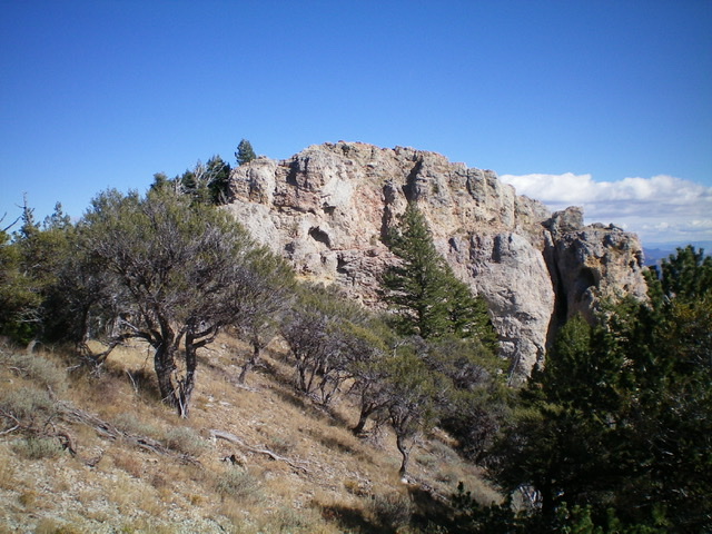
![The imposing rock (and mountain mahogany) of the [false] west summit of Peak 8037. Livingston Douglas Photo](https://www.idahoaclimbingguide.com/wp-content/uploads/B8667E95-2DF4-497A-AAD8-0357E8C3E85C.jpeg)
The imposing rock (and mountain mahogany) of the [false] west summit of Peak 8037. Livingston Douglas Photo
THIS is the summit block of Peak 8037 as viewed from just below it. Livingston Douglas Photo
The summit rocks of Peak 8037 with Scout Mountain in the background. Livingston Douglas Photo
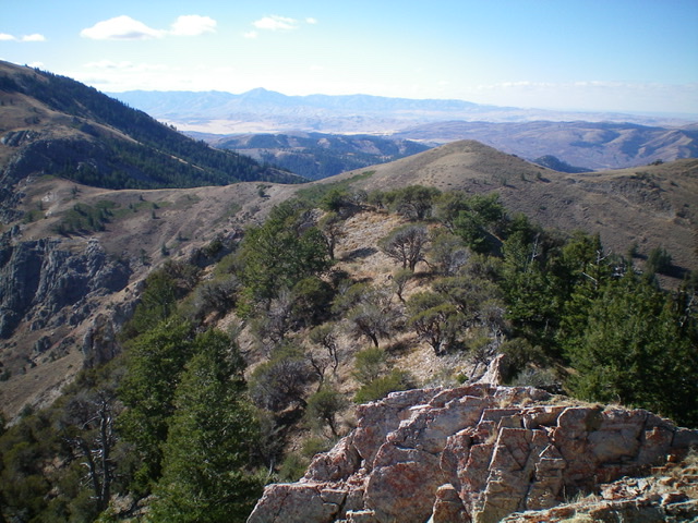
Looking down the west ridge from the summit of Peak 8037. You must return to the saddle on the left side of the photo to get back to the Crestline Trail/FST-148. Livingston Douglas Photo
Additional Resources
Regions: Bannock Range->SOUTHERN IDAHO
Mountain Range: Bannock Range
Longitude: -112.32401 Latitude: 42.69889