Elevation: 8,151 ft
Prominence: 371
This peak is not in the book. Published November 2021
Peak 8151 is located northwest of the Bonanza townsite. It is one of three ranked summits that have Jordan Creek to the east and the West Fork Yankee Fork to the south. USGS Mount Jordan
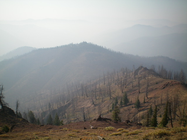
Peak 8151 (mid-ground) as viewed from the summit of Peak 8594 to its north. Livingston Douglas Photo
Access
This is the first leg of a 3-peak adventure that includes Peak 8151, Peak 8594, and Peak 8620. It covers 7.0 miles with 3,375 feet of elevation gain round trip. This area has substantial burn scars so take appropriate precautions in undertaking this climb.
West Fork Road/FSR-074 is located at the south end of the Bonanza townsite on Yankee Fork Road/FSR-013. The signed junction of FSR-013 and FSR-074 is located 7.7 miles up Yankee Fork Road from ID-75 and 0.6 miles south of the Loon Creek Road junction. Turn left/west off Yankee Fork Road onto West Fork Road and reset your odometer. At 0.1 miles, reach the Bonanza Guard Station. At 0.9 miles, reach an unsigned junction; go right here. At 1.1 miles, reach the West Fork trailhead (6,550 feet). Go right onto FSR-400 (“Boot Hill” sign). Drive 0.2 miles up FSR-400 to the Boot Hill Cemetery and park (6,695 feet).
Southeast Ridge, Class 2
The Climb
Boot Hill Cemetery sits at the base of the southeast ridge. From the cemetery, scramble northwest up a sagebrush slope and angle left-ish onto a forested shoulder. Bushwhack right/northeast up the semi-open shoulder then move left-ish/west to cross the head of a gully. Climb to the top of Point 7680+. From the top of this forested point, drop right/north to a saddle and continue north to reach the summit ridge. Head left/northwest up the semi-open ridge to reach the open summit of Peak 8151. The summit has a triangulation post and wiring. I built a summit cairn and stuck the post in it.
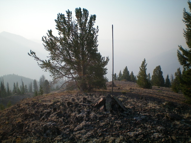
The summit of Peak 8151. Livingston Douglas Photo
Northwest Ridge, Class 2
The Descent
The summit has a 20-foot sheer cliff on its northwest side. From the summit, backtrack and downclimb to a gap to reach the [lower] northwest summit, which is a lateral ridge. The terrain is entirely burnt snags now. Scramble up over the northwest summit then bushwhack northwest through snags and downed, charred timber to reach a gentle saddle with lots of downed trees. This is the 7,780-foot connecting ridge with Peak 8594 and concludes the first leg of today’s 3-peak journey. Peak 8594 is up next.
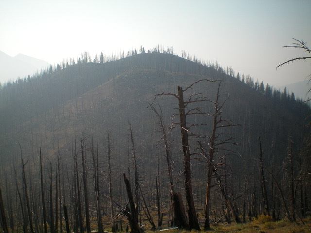
Peak 8151 and its north face (my descent route). Livingston Douglas Photo
South Ridge, Class 2
The Descent
From just above the 7,580-foot saddle on the south ridge, descend southwest on the open ridge through thick brush and willows to reach the aforementioned saddle. Head southwest up over a minor hump on easier terrain (mostly downed, charred timber). Continue left/southeast down the ridge. The ridge quickly loses its definition and becomes a forested mess of ridges and gullies. At about 7,200 feet, head south and reach open terrain at about 6,800 feet. Descend southeast to intercept the West Fork Trail (an ATV trail) in a gully and follow the trail briefly back to the West Fork trailhead. Hike 0.2 miles up FSR-400 to the Boot Hill Cemetery and your parked vehicle.
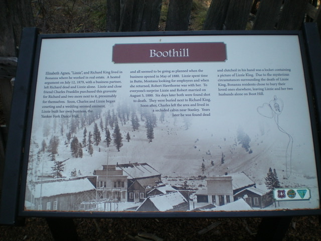
Historical plaque at Boot Hill Cemetery. Livingston Douglas Photo
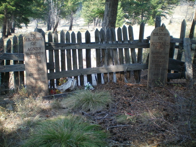
Two of the graves at Boot Hill Cemetery. Livingston Douglas Photo
Additional Resources
Regions: Eastern Salmon River Mountains->Salmon River Mountains->Southeast Corner Peaks->WESTERN IDAHO
Mountain Range: Eastern Salmon River Mountains
Longitude: -114.75201 Latitude: 44.38529