Elevation: 8,620 ft
Prominence: 360
This peak is not in the book. Published November 2021
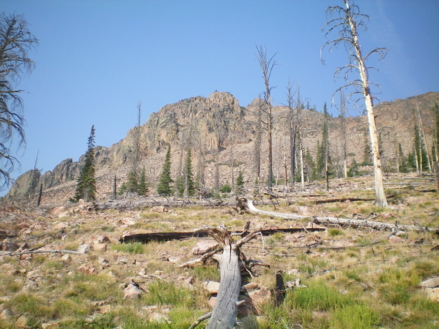
Peak 8620 is located northwest of the Bonanza townsite. It is one of three ranked summits that have Jordan Creek to the east and the West Fork Yankee Fork to the south. This area has substantial burn scars so take appropriate precautions in undertaking this climb. USGS Mount Jordan
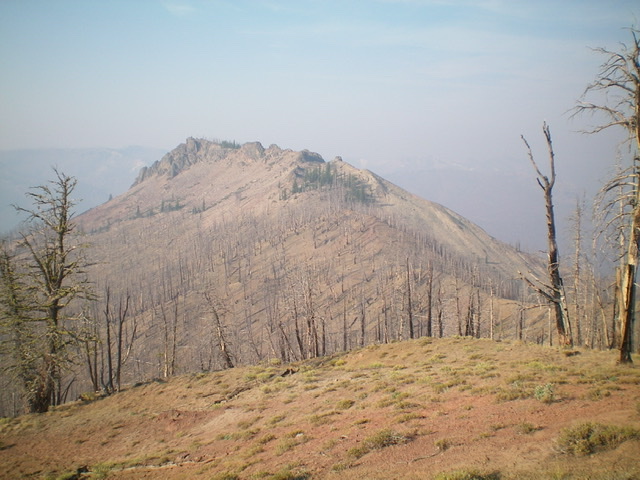
Peak 8620 as viewed from the east. Livingston Douglas Photo
Access
Same as for Peak 8151.This is the third leg of a 3-peak adventure that includes Peak 8151, Peak 8594, and Peak 8620. It covers 7.0 miles with 3,375 feet of elevation gain round trip.
Northeast Ridge, Class 3
The Climb
From the 8,260-foot connecting saddle with Peak 8594, scramble southwest up easy scree/scrub then skirt the right/northwest side of a series of ridge pinnacles on talus/scree. Higher up, cross to the left/east side of the ridge to skirt a final section of wicked ridge towers. Once past these towers, reach a final gully/notch to get back up onto the ridge crest (Class 3). Once back on the ridge, climb south up easy Class 2 rock to reach the rocky summit perch of Peak 8620. There were no signs of previous ascent, so I built a summit cairn.
The steep east face of Peak 8620 (my descent route). Livingston Douglas Photo
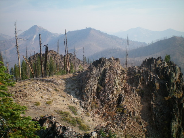
Looking back along the rocky northeast ridge from the summit. Livingston Douglas Photo
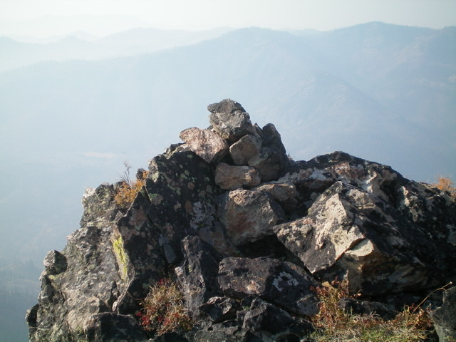
The summit cairn atop Peak 8620 in a sea of smoke. Livingston Douglas Photo
East Face, Class 3
The Descent
From the summit, descend north briefly to reach the top of the notch. Downclimb the notch (Class 3) on the east face to reach a steep, loose talus/scree slope. Carefully descend the talus/scree slope to reach the charred forest below. Work east then southeast through lots of downed timber and snags to reach the narrow gully that separates Peak 8620 from Peak 8151. Follow the tedious, narrow, timber-strewn gully for a short distance to reach a wider, easier area.
Do a diagonal left/south ascent with climbs up two separate shoulders to reach the south ridge of Peak 8151. There is a lot of downed timber to contend with and some sections of this ascent are steep and somewhat loose. You will reach the south ridge at about 7,650 feet, just above the 7,580-foot saddle. Descend the south ridge of Peak 8151 from here (see separate post).
Additional Resources
Regions: Eastern Salmon River Mountains->Salmon River Mountains->Southeast Corner Peaks->WESTERN IDAHO
Mountain Range: Eastern Salmon River Mountains
Longitude: -114.76859 Latitude: 44.38939