Elevation: 8,340 ft
Prominence: 320
This peak is not in the book. Published December 2020
Peak 8340 is one of several peaks that are near, or on, the Fourth of July Ridge deep in the Caribou Range due west of the north end of Palisades Reservoir. This climb is the first of a foursome that includes Peak 8340, Peak 8313, Peak 8393, and Fourth of July Ridge (8,378 feet). If you begin this adventure from the base of FSR-017 at Skyline Road/FSR-075, you will cover 15.5 miles with 4,250 feet of elevation gain round trip. You can significantly shorten this endeavor if you ride an ATV or MC up to Fourth of July Ridge via Forest Service roads in the area. USGS Red Ridge
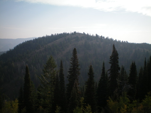
Peak 8340 as viewed from Fourth of July Ridge to its west. Livingston Douglas Photo
Access
From US-26 north of Swan Valley, ID, turn right/south at a signed junction just before a bridge crossing of the Snake River a few miles west of the junction of US-26 and ID-31 in Swan Valley. This junction is signed for Snake River Road and “Fall Creek Road 1 mile.” Drive 1.2 miles south on Snake River Road as it follows the west side of the Snake River and reaches a signed junction with Fall Creek Road/FSR-077. Turn right/west onto Fall Creek Road and drive 13.8 miles west to a signed “T” junction with FSR-075/Skyline Road. Turn left/south and drive 10.8 miles southeast on Skyline Road to a signed junction with FSR-017 (left/east turn). Park at this junction (7,280 feet) or drive up the rugged jeep road as far as you wish. The road is best suited for ATVs and MCs. However, some folks drive it all the way to Commissary Ridge and beyond, but not me.
The Approach, Class 2
Most of this approach is Class 1. Hike (or drive/ride) up FSR-017 for 3.0 miles to an unsigned junction on Commissary Ridge. Go left/northwest to continue on FSR-017. FST-017 soon turns right/northeast and descends down a steep shoulder. You quickly reach a signed junction with FST-260. Go right/southeast onto FST-260 (an ATV trail/road). It descends down to a meadow then turns north to climb a dry gully. As it approaches Fourth of July Ridge, FST-260 turns right/east and does a diagonal left ascent to an open shoulder at 8,000 feet. The trail turns hard left/north here.
Leave the trail soon after this sharp turn and follow a narrow but obvious use trail that heads diagonally right/northeast to climb up to the crest of Fourth of July Ridge. Upon reaching the ridge crest, you will find a ridge crest trail (unofficial and not shown on maps). Follow this use trail right/southeast along the ridge crest for a short distance. As the use trail approaches Point 8226, find a narrow but well-beaten use trail that heads diagonally left/east off the ridge crest to skirt the north side of Point 8226. This trail leads to a shoulder. The trail then follows the shoulder left/northeast down to an 8,020-foot saddle at the base of the southwest face of Peak 8340.
Southwest Face/Southeast Ridge, Class 2
The Climb
From the 8,020-foot saddle at the base of the southwest face, follow a use trail diagonally up and right/northeast to reach the southeast ridge at a forested saddle. Scramble up the right/east side of the southeast ridge on semi-open terrain (pine trees and brush) to open terrain higher up. There is a prominent grassy gully to the right/east of the southeast ridge. You will soon reach the gentle summit hump that is the top of Peak 8340. The summit had a small, torn-down cairn so I built a new one. The summit offers outstanding views of nearby Fourth of July Ridge (8,378 feet), Peak 8313, and Peak 8393.
Return back to the 8,020-foot saddle and follow the use trail back up onto Fourth of July Ridge. Follow the use trail northwest along the ridge until it simply disappears. Then scramble along the ridge crest, using game trails as available. The ridge crest is a combination of rocky outcrops and brush and is a bit tedious. The ridge descends modestly to reach a well-signed trail junction of FST-262 (an ATV trail heading northwest up Fourth of July Ridge) and FST-260 (a MC trail heading diagonally right/north and downward to Chaparral Hollow). This concludes the LONG first leg of this four-peak journey. Peak 8313 is up next.
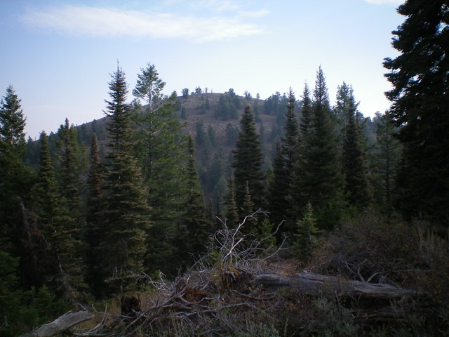
Another shot of Peak 8340 from Fourth of July Ridge. Livingston Douglas Photo
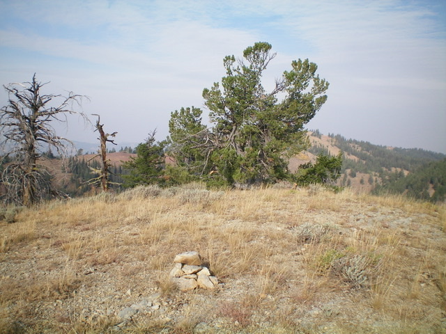
The summit area atop Peak 8340. Livingston Douglas Photo
Additional Resources
Regions: Caribou Range->SOUTHERN IDAHO
Mountain Range: Caribou Range
Longitude: -111.37069 Latitude: 43.29229