Elevation: 8,363 ft
Prominence: 343
This peak is not in the book. Published December 2020
Peak 8363 is one of four unnamed peaks located on the east side of Divide Creek and east of the Continental Divide. The peaks are Peak 8363, Peak 8961, Peak 9161, and Peak 9255. They are all ranked summits and are part of a four-peak journey that covers 12.5 miles with 3,300 feet of elevation gain round trip. USGS Deadman Lake
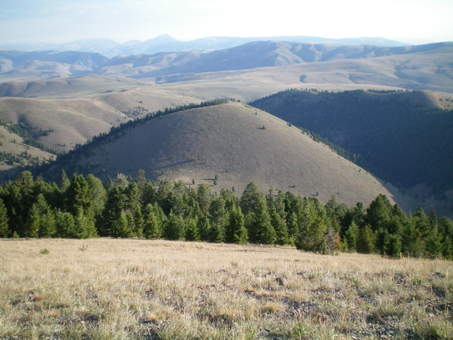
Peak 8363 (gentle hump in mid-ground, center) as viewed from the south. Livingston Douglas Photo
Access
From I-15 at Dubois, ID, drive west on ID-22 for 5.9 miles to [signed] Medicine Lodge Road. Turn right/north onto Medicine Lodge Road and reset your odometer. At 21.0 miles, the pavement ends. At 25.7 miles, reach a [signed] road junction with Irving Creek Road. At 27.5 miles, reach a [signed] fork in the road. The left fork is Fritz Creek Road; the right fork is Warm Creek Road. Go left onto Fritz Creek Road/FSR-199. Reset your odometer here.
At 0.2 miles, cross a cattle guard and reach a road junction. Straight/west is Fritz Creek Road and right/north is Bannack Pass Road. Go right/north here onto Bannack Pass Road/FSR-280. At 5.4 miles, reach a road junction with Divide Creek Road/FSR-300. Turn left/west onto Divide Creek Road and drive 0.9 mile up the road to a stiff cattle gate/fence (7,340 feet). If you can manage to open the wiring of the gate, you can drive another 0.5 mile to reach a parking area at the Divide Creek trailhead (signed as the “Webber Creek Trail/FST-111”). The road gets a bit rutted in this final 0.5 mile, so you may or may not be able to make it to the trailhead.
North Ridge, Class 2
The Climb
Hike (or drive) to the Divide Creek trailhead. Divide Creek Trail (labeled as Webber Creek Trail since it links to that trail) is FST-111 and is a MC trail open to hikers and horses. It is narrow and rocky early on and immediately enters a pine forest. It follows the east side of Divide Creek. Follow FST-111 west then southwest then south for just under a mile to reach an obvious gully on the left/east side of the Divide Creek drainage at 7,440 feet.
You are now at the base of the north ridge of Peak 8363. Continue briefly south on FST-111 and cross through a cattle gate/fence just past this gully. Leave the trail at this cattle gate. Bushwhack east through a short section of sagebrush to reach the pine forest. Using game trails (on and off), climb south up through the steep but easy forest to emerge in easy, short scrub high up then stroll to the bare hump that is the summit of Peak 8363. There is a modest cairn on top.
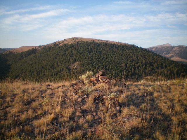
The summit cairn atop Peak 8363, looking south. Peak 8961 is dead center. Livingston Douglas Photo
South Face, Class 2
The Descent
From the summit, descend south to an 8,020-foot saddle on steep scrub and sagebrush. This is the connecting saddle with Peak 8961. This concludes the first leg of today’s four-peak journey. Peak 8961 is up next.
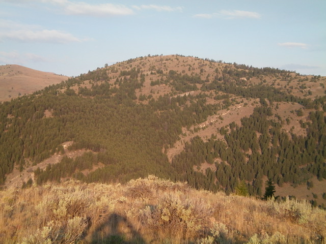
Looking west from the summit of Peak 8363. Peak 8980 (on the Continental Divide) is in the center. Livingston Douglas Photo
Additional Resources
Regions: Beaverhead Range->EASTERN IDAHO
Mountain Range: Beaverhead Range
Longitude: -112.79501 Latitude: 44.44759