Elevation: 8,700 ft
Prominence: 760
This peak is not in the book. Margo Mandella and Livingston Douglas contributed to this page. Margo wrote the first section and Livingston the additional routes below Margo’s entry. Updated December 2019
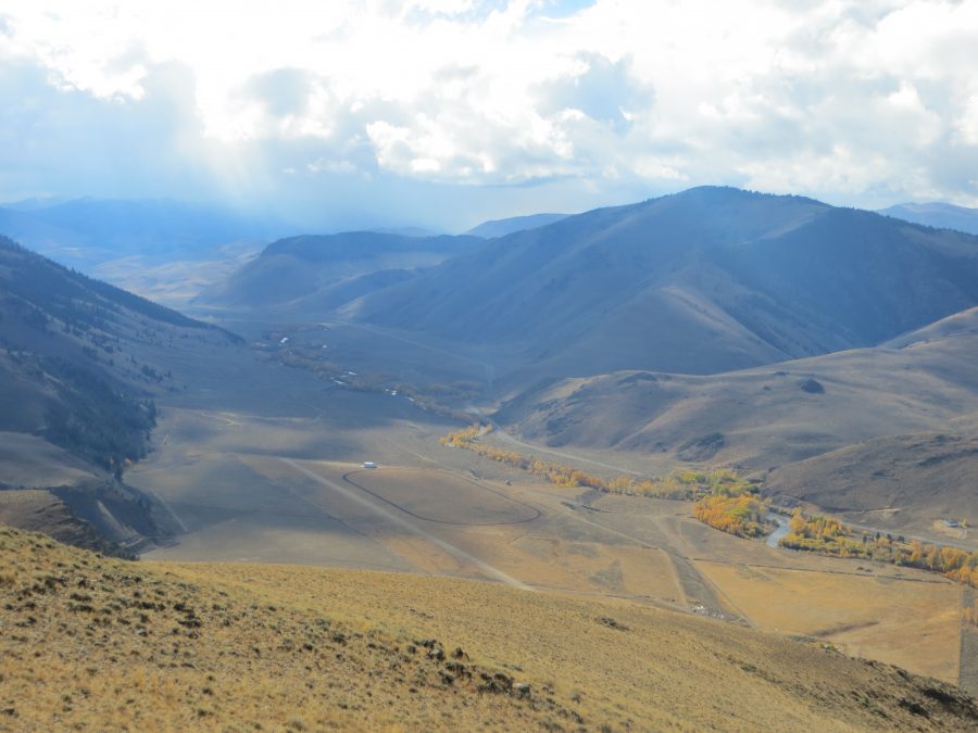
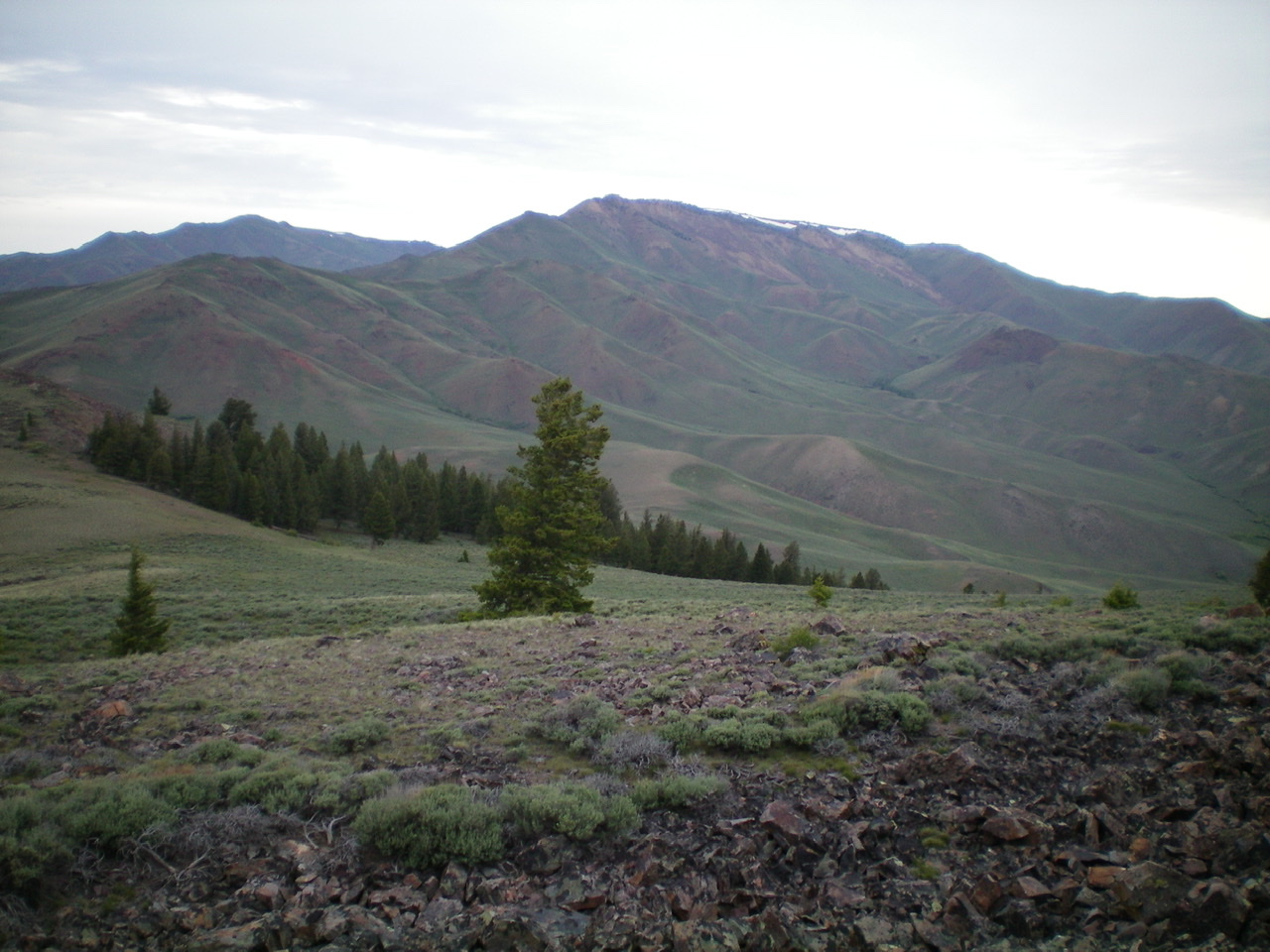
Peak 8700 lies south of Jerry Peak and north of Wildhorse Peak in the Challis National Forest. The peak’s location provides nice views of the Lost River Range, the Boulder Mountains, the White Knobs, and the Pioneer Mountains as well as the Big Lost River Valley. The east ridge approach is readily accessible from the road, making this peak a potential year-round climb when travel on Trail Creek Road is possible. USGS Harry Canyon
Peak 8700. Steve Mandella Photo
Access
From US-93 northwest of Mackay, Idaho, turn left onto Trail Creek Road and travel west-southwest toward Garden Creek Campground/Copper Basin. Just past Burnt Creek is the sign for Garden Creek (right) and a small pullout used by cattle ranchers. This pullout is at the base of the peak’s east ridge. If you pass the Garden Creek Campground (on the left), you have driven too far. You can park at this pullout or just across the Big Lost River, where there is a large parking area used by anglers.
East Ridge Approach, Class 2
Start your climb on the north side of the large rock outcrop at the base of the ridge, staying on the north side of the short section of fence on the ridge. The first 1/3 of the east ridge is steep, but the footing is excellent. The final 2/3 of the ridge is mellow as the ridge meanders toward the summit. A good game trail follows along the ridge a lot of the way. You’ll encounter a couple small rock gardens, pass through short sections of forest and, close to the summit, you’ll bypass a couple of small rocky outcrops. Our trip covered 4.6 miles with 1,969 feet of elevation gain round trip.
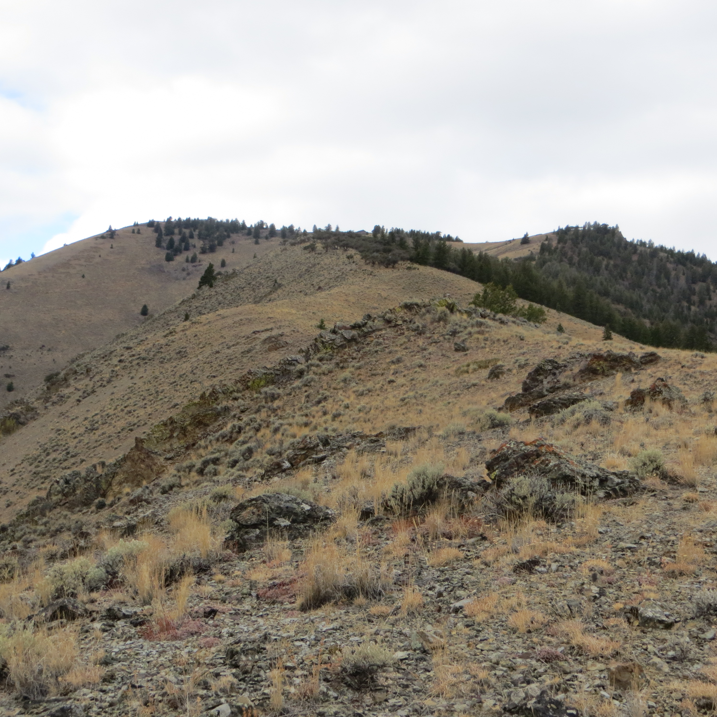
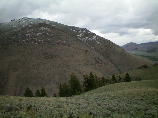
The meandering east ridge approach. Steve Mandella Photo
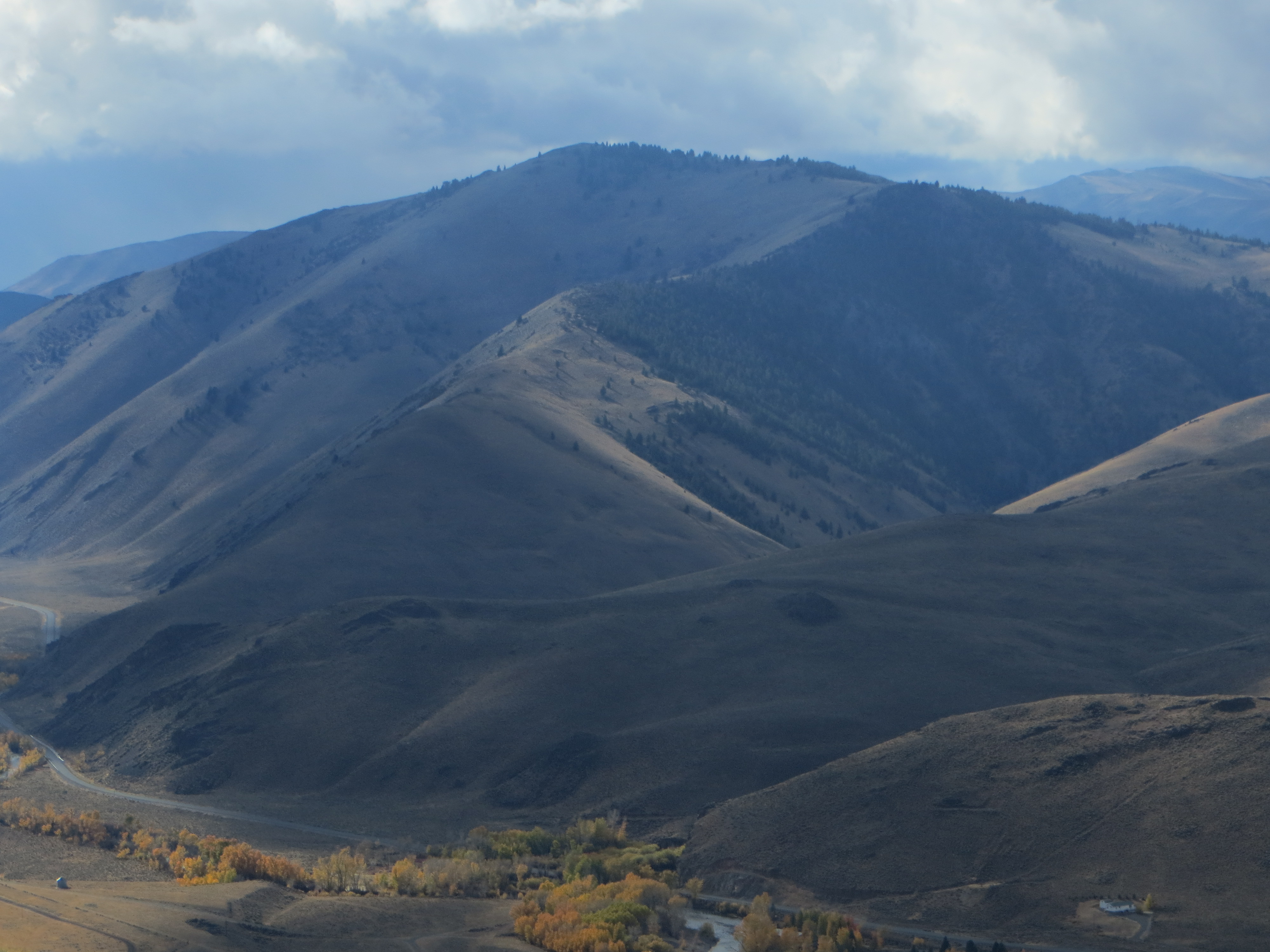
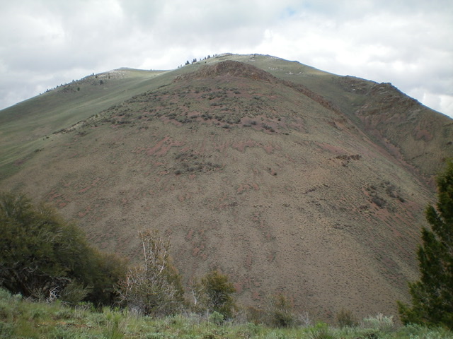
Approaching the rocky summit of Peak 8700 with the Lost River Range in the background. Steve Mandella Photo
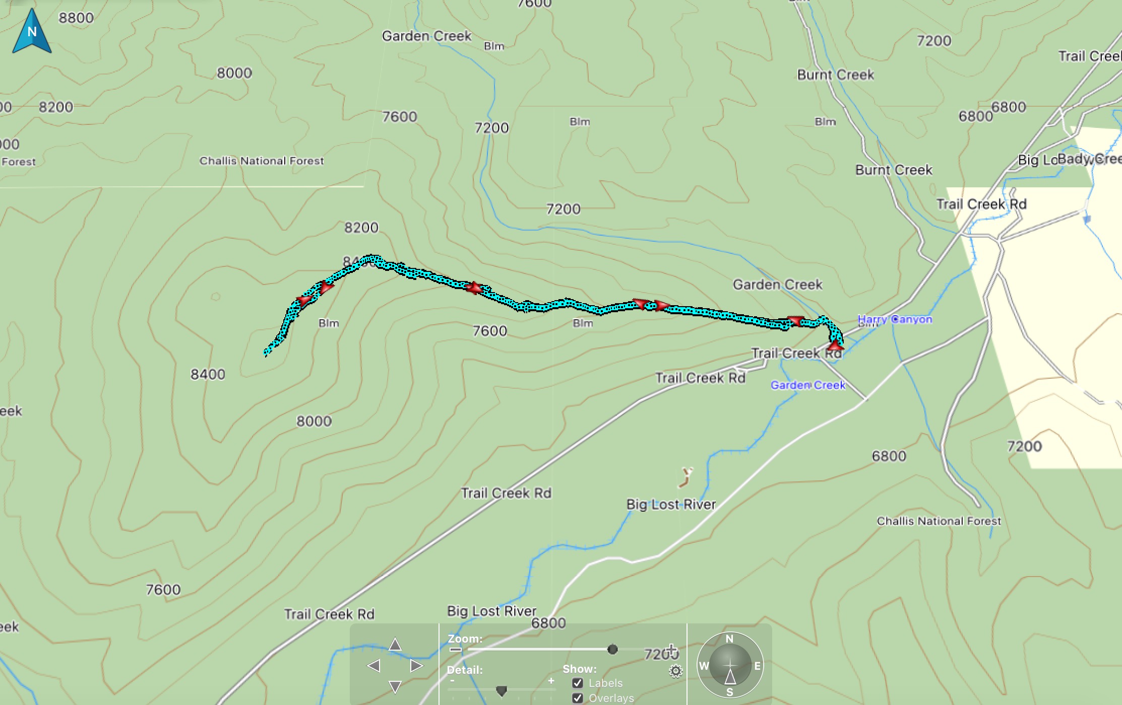
Climbing track. Steve Mandella Map
South Ridge and Southeast Shoulder Routes by Livingston Douglas
South Ridge, Class 2+
Access
From US-93 north of Mackay, turn left/west onto [signed] Trail Creek Road. At 13.2 miles, Garden Creek (signed) is on the right/north side of the road. At 13.5 miles, the Garden Creek Recreation Site is on the left/south side of the road. At 15.4 miles, turn right onto a 2-track jeep road signed for “Lake Creek.” Park in one of two pullout areas here in the grass. The elevation here is 6,832 feet. This is the base of the south ridge.
The Climb
From Trail Creek Road, Peak 8700 appears to be sagebrush hill, but it’s most assuredly not. It is a very rocky, shale-y peak with scrub thrown in to mask its true identity. Be careful here. Do not underestimate this seemingly-innocent hill. It has some “issues,” as they say. From the parking area, hike across a short section of easy sagebrush/grass to reach the toe of the south ridge. The initial section of the ridge is particularly steep and is very loose shale talus/scree.
Higher up, the slope eases, but the underlying shale is always there. Ridge rock joins the mix early on. There are two distinct south ridges (visible on the map as well), separated by a sagebrush gully. Stay on the right/east one to remain true to the south ridge of Peak 8700. High up, the two ridges join, with the left/west ridge angling right/northeast to join the true south ridge. As you near the summit, there is an easy section of short scrub leading up to the rocky summit area. The summit has a modest cairn atop the highest boulder.
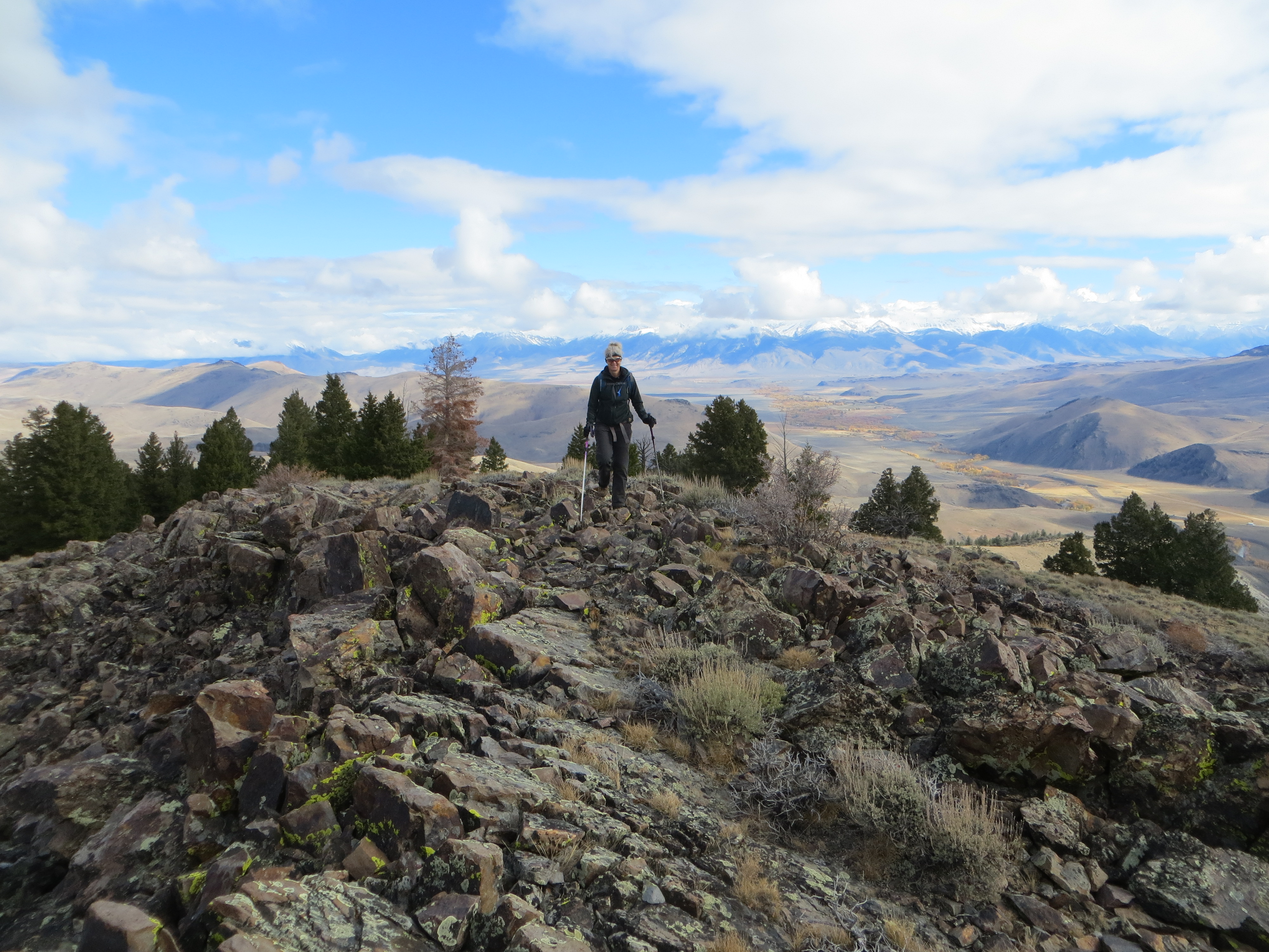
Peak 8700 and its magnificent south ridge (skyline on right). Livingston Douglas Photo
The upper ramparts of the south side of Peak 8700 as viewed from the south. The summit is the gentle hump left of center. Livingston Douglas Photo
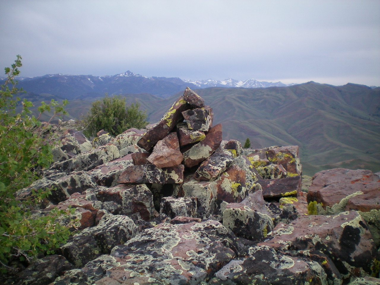
The summit cairn atop Peak 8700. Livingston Douglas Photo
View of South Jerry Peak (center) from the summit of Peak 8700. Livingston Douglas Photo
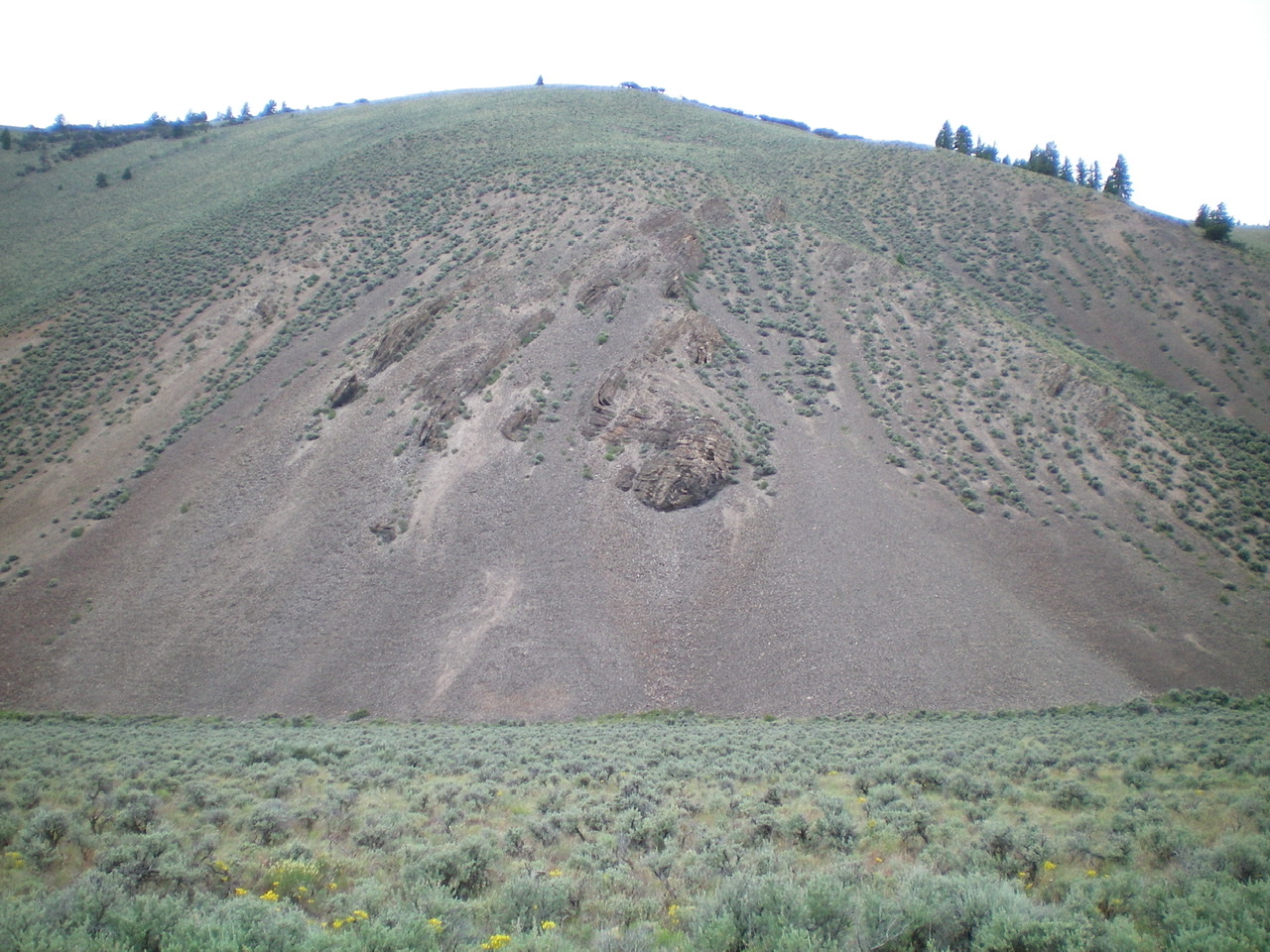
The southeast shoulder of Peak 8700 as viewed from its base along Trail Creek Road. The rocky outcrop in dead-center must be skirted in a steep gully on its north side. The final boot-ski down the loose scree (below the rocky outcrop) is delightful. Livingston Douglas Photo
Southeast Shoulder, Class 2+
Access
Same as for the south ridge
The Descent
From the summit, descend southeast on an obvious shoulder. The terrain is loose shale and scrub and can’t be boot-skied. Lower down, the shoulder loses its definition and becomes more of a face descent. The slope steepens considerably and you appear to be heading for a cliff face below. You must down-climb a Class 2+/3 gully on the left/northeast side of a rocky outcrop just above the sagebrush-covered valley floor. Once below the rocky outcrop, boot-ski down a scree slope to reach the valley floor. Bushwhack a short section of sagebrush to reach Trail Creek Road. Hike about 0.8 miles southwest on Trail Creek Road to return to the parking area near Lake Creek.
Additional Resources
Regions: Boulder Mountains->EASTERN IDAHO
Mountain Range: Boulder Mountains
Longitude: -114.09489 Latitude: 43.97719