Elevation: 8,986 ft
Prominence: 292
This peak is not in the book. LiDAR measurements changed the elevation from 8,980 feet to 8,986 feet. Livingston Douglas added a new route description with a different starting point and additional photos. Updated November 2024
This peak is located due north of Massacre Mountain. I first climbed this peak in 1988 on my way to North Massacre and Massacre Mountain. The climb was a quasi-death march which started at Buck Springs because the road was too muddy to go any farther. Rather than following the longer 4WD road around this peak, we chose to cross over its summit. USGS Massacre Mountain
Peak 8986
Access
Dry Creek Cutoff Road/Buck Springs Road [(A)(6.1 alt.) on Page 290]. Drive the 4WD Buck Springs Road until it forks at the 8,000-foot contour. Take the right fork, cross the small drainage and drive to the flat spot 100 yards to the north. Park here.
Northeast Ridge, Class 2
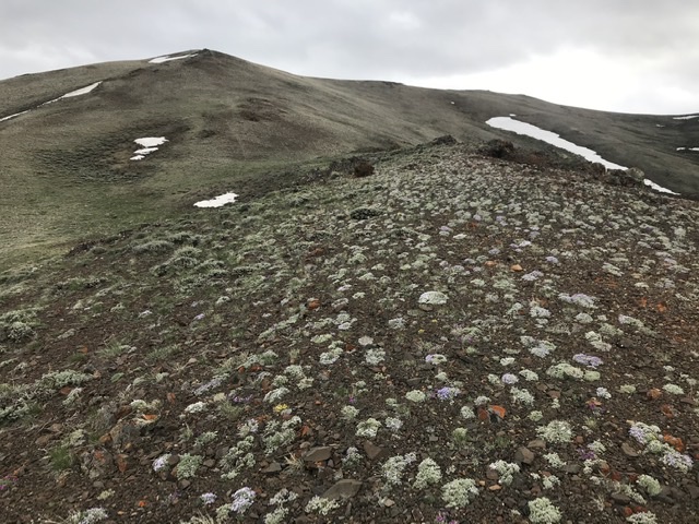
This peak can be climbed from any direction. This route looked as good as any. From the parking area, simply climb the steep slopes to the summit ridge. Once you reach the ridge, traverse around the summit to the twin high points. The westernmost point is the highest. The easternmost point has a large cairn on its top. This route covers 3.1 miles with 900 feet of elevation gain round trip.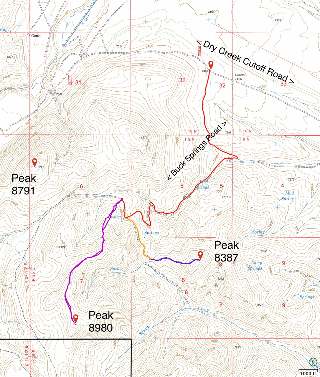
East Face/South Ridge and Northeast Ridge by Livingston Douglas
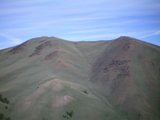
Peak 8986 as viewed from the east. The summit hump is left of center. Livingston Douglas Photo
Access
Same as for Peak 8387. This is the third leg of a 3-peak adventure that includes Peak 8387, Peak 8992, and Peak 8986. It covers 8.3 miles with 3,475 feet of elevation gain round trip.
Map/Informational Errors
LOJ fails to show the BLM road heading east from just north of Buck Springs and down a drainage that leads to Squaw Creek. LOJ shows the HP of Peak 8986 as the west summit hump but the east summit hump is five feet higher and has a large summit cairn. The NF map shows a block of private land in the Buck Springs area. However, it appears to now be BLM land and seems to be open to the public.
East Face/South Ridge, Class 2
The Climb
From the Squaw Creek drainage, bushwhack west up a shoulder (of sorts) in gapped, but thick-ish, scrub to reach the crest of the south ridge. Once on the easy, open ridge, scramble north up short scrub, scree, and ground talus to reach the bare west summit hump (the official LOJ high point). Continue east and drop 45 vertical feet to a ridge notch. The climb east 50 feet upward to the cairned east summit hump, which is the actual high point.
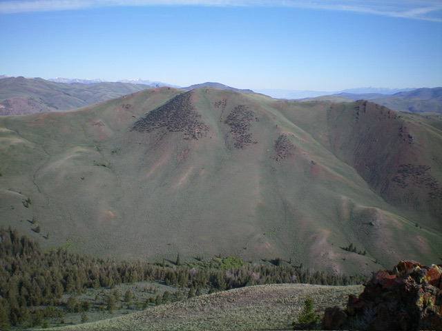
Peak 8986 as viewed from Peak 8992 to its southeast. The summit is in dead center. My ascent route heads up the east face (left of center) to the south ridge (skyline left of center) then goes up the south ridge to the summit. Livingston Douglas Photo
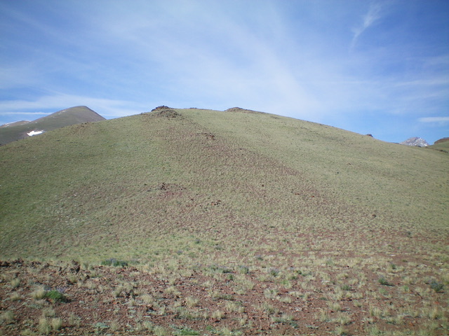
The easy, upper section of the northeast ridge. The summit hump is left of center. This was my descent route. Livingston Douglas Photo
Northeast Ridge, Class 2
The Descent
While this is the same descent route as the Lopez ascent route, I provide more detail on the ridge terrain. So here goes. From the east summit, descend northeast down an easy ridge of short grass/scrub to a high saddle. From the saddle, scramble up a mix of ground talus, minor rocky outcrops, and scrub right-ish/east to a ridge hump. Head north-northeast from here down the steepening ridge crest. The ridge bends right-ish/northeast and steepens even more before it moderates a bit as it approaches a visible 2-track road in a meadow.
The ridge terrain is easy grass/short scrub that becomes a bit thicker just above the meadow. Cross a small stream in the meadow to reach the 2-track road. Follow the overgrown 2-track briefly northeast and up slightly to reach a critical pass at about 8,000 feet. Leave the road just after this saddle and bushwhack north-northeast down a dry gully to cut down on mileage. Intercept the 2-track road at about 7,550 feet then follow it northeast down to Buck Springs and then to the road junction. Walk 0.3 miles east down the narrow BLM road to your parked vehicle.
Additional Resources
Regions: EASTERN IDAHO->Lost River Range
Mountain Range: Lost River Range
Year Climbed: 1988, 2020
Longitude: -113.52769 Latitude: 44.11959