Elevation: 9,187 ft
Prominence: 1,407
This peak is not in the book. Terri Rowe made the trek to the summit and submitted the route information set out below. Updated August 2020
Peak 9187 is located north of Middle Fork Peak. A trail of unknown quality runs across its forested summit. The trail leaves the Middle Fork Peak road between Peak 9187 and Peak 9101. The trail skirts the West Side of Peak 9101 and then follows the ridge north to this seldom-visited summit. USGS Hoodoo Meadows
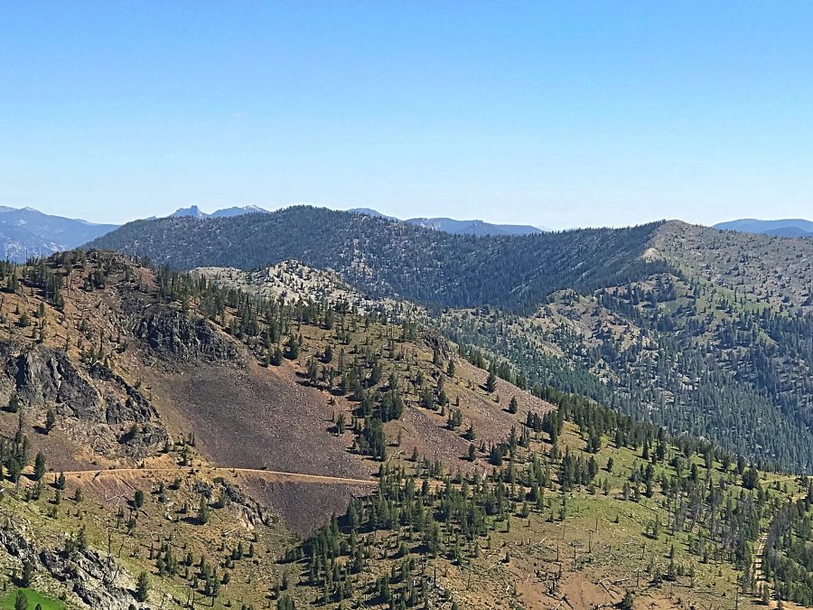
Peak 9187 as viewed from Middle Fork Peak and over the shoulder of Peak 9101.
Access
The starting point for the drive to the summit begins on Panther Creek and uses FS-110, the road that leads to the Bighorn Crags [(H)(4.1) on Page 143]. Google Maps will give you good directions all the way to the summit and the signage is good. Basically, from Panther Creek, follow FS-112 west for 15.0 miles to a 4-way junction. From this junction, continue on to FS-112 signed for Yellowjacket and Middle Fork Peak. From this junction, it is 14.25 miles to the end of the road just below the summit. Follow FS-112 all the way to the saddle just north of Middle Fork Peak. These 14.25 miles climb 5,647 feet and descend 2,290 vertical feet. You will pass the Yellowjacket Guard Station (available for rent on Recreation.gov) and the old mining town of Yellowjacket (private property) along the way. A 4WD vehicle with exceptionally good tires is required.
West Face, Class 2 by Terri Rowe
Park in the 8,736 foot saddle. The FST-6043 trailhead is signed for Hoodoo Meadows. From here it is about a 4.8 mile hike to the range highpoint with stunning views in every direction and beautiful wildflowers everywhere. I lost the faint trail in two spots on the way in but was able to follow the trail the whole way out. To stay on the trail, use the GPS track that goes LOWER in elevation in both cases. There are cairns marking these spots which I missed on the way in. Once immediately below the summit, leave the trail and head up hill a short distance up the peak’s west face to the highpoint. I left a register under a pile of rocks. About 9.6 miles roundtrip with 1,575 feet of elevation gain and a total of 5 hours hiking.
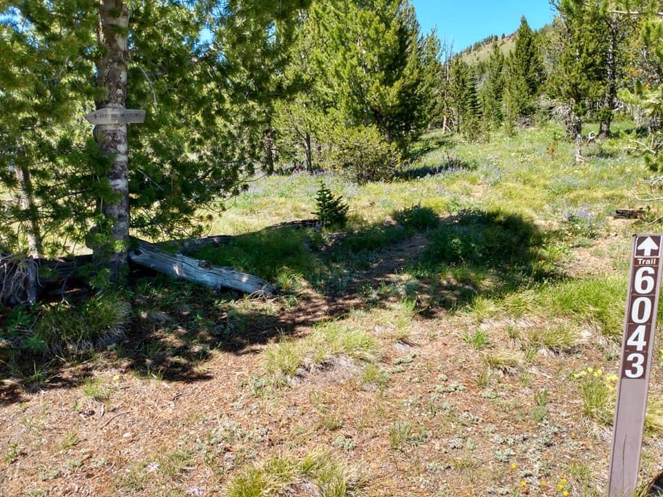
The trailhead. Terri Rowe Photo

The Yellowjacket Mountains High Point. Terri Rowe Photo
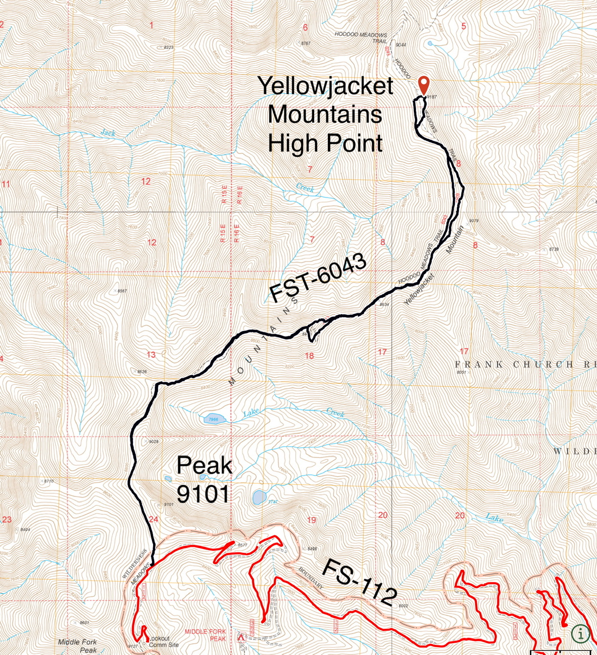
Terri’s GPS track.
Additional Resources
Mountain Range: Eastern Salmon River Mountains
Longitude: -114.62109 Latitude: 45.01009