Elevation: 9,344 ft
Prominence: 284
This peak is not in the book. Livingston Douglas added a new route starting at the Horse Wallow drainage which is set out down the page. Updated November 2021
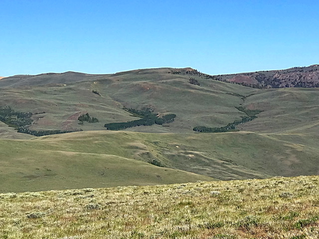
Peak 9344 is located west of Corral Creek Summit on the broad, complicated ridge that runs between Corral Creek Summit and Porphyry Peak. USGS Lehman Butte
Peak 9344 as viewed from the east
Access
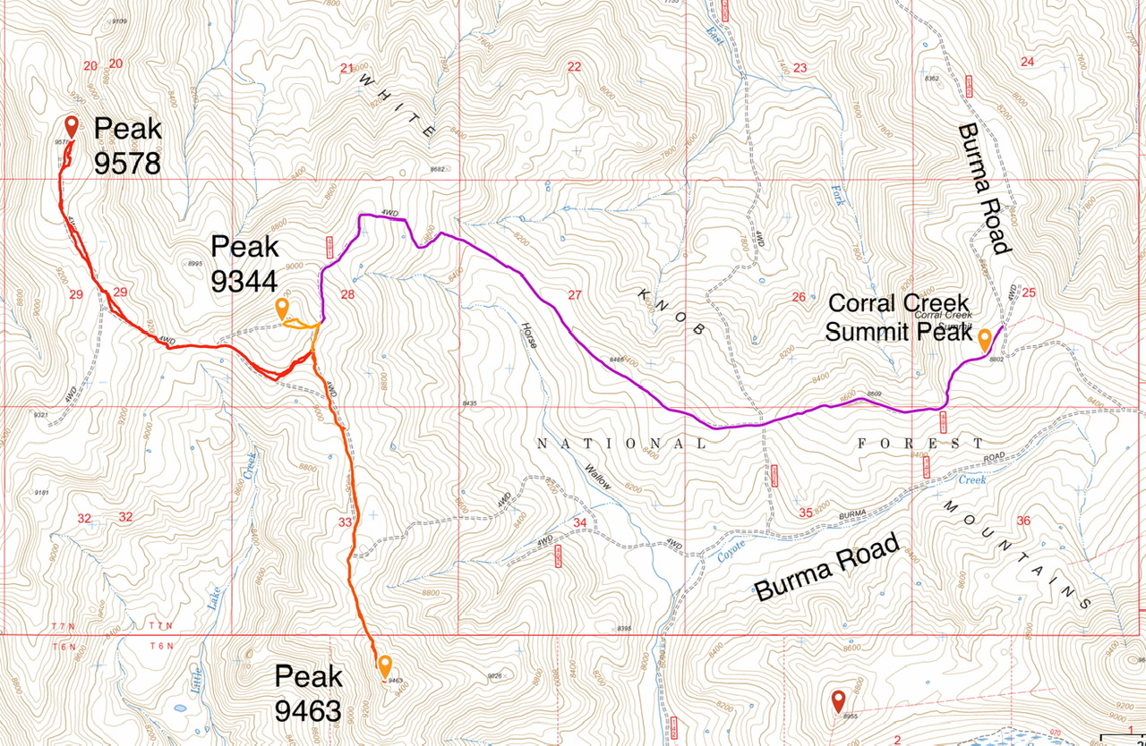
Primary access is via the FS-142/Burma Road [(B)(2) on Page 265]. Follow the Burma Road to Corral Creek Summit. FS-491 (a 4WD road) runs west from the pass to the base of Peak 9344. Follow it west over the peak designated as Corral Creek Summit and continue to the east side of Peak 9344. Park here. It is 4.0 miles to this spot. The road gains 436 feet of elevation and loses 850 feet along the way. A 4WD is recommended.
East Slope, Class 2
A closed ATV road runs from the parking area to the just south of the summit. Follow the road until the summit comes into view. Leave the track and walk to the summit. Round trip is less than 0.4 miles and gains only 136 feet of elevation.
Livingston Douglas’ New Routes
Peak 9344 is located at the head of Little Lake Creek. It is on a ridgeline that connects Corral Creek Summit with Peak 9578. This is the first leg of a 2-peak journey that includes Peak 9344 and Peak 9578. It begins at the base of Horse Wallow on Burma Road. This climb is entirely on BLM land.
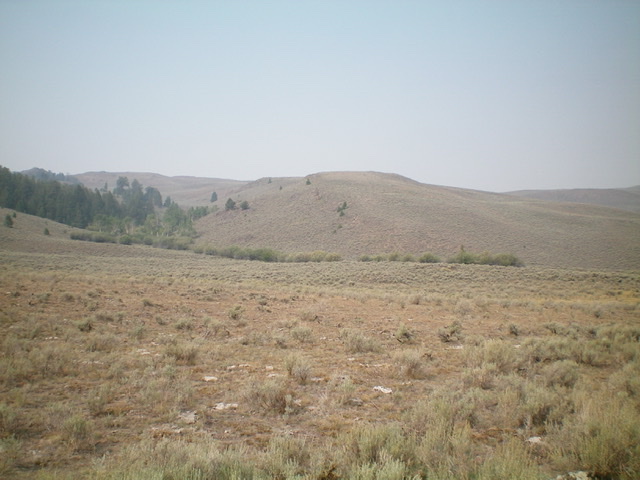
The east shoulder (dead center) as viewed from Horse Wallow. Livingston Douglas Photo
Horse Wallow Access
From the signed junction of FSR-135/Copper Basin Road and FSR-142/Burma Road, drive north on Burma Road for 5.5 miles to an unsigned junction with FSR-492 at the mouth of Horse Wallow. Park along Burma Road near this junction (8,015 feet). FSR-492 is nonexistent at Burma Road but it appears soon after at a cattle gate crossing in Horse Wallow.
East Shoulder/Southeast Ridge, Class 2
The Climb
From the road junction, hike west through clumpy field grass and dried mud then across easy field grass to reach FSR-492 (a 2-track road) just before reaching a cattle fence and cattle gate. Cross the cattle gate and follow the 2-track road west into Horse Wallow. The road crosses a small stream and then climbs up onto the west side of Horse Wallow and follows the Horse Wallow drainage northward on its west side. Go straight/north at an unsigned junction early on and ignore a second unsigned junction that heads left/west up a shoulder.
The 2-track road continues north and is not shown on the USGS topo map. Leave the 2-track road at about 8,200 feet and bushwhack left-ish/northwest across a gully to reach the east shoulder (see photo). The east shoulder leads up to the southeast ridge of Peak 9344 at a saddle at 8,980 feet. The terrain on the east shoulder is sagebrush with some underlying scree. It is a bit tedious but not difficult. As you near the top of the shoulder, angle diagonally right/northwest in short scrub and somewhat-loose underlying gravel to reach the ridge saddle. Look for a cattle trail to help in doing this traverse.
From the saddle, scramble north along the ridge crest (a choppy mix of talus and sagebrush) until a 2-track road comes up to the ridge crest from the left/west side. Follow this 2-track road north-northwest to a fence row where the road heads off to the right/east. Leave the road here and scramble northwest up the ridge crest near a dilapidated fence row on steep scrub and loose scree to reach the west summit hump of Peak 9344. Contrary to the point estimate on the map, the west summit is the high point (by five feet according to my altimeter). Traverse east to the official/east summit and a fence corner. There is a large “cattle fence” cairn on the east summit but no mountain climber’s summit cairn.
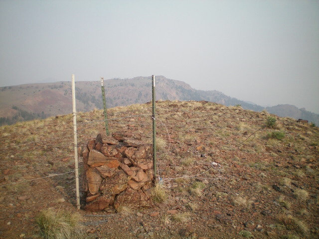
The official summit of Peak 9344. Livingston Douglas Photo
West Ridge, Class 1
The Descent
From the east summit, return to the west summit hump and find a weak 2-track road that descends the ridge crest to a junction and a much better 2-track road. Follow this good 2-track road west briefly to reach a 9,060-foot saddle at the base of the west ridge. This is the connecting saddle with Peak 9578 and concludes the first leg of today’s 2-peak journey. Peak 9578 is up next.
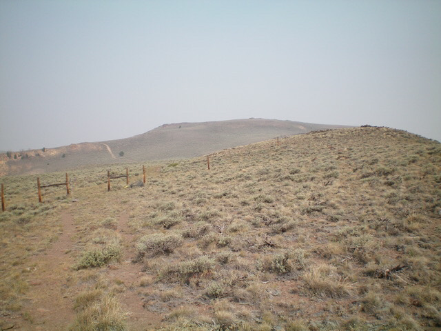
Peak 9344 (mid-ground in distance) as viewed from the saddle at the base of the southeast ridge. Livingston Douglas Photo
Additional Resources
Regions: EASTERN IDAHO->White Knob Mountains
Mountain Range: White Knob Mountains
Year Climbed: 2020
Longitude: -113.85919 Latitude: 43.90569