Elevation: 9,578 ft
Prominence: 1,038
This peak is not in the book. Livingston Douglas climbed this peak and Peak 9344 from Horse Wallow. His route is set out below and on the Peak 9344 page. Updated November 2021
Peak 9578 is located west of Corral Creek Summit on the broad, complicated ridge that runs between Corral Creek Summit and Porphyry Peak. USGS Porphyry Peak
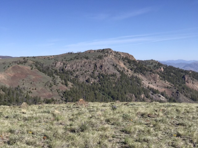
Peak 9578 as viewed from Peak 9344
Access
Primary access is via the FS-142/Burma Road [(B)(2) on Page 265]. Follow the Burma Road to Corral Creek Summit. FS-491 (a 4WD road) runs west from the pass to the base of Peak 9344. Follow it west over the peak designated Corral Creek Summit and continue on to Peak 9344. Follow the road around to the south side of Peak 9344 where there is parking and road closures. It is 4.2 miles to this spot. Park here. The road gains 436 feet of elevation and loses 850 feet of elevation along the way. A 4WD is recommended.
South Ridge, Class 2
From the parking area, contour west along the base of Peak 9344 until you meet the closed road that runs west. This cross-country walk saves you from losing elevation. Once on the road, follow it toward the Peak 9578. There is a fence in the Peak 9344/Peak 9578 saddle. There is a gate that was so tight in 2020 that we scooted under it rather than trying to open and close it. Once through the fence, continue up the road to the peak’s south ridge. Leave the road and walk up the low-angle road to the summit. Round trip covers 3.8 miles with 528 feet of elevation gain.
Livingston Douglas’ Route
Peak 9578 sits above Lehman Basin and is on the east side of Boone Creek. It is a rocky outcrop with a steep east face. This is the second leg of a 2-peak journey that includes Peak 9344 and Peak 9578. It covers 9.0 miles with 2,075 feet of elevation gain round trip.
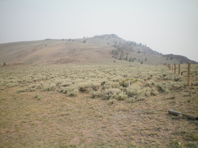
Peak 9578 as viewed from the base of the south ridge. Livingston Douglas Photo
Horse Wallow Access
Same as for Peak 9344. This is the second leg of a 2-peak adventure.
South Ridge, Class 2
The Climb
From the 9,060-foot connecting saddle with Peak 9344, follow the 2-track road west up onto the south ridge and a fence row at a “T” junction. Go right/north onto a 2-track road and follow it briefly then follow a cattle trail that tracks the crest of the south ridge. The cattle trail ends at a field of embedded talus in a flat, saddle-like area. Continue up the ridge crest on firm talus until the 2-track road rejoins the ridge just west of the ridge crest. Cross a cattle fence and follow the 2-track road north alongside the ridge. When the road nears the rocky summit, leave the road and scramble right/east up onto the narrow, rocky ridge crest and follow it to the summit. The ridge crest is Class 3 but can be kept at Class 2 if you skirt its left/west side. I rebuilt the torn-down summit cairn.
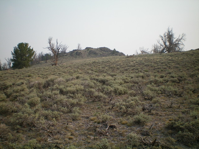
Approaching the rocky summit of Peak 9578 on the south ridge. Livingston Douglas Photo
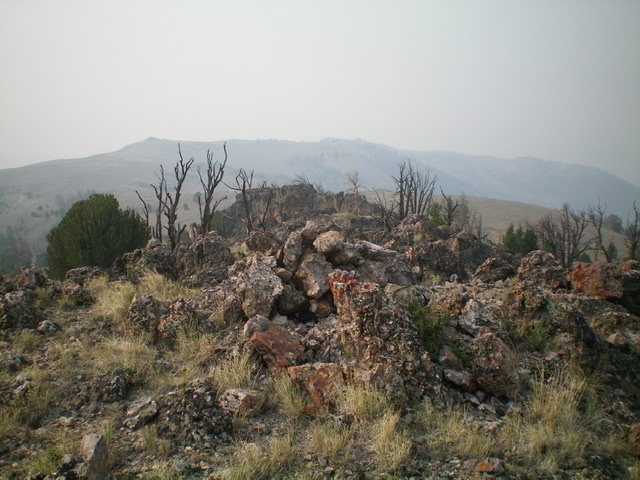
The rocky summit of Peak 9578, looking south along the rocky upper ridge. Livingston Douglas Photo
The Descent
Return to the connecting saddle with Peak 9344. Follow a good 2-track road southeast as it skirts the south side of Peak 9344 and returns to the entry saddle at 8,980 feet. Retrace the ascent route for Peak 9344 back to your parked vehicle on Burma Road at the mouth of Horse Wallow.
Additional Resources
Regions: EASTERN IDAHO->White Knob Mountains
Mountain Range: White Knob Mountains
Year Climbed: 2020
Longitude: -113.87779 Latitude: 43.91729