Elevation: 9,423 ft
Prominence: 323
This peak is not in the book. Published November 2022
Peak 9423 is located at the south end of a forested ridgeline that separates the Salmon River drainage from the Frenchman Creek drainage in the Sawtooth Range south of Stanley. USGS Frenchman Creek
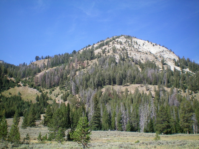
Peak 9423 and its southeast face (left of center). This was my descent route. Livingston Douglas Photo
Access
Same as for Peak 9139 (North Frenchman Peak). This is the final leg of a 3-peak adventure that includes Peak 9139, Peak 9345 (Frenchman Peak), and Peak 9423.
West Ridge, Class 2
The Climb
From the 9,020-foot connecting saddle with Peak 9345, follow the semi-open forested ridge south then southeast then east as it bends to reach the top of Point 9296. From Point 9296 to the summit, the ridge is narrow and rocky. It is semi-open and has ridge firs to avoid. There is no elk trail to help you out. The final push to the summit is in mostly open scrub/scree. The summit of Peak 9423 is open terrain with standing, charred snags on the west side of the summit ridge area. The summit has a decent cairn.
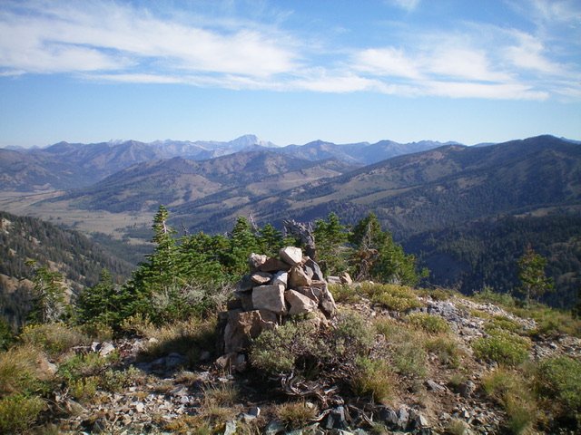
The large summit cairn atop Peak 9423. Livingston Douglas Photo
Northeast Ridge/East Face, Class 2+
The Descent
From the summit, descend the northeast ridge to a critical ridge junction at 9,200 feet. Leave the northeast ridge here and descend the east ridge (which is well-defined here) in steep, loose scree/gravel with scattered pines. Continue downward until the ridge becomes a rounded shoulder and ends at a prominent side gully. Drop into the gully and follow its narrow, rocky, debris-strewn center tediously down to the valley floor with an easy finish on open scrub. Head east across the dry valley floor and jump across a small stream to reach the edge of the forest then bushwhack up about 20 feet to find the Mule Creek Trail. Follow the trail northward for about 1.5 miles back to the trailhead.
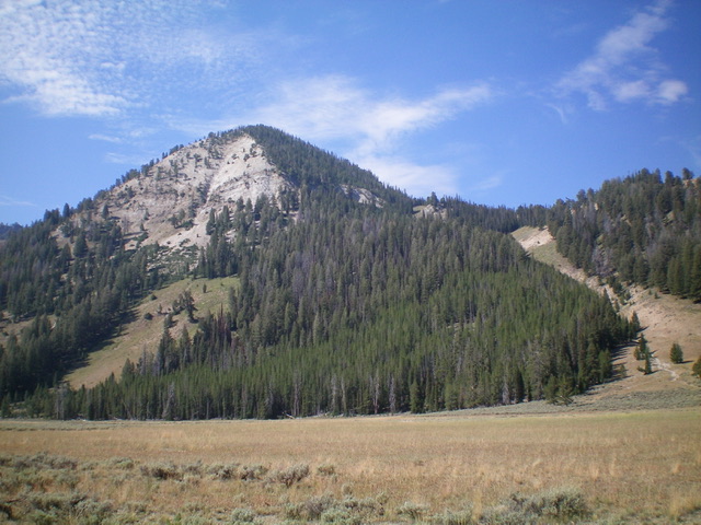
Peak 9423 and its northeast side. The gully on the right is probably a good ascent route. Livingston Douglas Photo
Additional Resources
Mountain Range: Sawtooth Range
Longitude: -114.77001 Latitude: 43.82609