Elevation: 9,463 ft
Prominence: 483
This peak is not in the book. Livingston Douglas added the southeast spur/east ridge route to this page. Updated November 2020
This attractive summit is located between on the broad, complicated ridge that runs between Corral Creek Summit and Porphyry Peak. USGS Lehman Butte
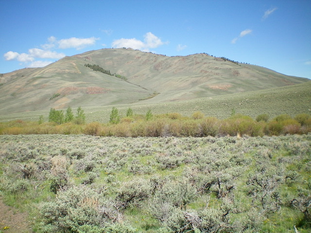
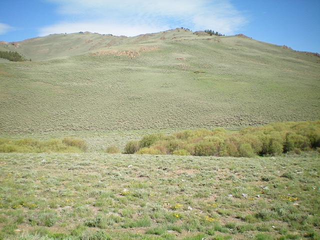
Peak 9463 as viewed from the north
Access
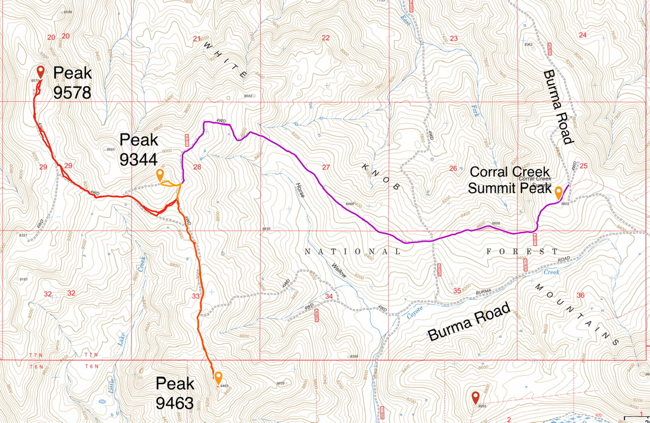
Primary access is via the FS-142/Burma Road [(B)(2) on Page 265]. Follow the Burma Road to Corral Creek Summit. FS-491 (a 4WD road) runs west from the pass to the base of Peak 9344. Follow it west, over the peak designated Corral Creek Summit and continue on to Peak 9344. Follow the road around to the south side of Peak 9344 where there is parking and road closures. It is 4.2 miles to this spot. The road gains 436 feet of elevation and loses 850 feet along the way. A 4WD is recommended. Park here.
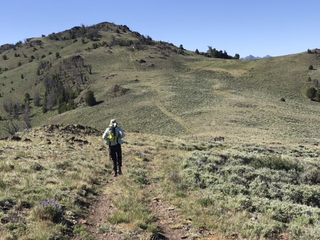
North Ridge, Class 2
From the parking spot, a closed ATV track runs south along the west side of a fence line from the road closure. Follow the track until it ends and then continue along the ridge to the summit working around a couple of false summits. Round trip stats: 3.2 miles with 600 feet of elevation gain.
Southeast Spur/East Ridge by Livingston Douglas
Peak 9463 is located on the west side of Burma Road, just north of the confluence of Coyote Creek and Corral Creek. It is a fun scramble from Burma Road and presents no problems.
Peak 9463 as viewed from the Corral Creek drainage to its southeast. The summit is just left of center. Livingston Douglas Photo
Peak 9463 as viewed from Burma Road and the starting point for the ascent of the southeast spur/east ridge route. The east ridge is the far right skyline. Coyote Creek is in the foreground surrounded by tall, thick willows. Livingston Douglas Photo
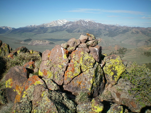
The summit cairn atop Peak 9463, looking southwest at the east side of the Pioneer Mountains. Livingston Douglas Photo
Access
Burma Road/FSR-142 is located along Copper Basin Road/FSR-135 exactly 3.9 miles southeast of the junction of FSR-135 and FSR-138/Copper Basin Loop Road. Drive 4.5 miles on Burma Road (crossing Corral Creek at 3.8 miles) to reach a large pullout area on the left/west side of the road just past a cattle guard/fence). Park here (7,965 feet). This is as close a parking spot as you will get for the southeast spur/east ridge route on Peak 9463.
Southeast Spur/East Ridge, Class 2
The Climb
From the parking pullout area, drop 25 vertical feet west to cross Coyote Creek (a small stream) through a prominent, albeit marshy, break in the thick, tall willows surrounding the creek drainage. Once across the creek, scramble west up through reasonable sagebrush (some weaving required) to reach an obvious spur ridge heading northwest toward the main east ridge. From a flat ridge area at 8,380 feet, leave the spur and climb directly north to reach the crest of the east ridge through thicker sagebrush and some underlying loose scree. Climb northwest then west along the ridge crest on easy open scrub with a few rocky outcrops to navigate. The summit of Peak 9463 is a small, rocky perch with a modest cairn. It offers great views of Copper Basin and the surrounding peaks.
Additional Resources
Regions: EASTERN IDAHO->White Knob Mountains
Mountain Range: White Knob Mountains
Year Climbed: 2020
Longitude: -113.85009 Latitude: 43.88289