Elevation: 9,937 ft
Prominence: 406

This peak is not in the book but is referenced on page 215. Two routes are set out below and there is a discussion of the peak’s North Ridge as a possible ascent route. Use this link to read the new access route: North Smoky Dome Road Access. Updated July 2018
North Smoky Dome rises 406 feet from the saddle it shares with Smoky Dome. Most people, myself included, ignore this peak when they climb Smoky Dome. In my case, it was a hot day. The long climb of Smoky Dome and the broken talus on North Smoky Dome convinced me to head for the car. Nevertheless, this peak is an impressive mountain. USGS Boardman Creek
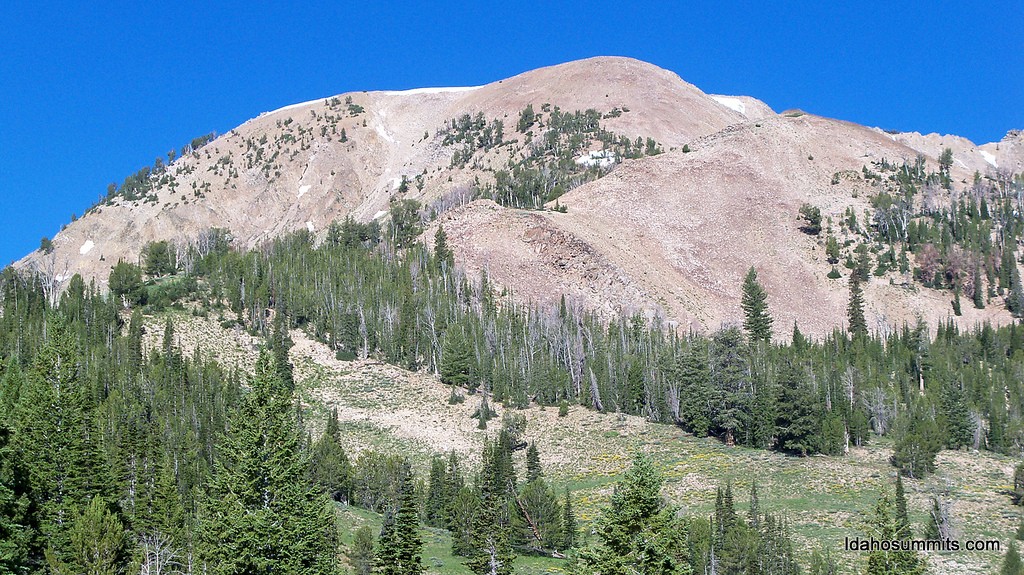
North Smoky Dome. Dan Robbins Photo
South Ridge, Class 2
The peak’s South Ridge connects with Smoky Dome’s Northeast Ridge at a 9,531-foot saddle. The saddle can be reached by a long slog up the South Fork Soldier Creek [(A)(1.1) on Pages 216-217] or by descending from Smoky Dome’s summit (it is 0.7 miles between the two summits). It is also possible to traverse across the peak’s East Face from the road that climbs the peak’s North Ridge (see North Smoky Dome Road Access).
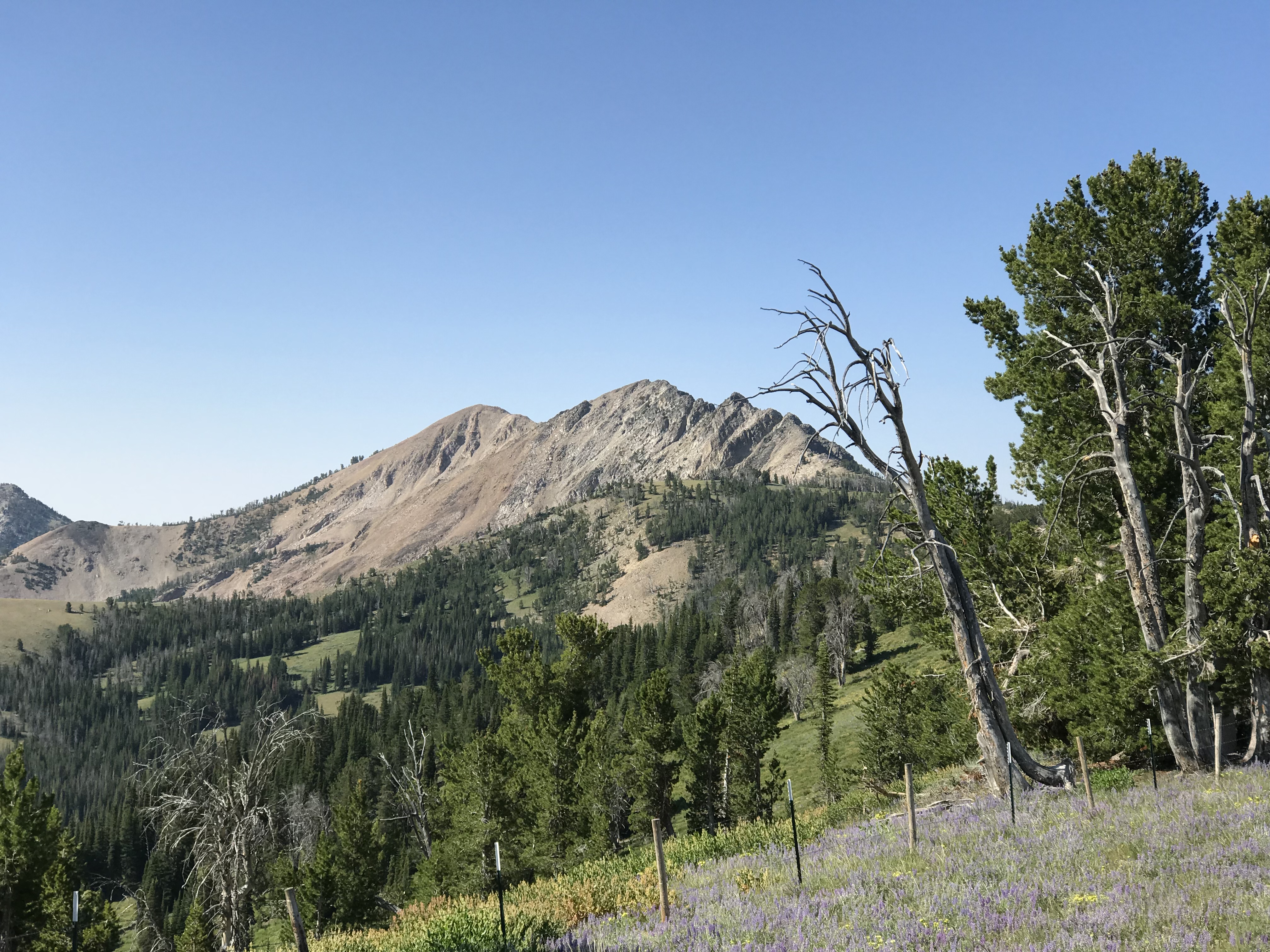
North Smoky Dome and its East Face as viewed from the north. The highest point is on the left.
East Face, Class 2+
The East Face is a complicated conglomeration of cliffs, talus fields and broken ribs. There are probably several lines that are climbable besides the one shown in the accompanying GPS track. Use this link to read the new access route: North Smoky Dome Road Access.
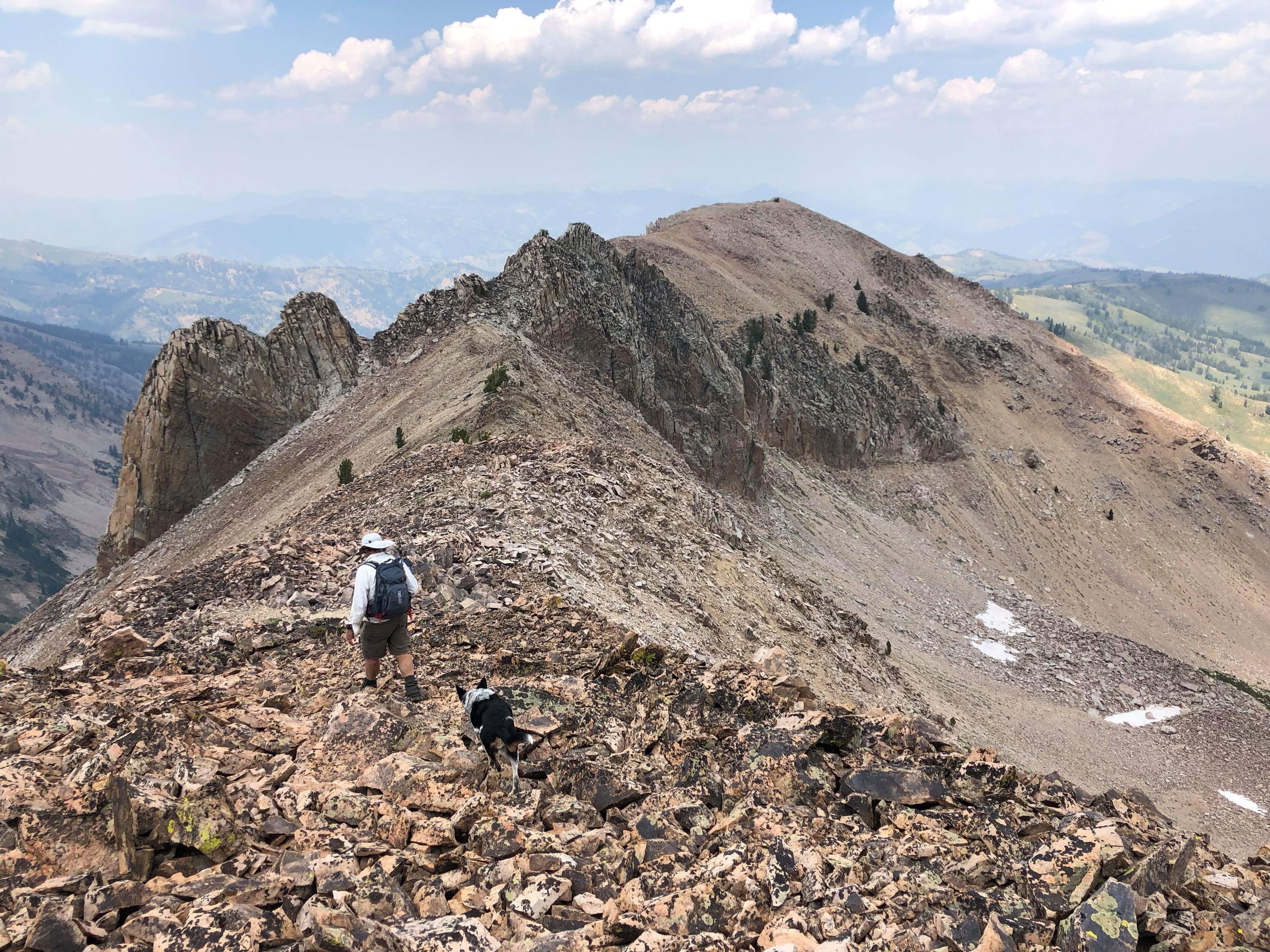
The route shown makes a climbing traverse to a broken, rocky rib and then climbs the rib to the summit ridge north of the summit. Traverse the summit ridge north to a group of towers that blocks the route. Pass the first low tower on the west. Once on its south side, more towers come into view. The route climbs up and between the two towers on the right. Once past this point, it is a quick walk to the summit.
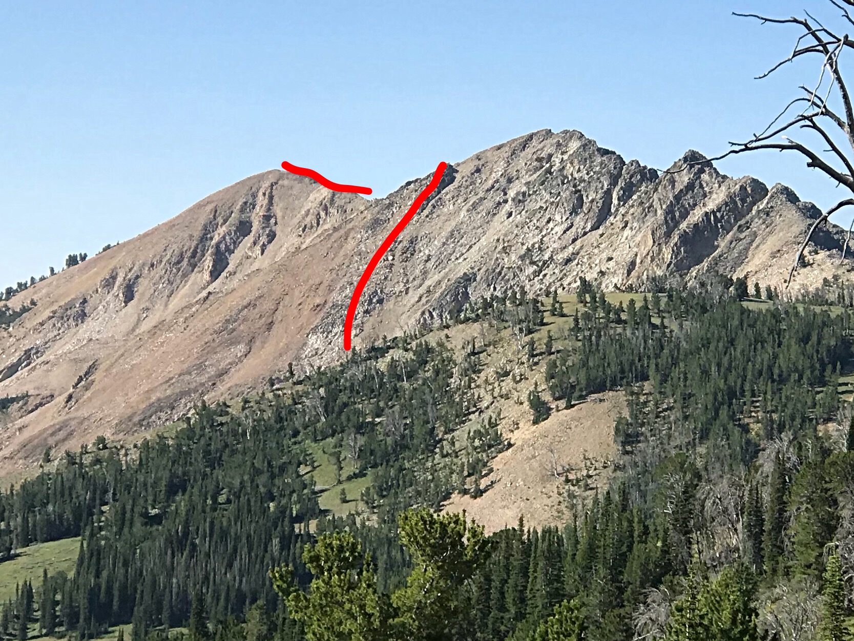
The approximate line up the East Face. The blocking towers are not visible in this photo.
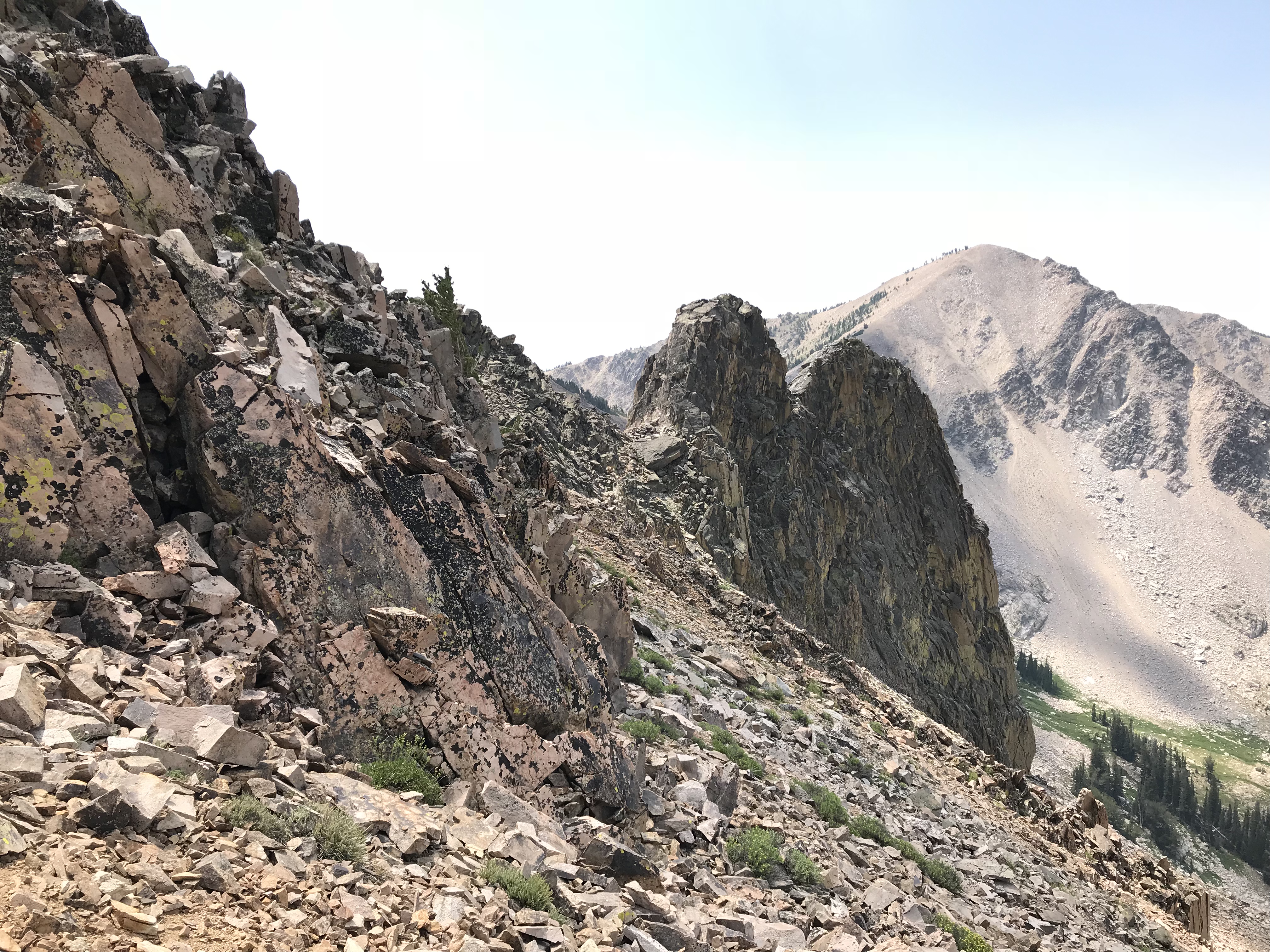
The view as you pass the first tower. Keep left.
The route climbs up to the upper left corner of this photo and passes the tower on the left.
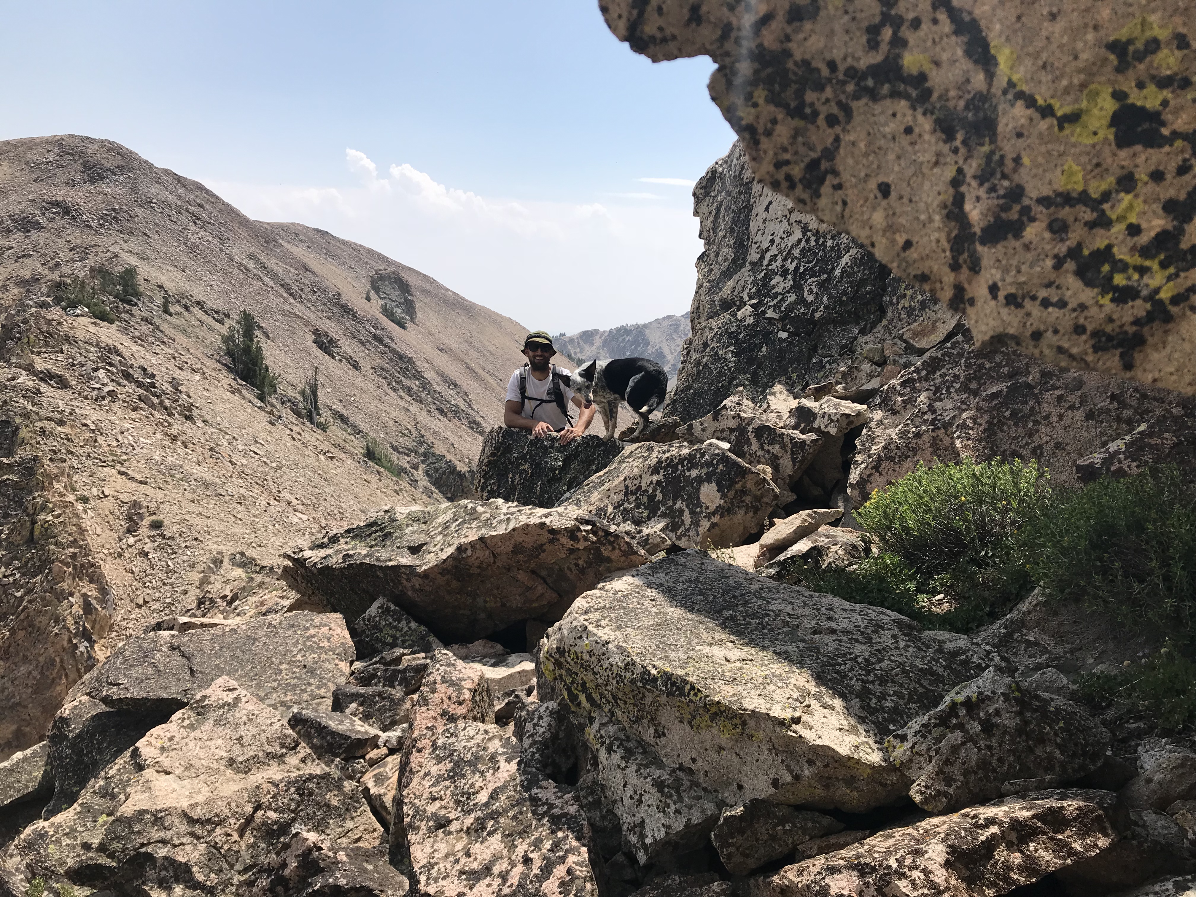
Derek Percoski and Skye at the point where the route passes the last tower.
Looking back north from the summit to the towers. Derek Percoski Photo
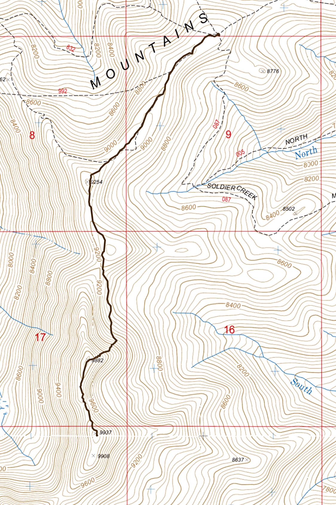
My GPS track from the North Ridge to the summit. Round-trip stats: 5.4 miles with 1,200 of elevation gain.
North Ridge, Class?
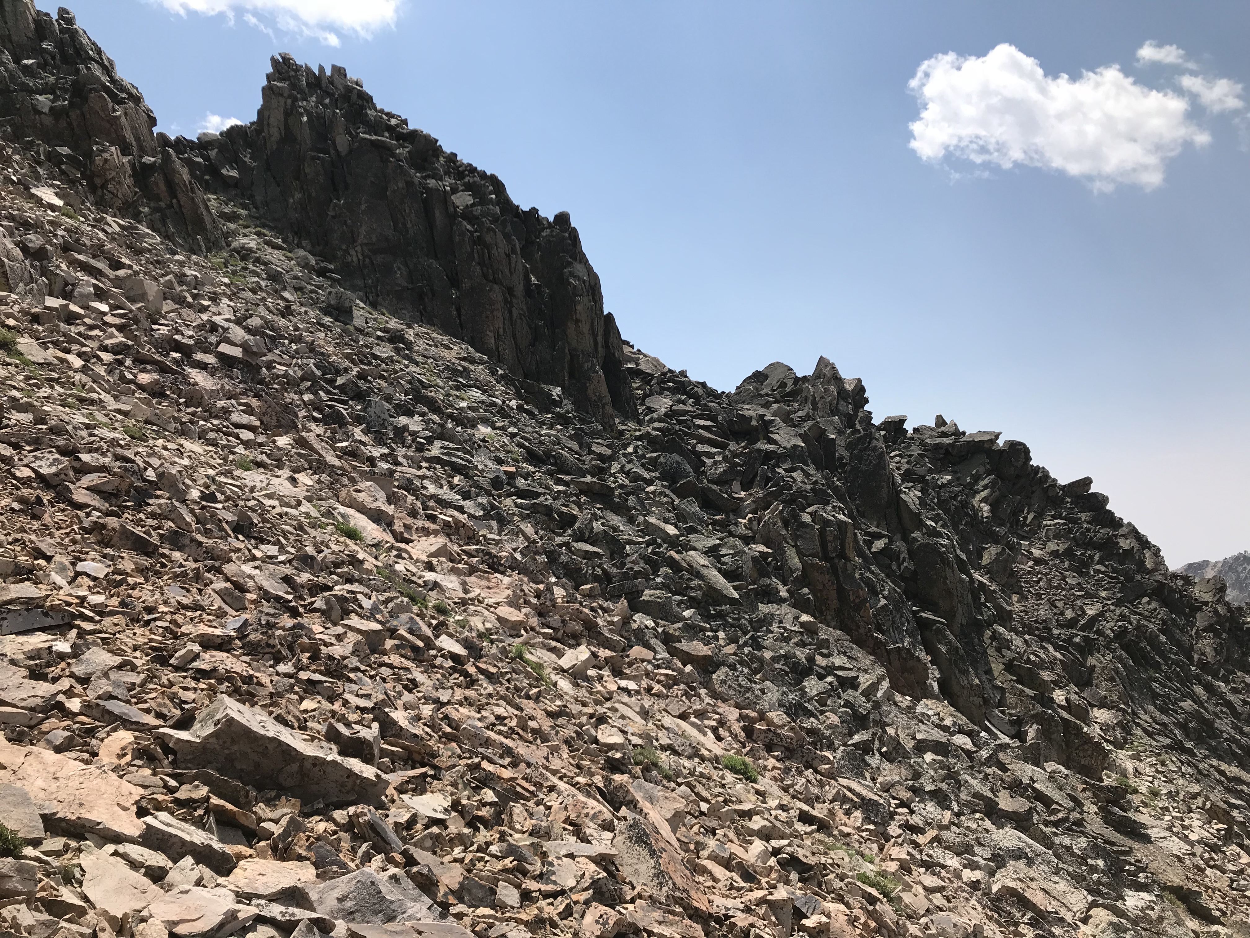
I started up the peak’s North Ridge in 2018. At the top of the first Class 3 tower, the route ahead looked difficult and unquestionably time-consuming. We aborted the ascent and climbed the East Face instead. There are at least two more notches and broken towers blocking the route. The rock on these towers is blocky and forms some steep walls. There may be a Class 4 route over these obstacles, but I suspect the terrain from my vantage point would involve technical climbing. Please let me know if you climb this ridge.
Additional Resources
Regions: Soldier Mountains->WESTERN IDAHO
Mountain Range: Soldier Mountains
Year Climbed: 2018
Longitude: -114.92759 Latitude: 43.50009