Elevation: 10,095 ft
Prominence: 3,275
Climbing and access information for this peak is on Page 215 of the book. The book lists the Grand Tour Route which begins near the Soldier Mountain Ski Area. Below you will find additional route details. There is also additional information on the traverse between Smoky Dome and North Smoky Dome set out below. Updated July 2018
Smoky Dome is the highest peak in the Soldier Mountains. This big mountain is one of the largest mountain masses in Idaho. Because of its massive prominence (3,275 feet), it is a popular summit for prominence baggers. The Southwest Face Route listed below has become the most popular route to the top. USGS Smoky Dome
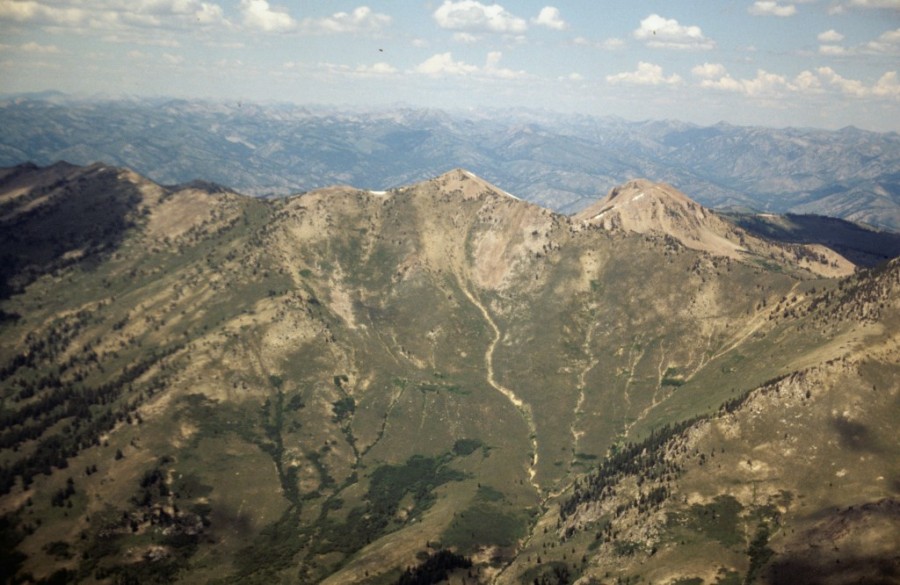
This aerial shot shows both Smoky Dome and North Smoky Dome.
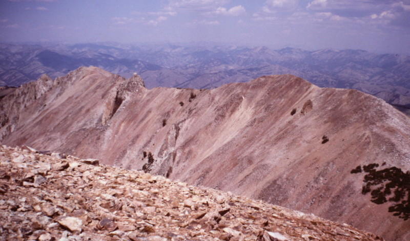
Smoky Dome as viewed from North Smoky Dome.

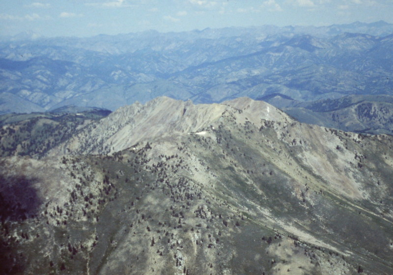
Smoky Dome as viewed from the air.
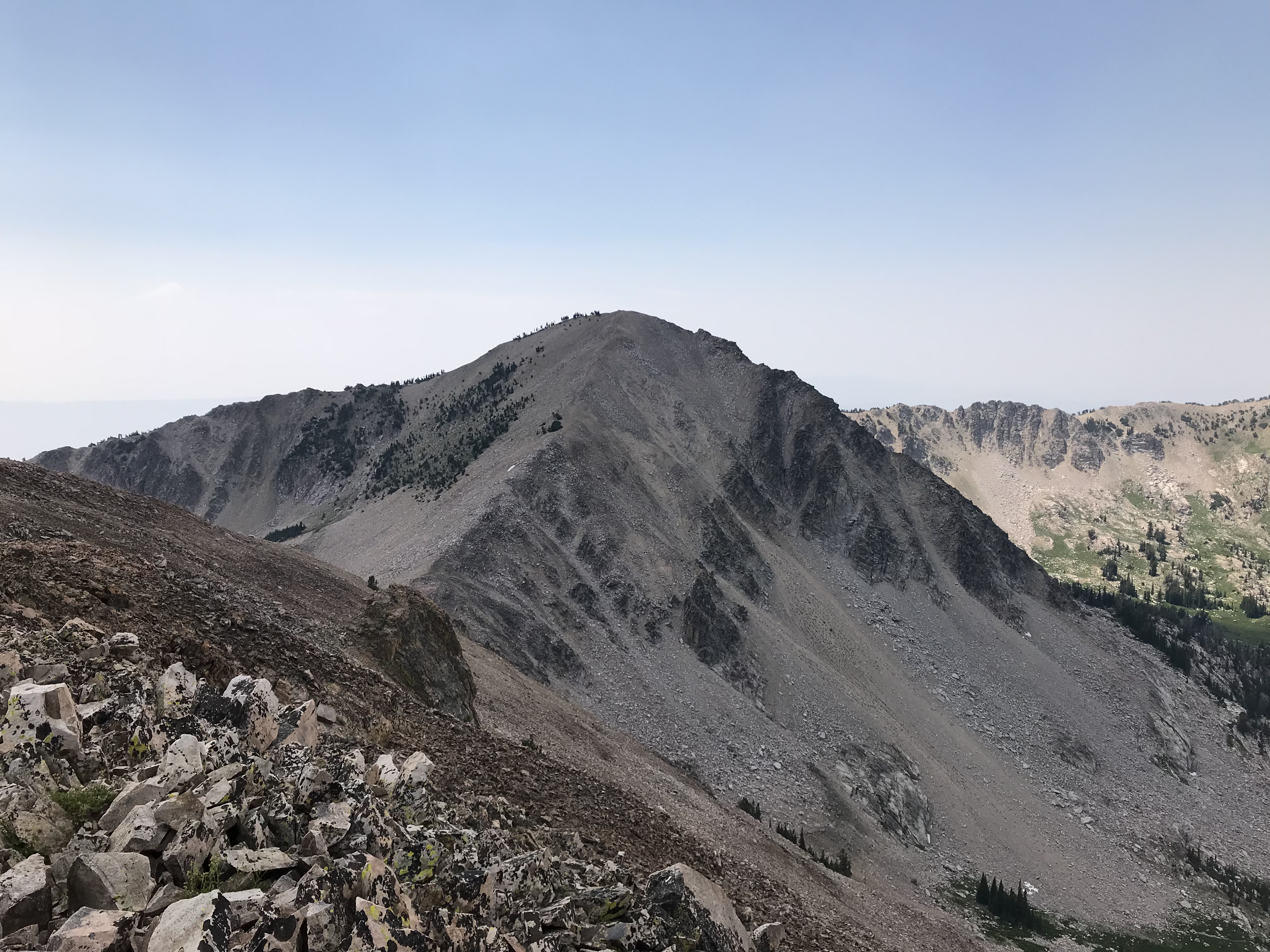
North Smoky Dome (9,937 feet) as viewed from the summit of Smoky Dome.
Southwest Face, Class 2, (Adopted from entries on Peakbagger.com)
Access
From US-20 in Fairfield, Idaho, drive north through downtown for 1.8 miles. Turn left onto 200N. Continue west on 200N for 10.3 miles. Turn right onto 1100W. Zero out your odometer. Follow 1100W north for 1.0 miles and turn left onto Chimney Creek Road. After 1.5 miles, reach a gate. At 5.1 miles, continue straight through another gate. The road is now signed as FSR-484. There are corrals at 8.9 miles and more corrals at 9.6 miles. Turn right onto a rough road. A 4WD is recommended from this point. At 11.2 miles, take the right fork. The road quickly makes a hairpin turn. At 11.6 miles, go left. Park at 12.0 miles. The elevation here is 7,760 feet.
Route
From the parking area, follow an ATV trail up to about 8,100 feet and then a game trail up the drainage. At roughly 8,200 feet, cross the creek. The route continues following game trails up toward the Point 9884. Cross below Point 9884 on its right side. From the other side of Point 9884, follow the ridge to the summit. It is a bit over 3.0 miles to the summit with 3,000 feet of elevation gain.
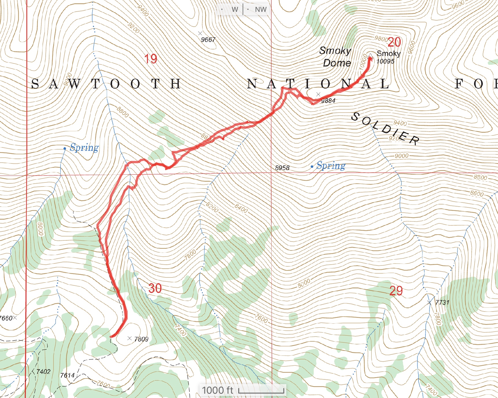
Bob Bolton’s GPS track.
Read about Bob Bolton at this link. Bob Bolton
Northeast Ridge, Class 2
The peak’s Northeast Ridge climbs from the saddle between Smoky Dome and North Smoky Dome in less than 0.4 miles with around 500 feet of elevation gain. The saddle can be reached either from Soldier Creek or from the North Ridge of North Smoky Dome. See North Smoky Dome Access to reach the North Ridge of North Smoky Dome.
Additional Resources