Elevation: 7,717 ft
Prominence: 337
This peak is not in the book. Livingston Douglas added a new access point, a new route, and photos. Updated November 2024
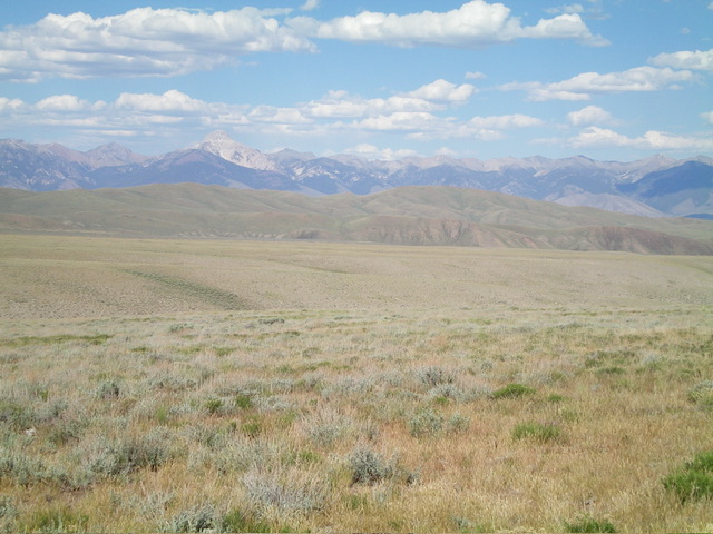
Red Hill is the second highest peak in the Red Hills subrange of the Lost River Range. It is a treeless peak with one of the best 360-degree views in Idaho. USGS Red Hills
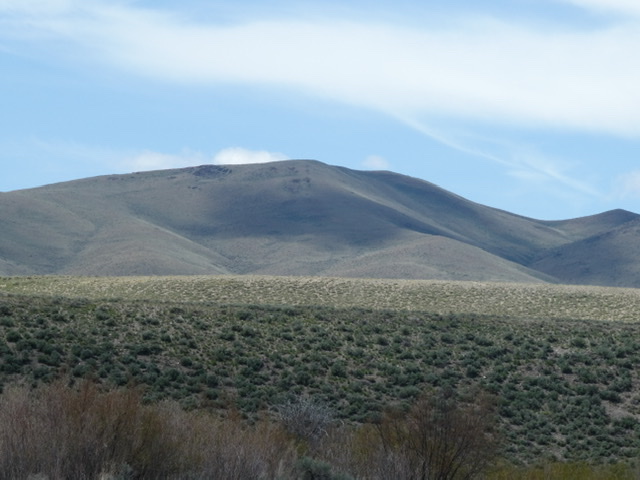
Red Hill viewed from the southeast
Access
Primary access is from the Wet Creek/Pass Creek Road [(A)(6.1) Page 290]. Follow this road west from Clyde. Just after the road crosses Wet Creek it climbs up a hill and meets a junction. Turn right and follow a good gravel road north to a cattle guard. Just after the cattle guard turn left/west on to a 4WD road. Follow this road for 2.8 miles to its end on Red Hill’s south ridge.
South Ridge, Class 2
The south ridge is a broad slope with good footing. There are no obstacles and the summit is 0.8 miles and 557 feet of elevation gain from the road’s end.
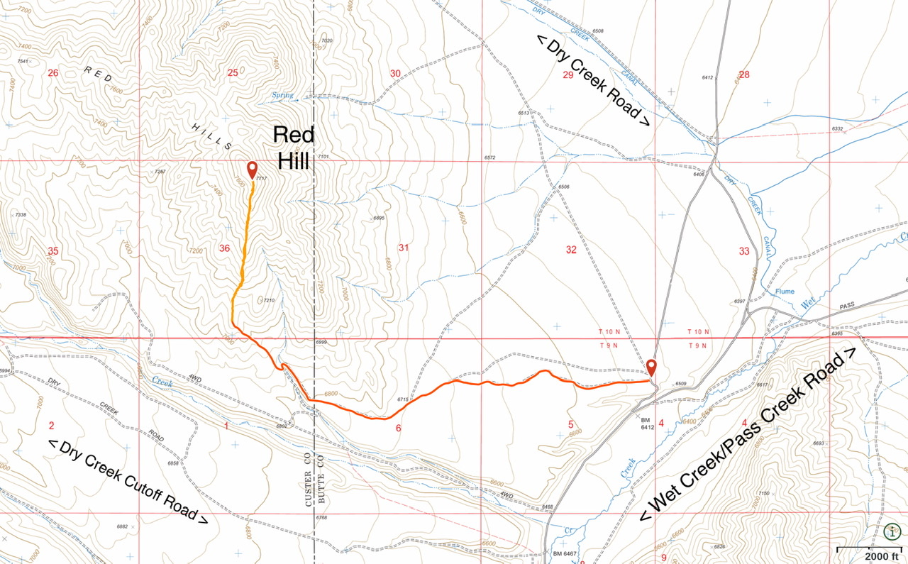
This map shows the most efficient way to reach Red Hill. The red line shows the 4WD road approach. The orange line is my GPS track to the summit.
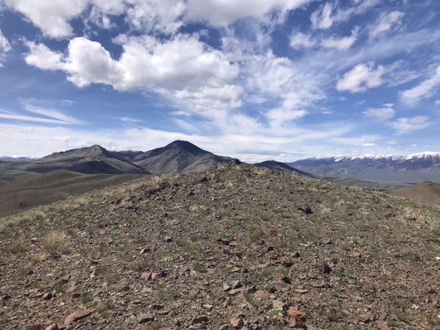
The summit of Red Hill
East Shoulder by Livingston Douglas
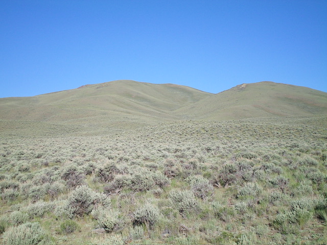
Red Hill and its east shoulder (left of center, coming at the camera). This was my ascent route. Livingston Douglas Photo
Access
From ID-33 in Howe, drive 27.6 miles northwest on the Little Lost River Highway to a signed road junction with Wet Creek Road in Clyde. Reset your odometer here. Turn left/west onto Wet Creek Road. At 5.9 miles, turn right/north onto an [unsigned] excellent gravel road. At 6.8 miles, reach an unsigned “T” junction with Pass Creek Road. Go hard left/southwest onto this well-maintained road and drive 100 feet to an unsigned junction with a 2-track road heading right/west.
Drive 1.0 mile west then northwest on this poor 2-track road (ruts in the gully/wash that it crosses) to reach a sharp right/north bend in the road. Park in the sagebrush here (6,515 feet and 44⁰09’51”N, 113⁰23’23”W). Better yet, continue another ½ mile northwest up the 2-track road to a junction with another 2-track road that heads west. Drive about 0.7 miles up that side road to a grassy, flat area and park. That parking spot cuts the hiking distance in half while climbing the same shoulder.
East Shoulder, Class 2
The Climb
The east shoulder of Red Hill is far more pronounced (and impressive) than the USGS topo map suggests. It is a magnificent sight. From my parking spot at 6,515 feet, bushwhack west-southwest directly at the shoulder, crossing endless [gapped] sagebrush with some minor gullies and ridges/humps along the way. Once on the east shoulder, follow it west then southwest then west to the summit. There is a large wash/gully on its right/north side. Higher up, the grass and sagebrush becomes short, gapped, and easy. It always has a gravel/scree base. The summit has a decent cairn and is clearly the high point on the ridge crest.
Red Hill (in mid-ground) as viewed from the west. Livingston Douglas Photo
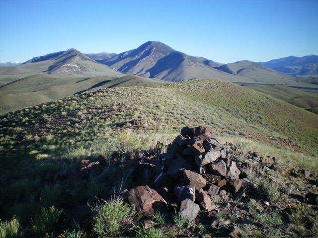
The summit cairn atop Red Hill. Livingston Douglas Photo
Additional Resources
Regions: EASTERN IDAHO->Lost River Range->Red Hills
Mountain Range: Lost River Range
Year Climbed: 2020
Longitude: -113.42329 Latitude: 44.15929