Elevation: 7,929 ft
Prominence: 349
This peak is not in the book. Published January 2023
Ross Peak is located northeast of Swan Valley, Idaho. The easiest approach is from Rainey Creek Road/FSR-257 to its south. This is the first leg of a 3-peak adventure that includes Ross Peak, Peak 8191, and Peak 7843. This journey covers 10.2 miles with 3,325 feet of elevation gain round trip. USGS Swan Valley
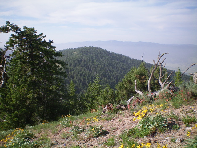
Ross Peak as viewed from the east ridge of Peak 8191 to its north. Livingston Douglas Photo
Access
From the junction of ID-31 and US-26 in Swan Valley, drive east on ID-31 for 8.0 miles to a signed junction with FSR-250/Mike Spencer Canyon Road. Turn right/east onto FSR-250 and drive 1.9 miles to the end of the road at the Burnt Canyon Trailhead/FST-087. There is a large parking lot and a bathroom here (6,230 feet).
The Approach, Class 2
Hike south up narrow FST-087 to a saddle (7,420 feet) at the head of Burnt Canyon. This saddle is on the edge of a dense pine forest. The USGS topo map shows a trail junction here, but it does not exist. Leave the trail here before it reaches a junction with the Corral Canyon Trail/FST-086 and begins a climb up to Point 7677. From the saddle, bushwhack southwest through a flattish, thick pine forest (with lots of underbrush) and quickly find a game/use trail that follows the center line (then ridge) to an intervening lateral ridge that must be crossed. Once atop the lateral ridge, follow it south through semi-open pine forest (with somewhat thick veg and blowdown) to another ridge hump. From this hump, descend right/west to a forested saddle at 7,460 feet.
Follow the ridge crest west then southwest up through a semi-open pine forest with thick-ish veg and some blowdown to skirt (a game trail helps) to reach an obvious ridge junction with the ridge that heads left/south to a saddle and Ross Peak, which is now visible. Descend the semi-open ridge south to a saddle at 7,580 feet. This saddle is at the base of the north ridge of Ross Peak.
North Ridge, Class 2
The Climb
From the saddle, scramble south up a more tedious ridgeline with some open knobs and some areas of dense veg and blowdown to reach the well-cairned summit of Ross Peak. The summit also has a sign for Ross Peak, a nearby USGS benchmark, and an ammo box secured to the summit post. Return north to the saddle then scramble north to the ridge junction with the east ridge of Peak 8191. This concludes the first leg of today’s 3-peak adventure. Peak 8191 is up next.
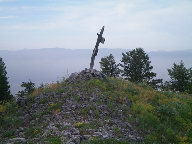
The summit of Ross Peak. Livingston Douglas Photo
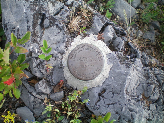
The USGS benchmark atop Ross Peak. Livingston Douglas Photo
Additional Resources
Mountain Range: Big Hole and Snake River Mountains
Longitude: -111.27249 Latitude: 43.48069