Elevation: 9,349 ft
Prominence: 1,509
This peak is not in the book. Derek Percoski provided the route information set out below. I added photos and maps from my climb. Livingston Douglas climbed the peak from Peak 9053. His route is set out below. Updated November 2021
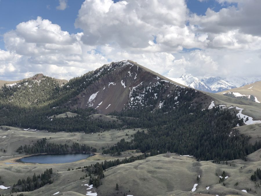
Spring Hill is located east of the main Lost River Range Crest, a couple of miles north of Horseheaven Pass. It abruptly rises up above the Pahsimeroi Valley and is the highest point of a somewhat-isolated group of 7 peaks, 5 of which are ranked summits. As a result of its prominence, Spring Hill was used as a surveying site as early as 1915. USGS Spring Hill
Spring Hill as viewed from the north. Derek Percoski Photo
Northwest Ridge, Class 2 by Derek Percoski
Access
From Doublespring Pass Road [(C)(3) on Page 293], turn east onto FS-117 toward Horseheaven Pass. Reset your odometer. At roughly 1.2 miles, the road forks. Go left/northeast onto FS-268. At 2.5 miles, go left at another junction. At 4.6 miles, the road tops out at 8,700 feet directly on the northwest ridge of Spring Hill. A high-clearance vehicle is required and 4WD is recommended.
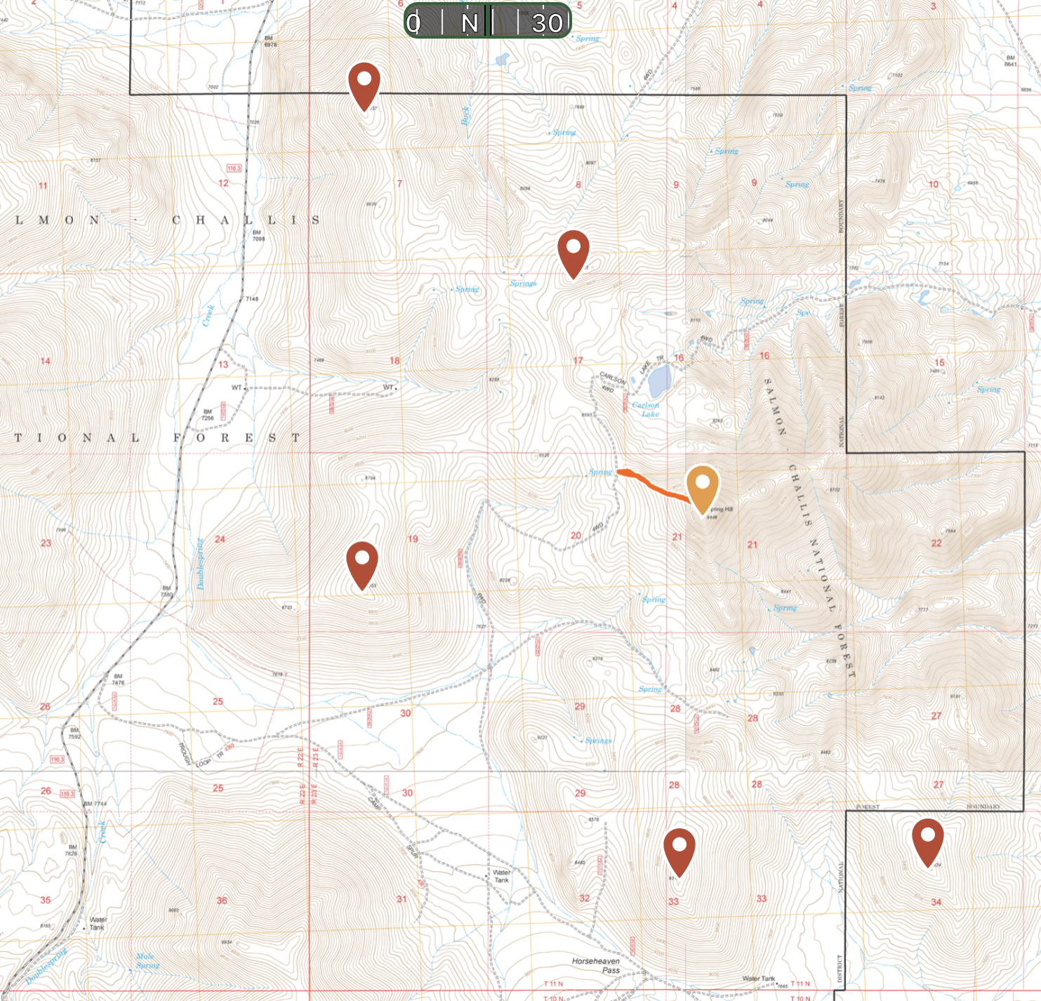
This map shows the 4WD access route and the ranked peaks in the Spring Hill group.
Route
From the road, it is just over a half a mile with 754 feet of elevation gain up the northwest ridge to the summit. An occasional game trail can be used for parts of the climb.
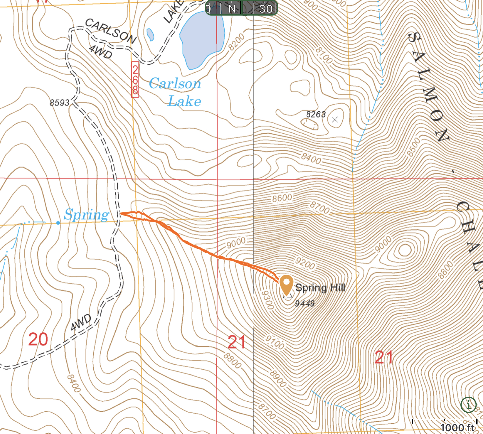
Spring Hill with the Northwest Ridge Route in red. Derek Percoski Photo
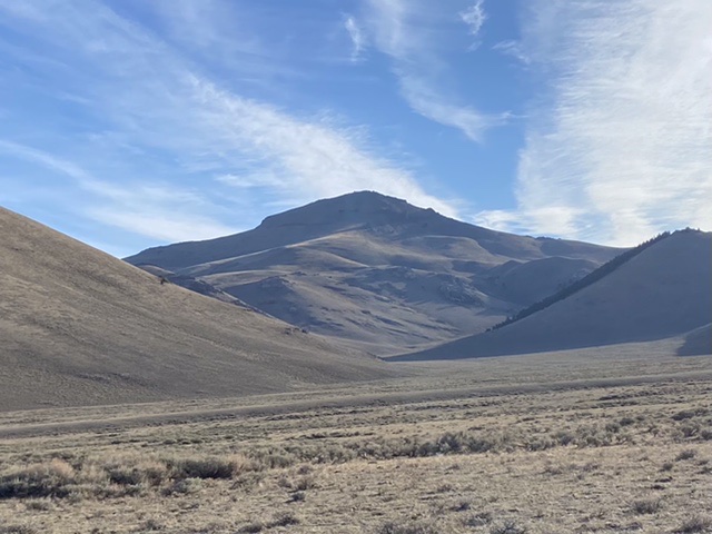
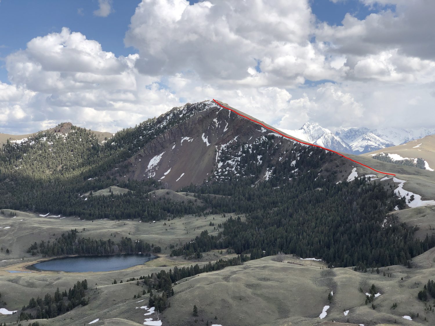
Spring Hill as viewed from the Horseheaven Pass Road.
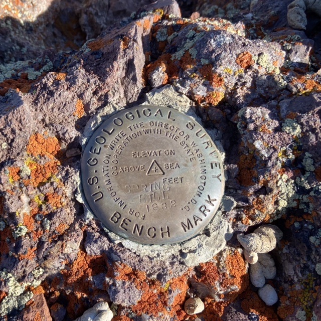
The summit benchmark
Additional Access Information
Your 4WD adventure can continue on unofficial ranchers’ roads along the ridge to Peak 8937. The 4WD road goes to the summit. Along the way to Peak 8937, we stopped and climbed soft-ranked Peak 8860. Reaching this peak requires jumping a cattle fence on National Forest Land.
Livingston Douglas Trip Report
Spring Hill sits above Carlson Lake. Its north and east aspects are particularly rocky and rugged. The mountain’s weakness is its west side and the northwest ridge is the easiest ascent route. This is the second leg of a 4-peak adventure that includes Peak 9053, Spring Hill, Peak 8860, and Peak 8937. It covers 12.0 miles with 4,175 feet of elevation gain round trip.
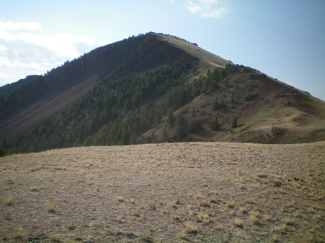
A close-up shot of the northwest ridge from its base. Livingston Douglas Photo
Access
Same as for Peak 9053. This is the second leg of a 4-peak journey.
Northwest Ridge, Class 2
The Climb
From the 8,220-foot connecting saddle with Peak 9053, follow a jeep/ATV road (not shown on maps) east then northeast up the ridge to reach an unsigned road junction on the main north-south ridge crest that sits above Carlson Lake. Go right/southeast at this junction and follow the ridge on a jeep/ATV road to reach the base of the steep northwest ridge of Spring Hill. Leave the road the follow a fence row (which soon ends) on the ridge crest then scramble up the field grass and scree/gravel on the ridge to reach the summit of Spring Hill.
Skirt a few minor rocky outcrops/cliff bands on their right/south side. The rocky summit perch has a small cairn and two USGS benchmarks. It offers a beautiful view of nearby Carlson Lake. From the summit, descend the ridge northwest then north to reach a narrow saddle at 8,580 feet, passing Carlson Lake along the way. Leave the 2-track road near the ridge to avoid needless ups-and-downs as you approach the saddle. Cross to the right/east side of a fence row on the ridge crest and descend the scrub to a flat area at the base of the southwest ridge of Peak 8860. This is the connecting saddle with Peak 8860 and concludes the second leg of today’s 4-peak journey. Peak 8860 is up next.
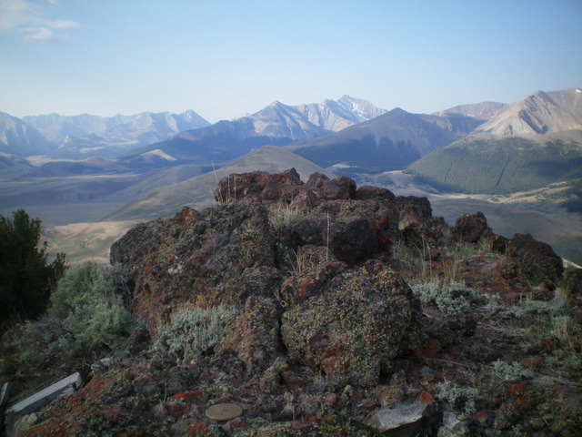
The rocky summit of Spring Hill. Livingston Douglas Photo
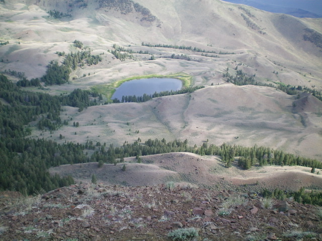
Beautiful Carlson Lake as viewed from high up on Spring Hill. Livingston Douglas Photo
Additional Resources
Regions: EASTERN IDAHO->Lost River Range
Mountain Range: Lost River Range
Year Climbed: 2021
Longitude: -113.74809 Latitude: 44.27089