Elevation: 10,158 ft
Prominence: 778
This peak is not in the book. This page details three routes: Southeast Rib, Headwall, and Livingston Douglas’ East Face/South Ridge Route. Updated November 2022
Peak 10158 is located on the main Smoky Mountain Crest between Camas County High Point and Prairie Creek Peak. Specifically, it is 2.5 miles west-northwest of Norton Peak. The recommended name is Shadow Peak. USGS Galena
Southeast Rib and Headwall Routes
Overview
Dan Robbins told me about the peak and said “even Rick Baugher has not recorded an ascent of this peak.” Dan suggested that the peak was potentially unclimbed and we did not find evidence of prior occupation. Dan suggested we climb the peak from Prairie Creek and we did so on August 17, 2014. We did a traverse of the peak. We climbed the Peak’s southeast rib and descended the headwall between the peak and Point 10092. Both routes will give you a strenuous workout. Both ponds shown on the peak’s east side were dry. The climbing team was Dan Robbins, John Fadgen, Tamara Fadgen, Shadow, their dog, Tom Cox, Steve Weston and myself.
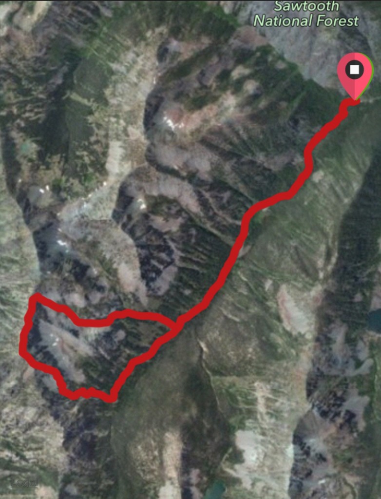
My GPS track for Shadow Peaks’ Southeast Rib and Headwall Routes
Total distance was 10.36 miles with an elevation gain of 3,305 feet.
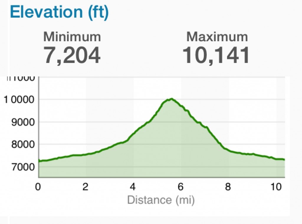
I am not sure why the GPS (which was corrected for elevation) shows the wrong figure for the high point, but the profile is correct.
Southeast Rib Route, Class 2-3
The ascent route follows Prairie Creek for 3.64 miles and then climbs in a west-northwest direction up steep grass and tree-covered slopes to a rib that climbs up to the crest roughly 2.5 miles south of the summit. The climb up the ridge can made directly with Class 3 moves or indirectly over mostly Class 2 terrain.
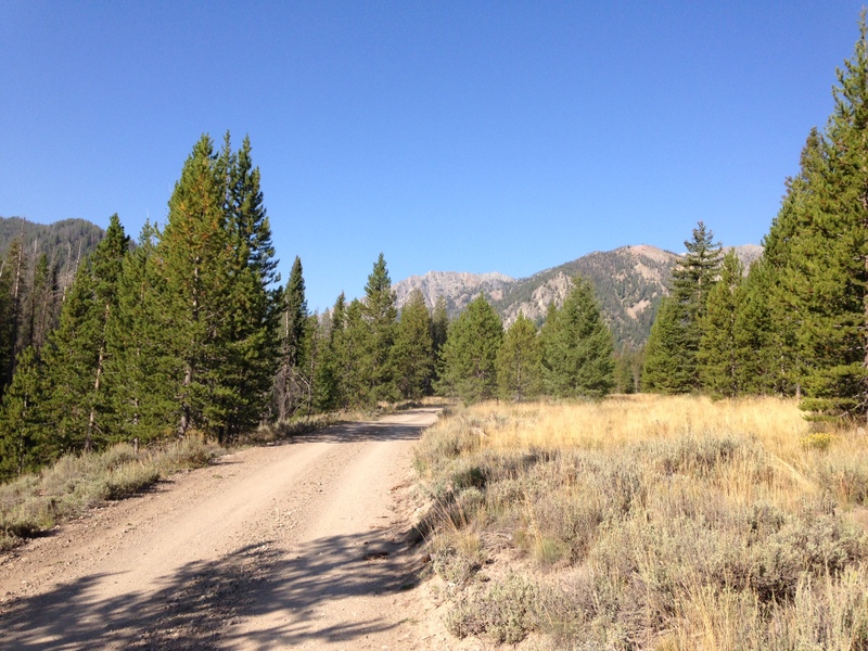
The road up Prairie Creek is well graded for its entire 3-mile course
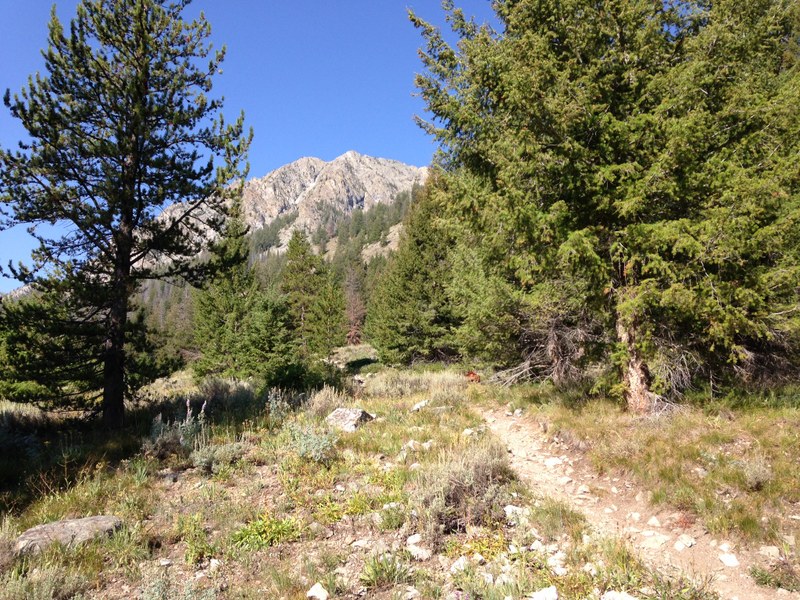
Like the road, Prairie Creek Trail is in good shape.
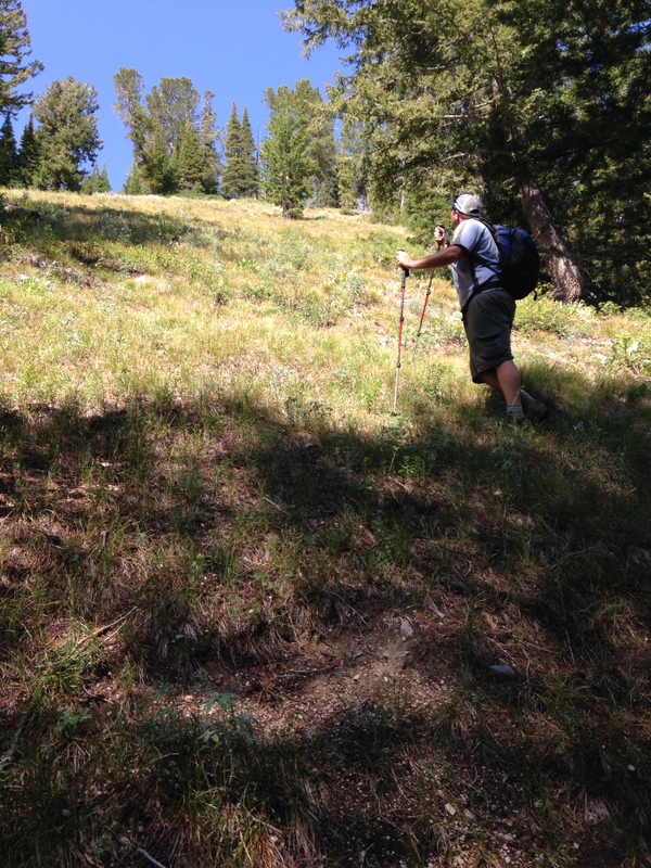
Dan Robbins pacing us up the lower slopes of the Southeast Rib Route
Higher up, the route leaves the trees and crosses rock. Dan Robbins ascending.
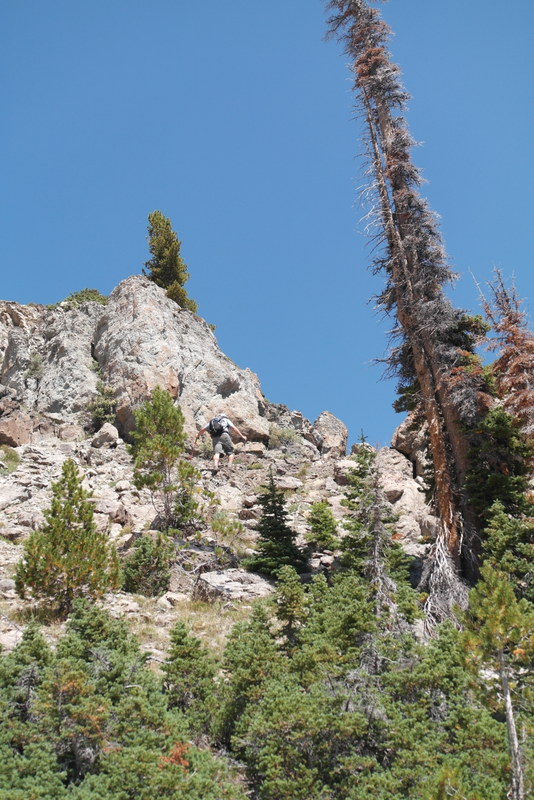
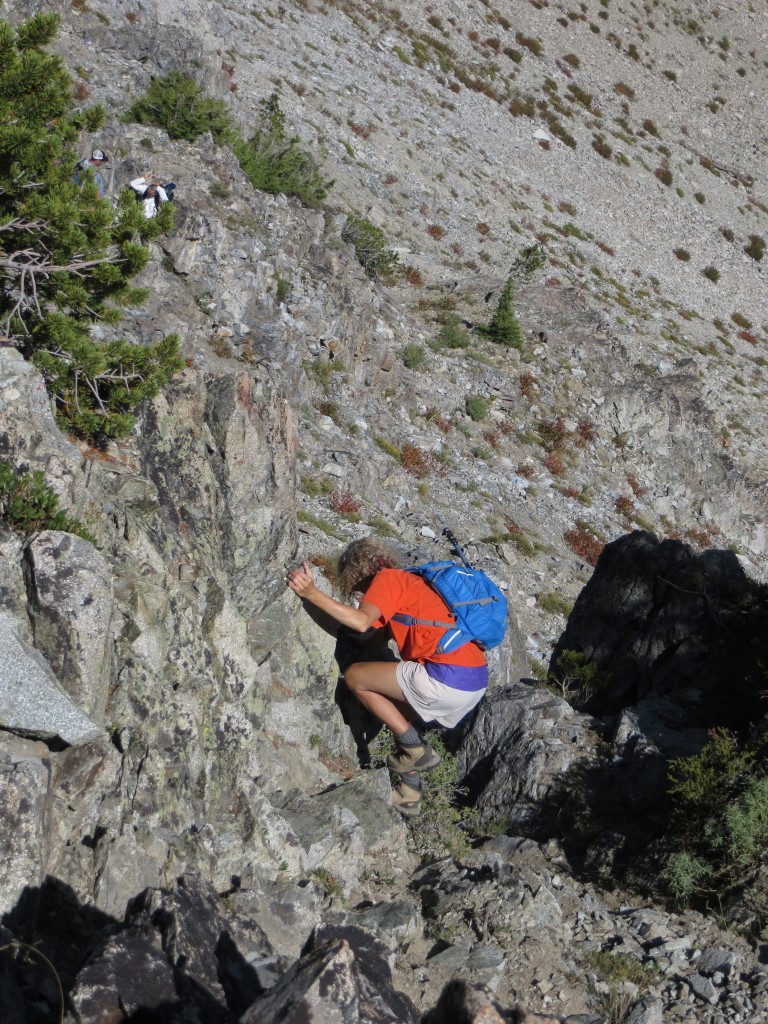
The Southeast Rib rising from the right-hand side of the photo. Tom Cox Photo
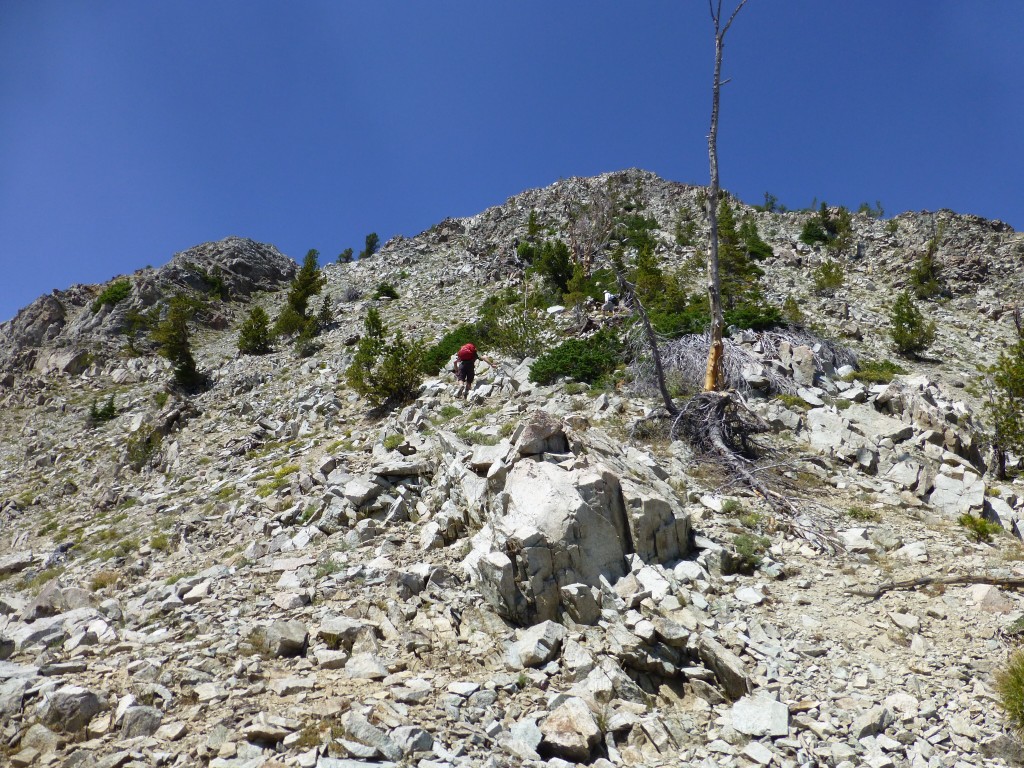
Climbing up the southeast rib. Dan Robbins Photo
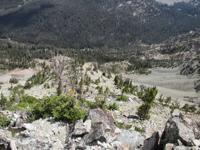
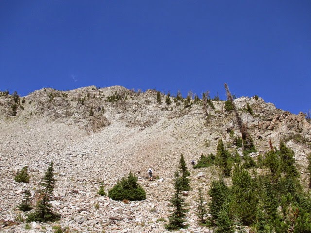
Looking back down the southeast rib. Tom Cox Photo
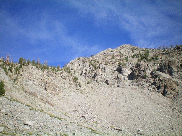
The view toward the summit from the top of the ridge
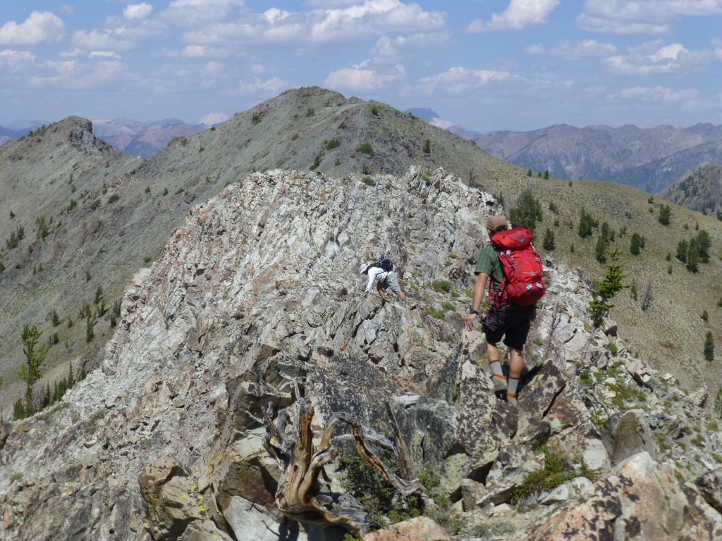
Crossing the summit ridge. Dan Robbins Photo
A climber approaching the summit. John Fadgen Photo
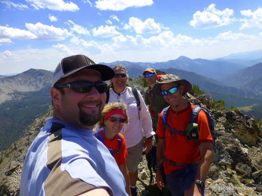
The happy climbers. Dan Robbins Photo
Headwall Route, Class 2-3
This route descends north off the summit to the col between the peak and Point 10092. The peak’s north ridge is festooned with several spires that can be bypassed or climbed over. The difficulty of the traverse will depend on your choice of route. It can be done at Class 2 with some difficulty. There are some steep tricky moves either way. If you want to climb this route, leave the trail at 2.55 miles from the trailhead and climb directly up to the drainage. You should find running water a couple of hundred yards above the trail. The water did not reach the trail. We descended on the right side of this stream until the drainage to the Lake 9011 turns off to the west. The creek continues up to the north and does not lead to the dry lake.
Descending down the peak’s north ridge. Dan Robbins Photo
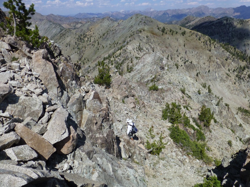
Head to the northern side of the col and then descend down and to the northeast. See photos below. The headwall is steep and cliffy. A direct descent would be dangerous.
This is a view of the headwall from two-thirds of the way down. The descent gully (shown in the next photo) is just right of center at the top of the headwall.
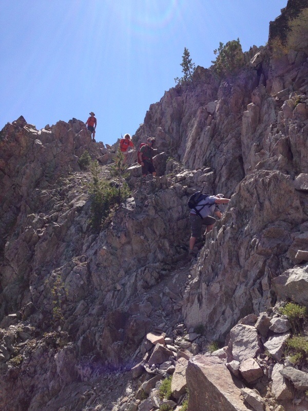
The descent down the headwall is made possible by this diagonal gully which is probably about 100 feet below the col on its north side. This is the easiest path through the cliffs that cross the top of the headwall.
Tamara is at the top of the diagonal gully swinging around a rock at the top of the diagonal gully to gain entry. You can see Tom and Dan in the upper left. John Fadgen Photo
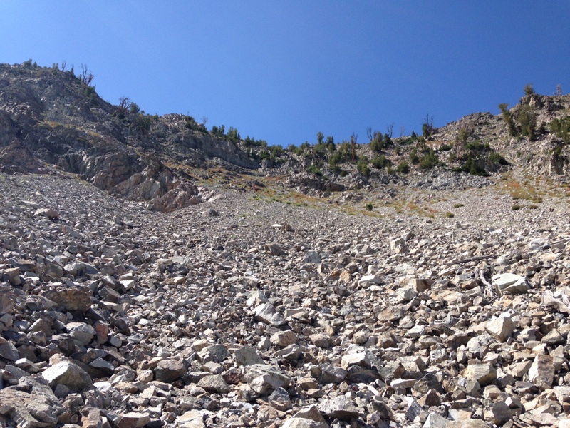
Once off the headwall, you can descend the steep talus to the lake (dry this year) and then follow the drainage from the lake out to the trail. Choose the route that works best for your temperament.
Enjoy ast Face/South Ridge by Livingston Douglas
Hike up Prairie Lakes Trail/FST-134 for about 3.5 miles to a flattish trail area and a clearing at 8,110 feet. Leave the trail here and bushwhack briefly west up a veg-filled dry drainage (in between the forested areas). Leave the drainage and scramble left/south up steeply onto a forested shoulder. The drainage now has a stream in it. Climb the forested shoulder (thick with firs and blowdown at times) west then west-northwest as it gains definition. Midway up, move right/north across a minor dry gully onto a more-open shoulder which soon became forested. Move to the left/south edge of the forest to reach some open terrain. You will soon reach tree line and magnificent open terrain with clear views of the task ahead.
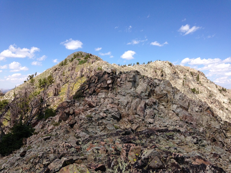
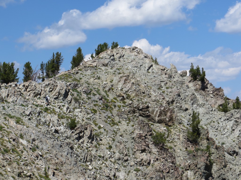
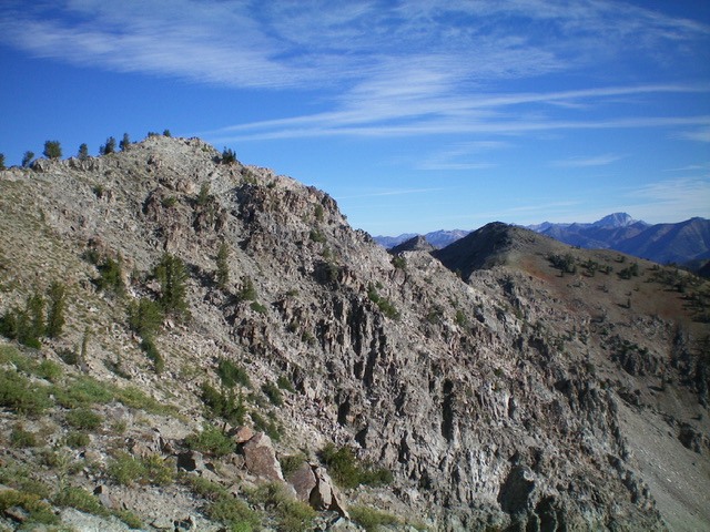
Looking up at Shadow Peak (summit is right of center) from the forest line on the east rib. The ascent gully is in dead center. The south ridge is the left skyline. Livingston Douglas Photo
Once at tree line, the south ridge is directly in front of you. The question is: how best to reach it? There is a wide gully to the right/north. The summit is to the right/northwest, up the south ridge. There is a ridge saddle at the head of the gully that looks particularly easy and inviting. Angle diagonally right/northwest from the open shoulder to get into the wide, dry gully. Cross decent, angled talus slopes to get there. Once in the center of the gully, you must make a decision. The gully splits higher up. The right branch is too steep and loose. The left branch is probably a better option.
Climb up the left branch of the gully briefly. Unfortunately, it becomes too steep and loose, so move onto the rocky face/rib in between the two branches of the gully and scramble up decent Class 3 ledges and boulders to reach the gentle saddle on the south ridge, just north of Point 9670. Once on the south ridge at the 9,620-foot saddle, you still have over 500 feet of uphill to go. The ridge ascent measures at only ½ mile on the USGS topo map, but it sure seems like a lot longer than that, perhaps due to the numerous ups-and-downs along the way and, seemingly, endless false summits.
The south ridge is a mix of decent, albeit steep, ridge rock with loose scree/gravel mixed in. Stay on the meandering ridge crest when possible. High up, the final flattish ridge section is a series of ridge blocks/towers and is a bit tedious. The rocky, ridgeline summit had no summit cairn so I built one atop the highest boulder/outcrop. There are two rocky ridge points of almost equal height. There is a 20-foot drop between them. I believe that the northern one is the highest point and that is where I built the summit cairn.
Shadow Peak (summit is left of center) and its rugged north ridge (descending diagonally rightward from the summit). My descent route followed the choppy north ridge almost down to the saddle. Livingston Douglas Photo
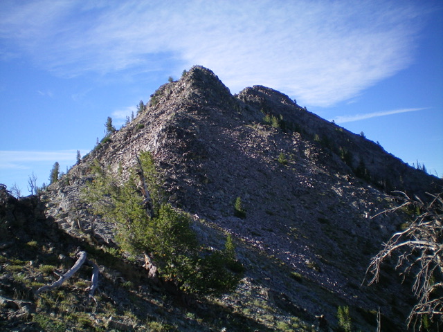
Looking back up the rocky north ridge of Shadow Peak from near the saddle. Livingston Douglas Photo
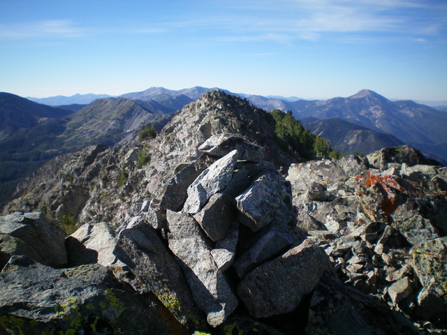
The newly-built summit cairn atop Shadow Peak with the [slightly-lower] south summit hump just behind the cairn. Livingston Douglas Photo
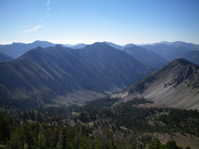
Shadow Peak is the high point on the ridge in mid-ground. The summit is in dead center. This view is from Robbery Peak to its north. Livingston Douglas Photo
Additional Resources
Regions: Smoky Mountains->WESTERN IDAHO
Mountain Range: Smoky Mountains
Year Climbed: 2014
First Ascent Information:
- First Ascent Year: 2014
- Season: Summer
- Route: Southeast Rib
- Party: Dan Robbins, John Fadgen, Tamara Fadgen, Tom Cox, Tom Lopez
- Other First Ascent: East Face/South Ridge
- Year: 2022
- Season: Summer
- Party: Livingston Douglas