Elevation: 11,393 ft
Prominence: 4,243

Climbing and access information for this peak is on Page 327 of the book. The access directions in the book are no longer valid due to a road closure. Use the access information set out below. Additionally, there is a much better climbing route to the summit (see below) than the route listed in the book, which I only recommend as a snow climb when there is no avalanche danger. Updated January 2020
Scott Peak is the highest point in the Idaho portion of the Beaverhead Range. It is the 55th-highest Idaho summit and is located south of Italian Peak and just south of the Continental Divide. Because of its 4,234 feet of prominence, it is of special interest to prominence-oriented peakbaggers. Huhs Horn, Webber Peak and the Clark County High Point are all easily accessed from Scott Peak. Getting to the summit of Scott Peak is the hard part. USGS Scott Peak
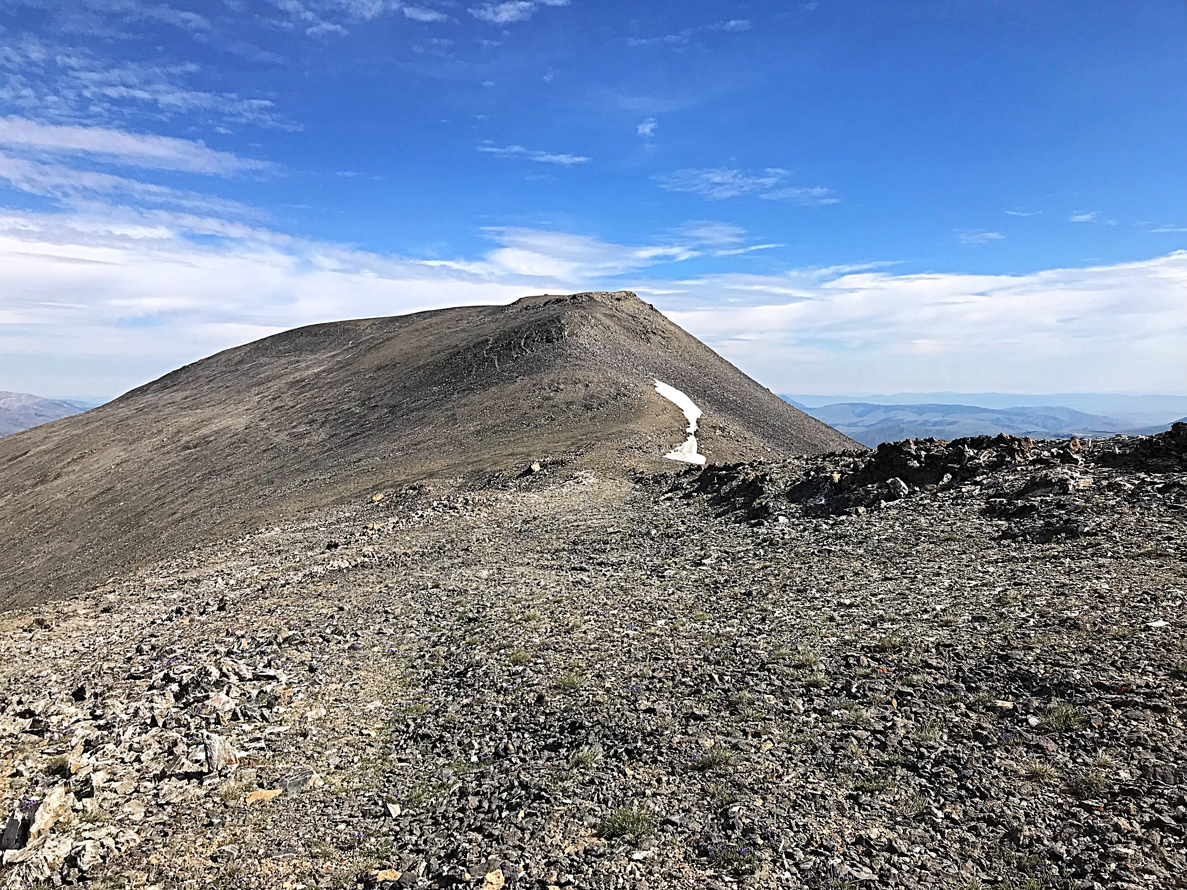
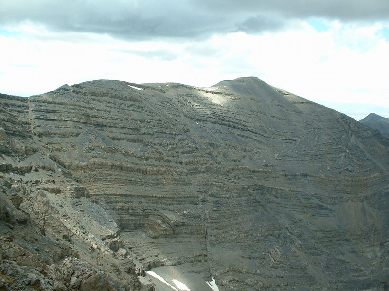
The summit of Scott Peak as viewed from the top of the Tower Rib. Scott Peak’s summit ridge is nearly a mile long. The southern end of the ridge encompasses Webber Peak and the Clark County High Point.
Access by Livingston Douglas
From the junction of ID-28 and ID-33 in Mud Lake, drive N on ID-28 for 42.5 miles to [signed] Nicholia Road. Nicholia Road is located 6.1 miles N of the Kaufman Picnic Area on ID-28. Turn R/NNE onto Nicholia Road and drive 3.1 miles to an unsigned junction with a dirt road that runs southward at the base of the mountains. Drive 4.5 miles S on this dirt road to reach an unsigned L turn for Scott Canyon. You will pass 2 turnoffs for Eidelman Canyon (at 0.9 miles and 1.6 miles), a turnoff for Italian Canyon (at 2.5 miles), and a sign for Irish Canyon (at 3.7 miles) on the way.
At 4.5 miles, reach an unsigned left turnoff for Scott Canyon Road. Reset your odometer. At 0.3 miles, enter the Targhee National Forest (signed). The road is now officially FSR-190. At 1.8 miles, pass Blind Canyon (signed on left). At 2.9 miles, reach an unsigned road junction. FSR-190/Scott Canyon Road is badly rutted past this point. You may want to park on this old side road if necessary (7,509 feet). If your vehicle and road conditions permit, drive another mile to the end of FSR-190 at 3.9 miles. This is the parking area for two trails: FST-006 and FST-174. FST-006 is a MC trail that heads up Scott Canyon. The trailhead parking area is a large grassy meadow at a fork in the canyon. There are some shaded, dispersed campsites on the R/S side of the meadow.
Once at the road’s end, the route turns into a Forest Service trail. This trail is at first designated FST-006 until the canyon splits and then FST-081 at an elevation of 7,993 feet. Keep right at this poorly-marked junction and follow the trail up to the pass between Scott Canyon and Crooked Creek at 8,975 feet. This trail is easy to follow. It is flat at first and then steepens.
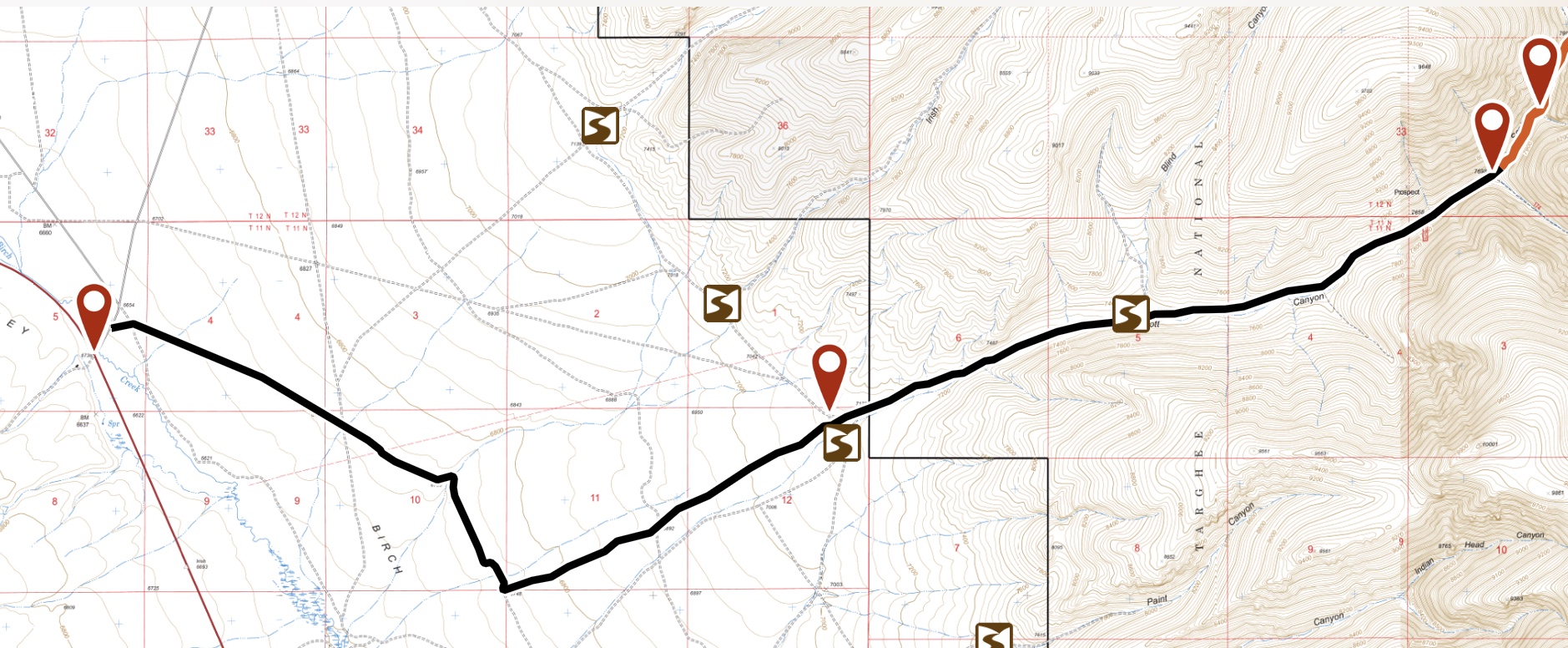
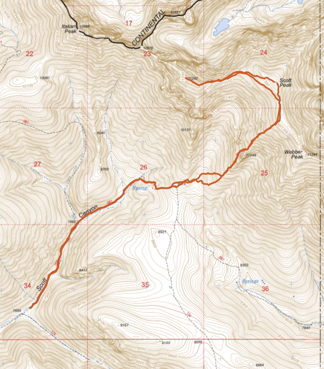
The access route in the book is closed. The route shown on this map is signed by the Forest Service and is a more direct route. This route is 9.0 miles long and gains over 1,000 vertical feet.
West Face, Class 2+
This is the route set forth in the book. The route line is shown in John Platt’s photo below. The steep talus on this route is not practical when there is no snow cover.
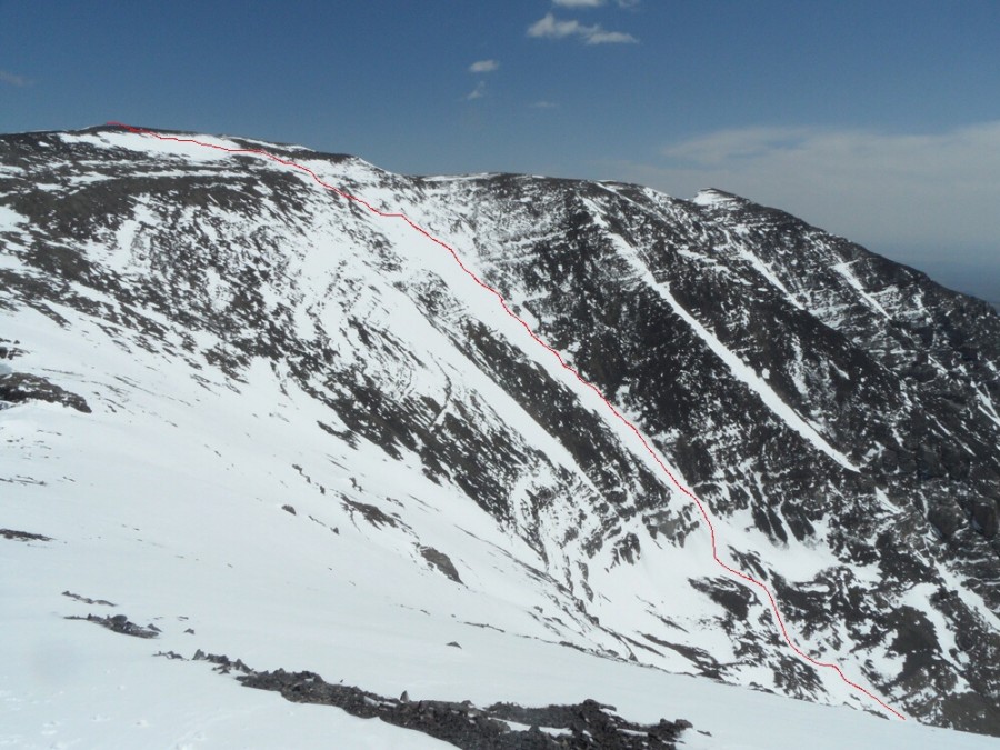
Scott Peak and the West Face Route. John Platt Photo
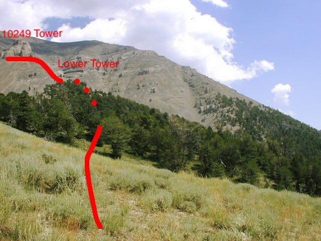
Tower Rib, Class 2+
The Tower Rib is located on the South Side of the peak’s West Face. It is distinctive because of two large towers located on its lower third. From the high point of FST-081, leave the trail and traverse east across the gully that empties the West Face to the base of the Tower Rib. Climb up the lower rib through a mostly open forest to the base of the small, lower tower.
Looking from the trail high point to the Tower Rib with the approximate route in red. Bob Bolton Photo
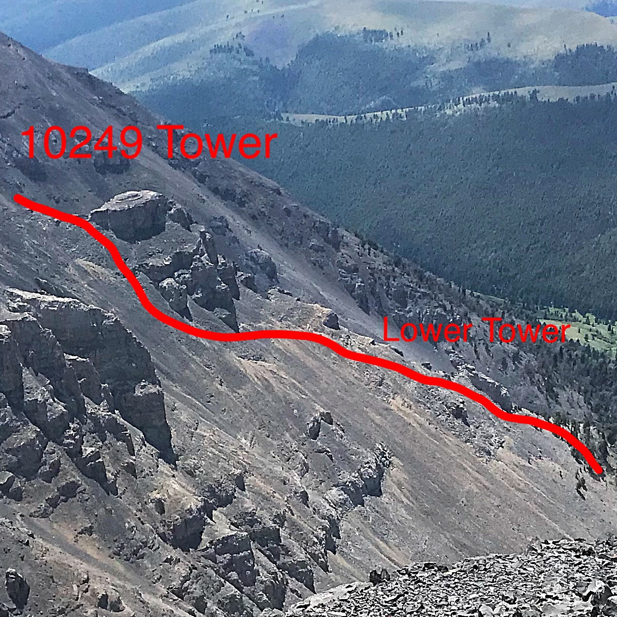
This photo shows the two towers and the approximate location of the route.
Bypass the lower tower on its West Side following goat tracks in places. Aim for the larger tower above staying close to the top of the rib. As you get closer to the upper tower, look for a goat track that leads around the Northwest Base. When the goat track eventually ends, climb the steep scree and slabs to the top of the rib above the 10,249-foot tower.
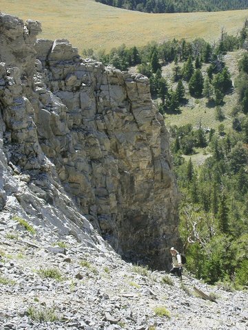
Dean Molen crossing under the lower tower. Bob Bolton Photo
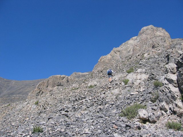
Bob Bolten traversing under the 10,249-foot tower. Dean Molen photo courtesy of Bob Bolten
Mike Fox gaining the top of the Tower Rib. The tower is located in the upper left-hand corner.
Once above the tower, the route is a straightforward slog up the rib. The talus is broken by several steps that can be climbed (Class 3) or bypassed on Class 2 terrain. The talus footing is relatively good, considering the steepness of the slope.
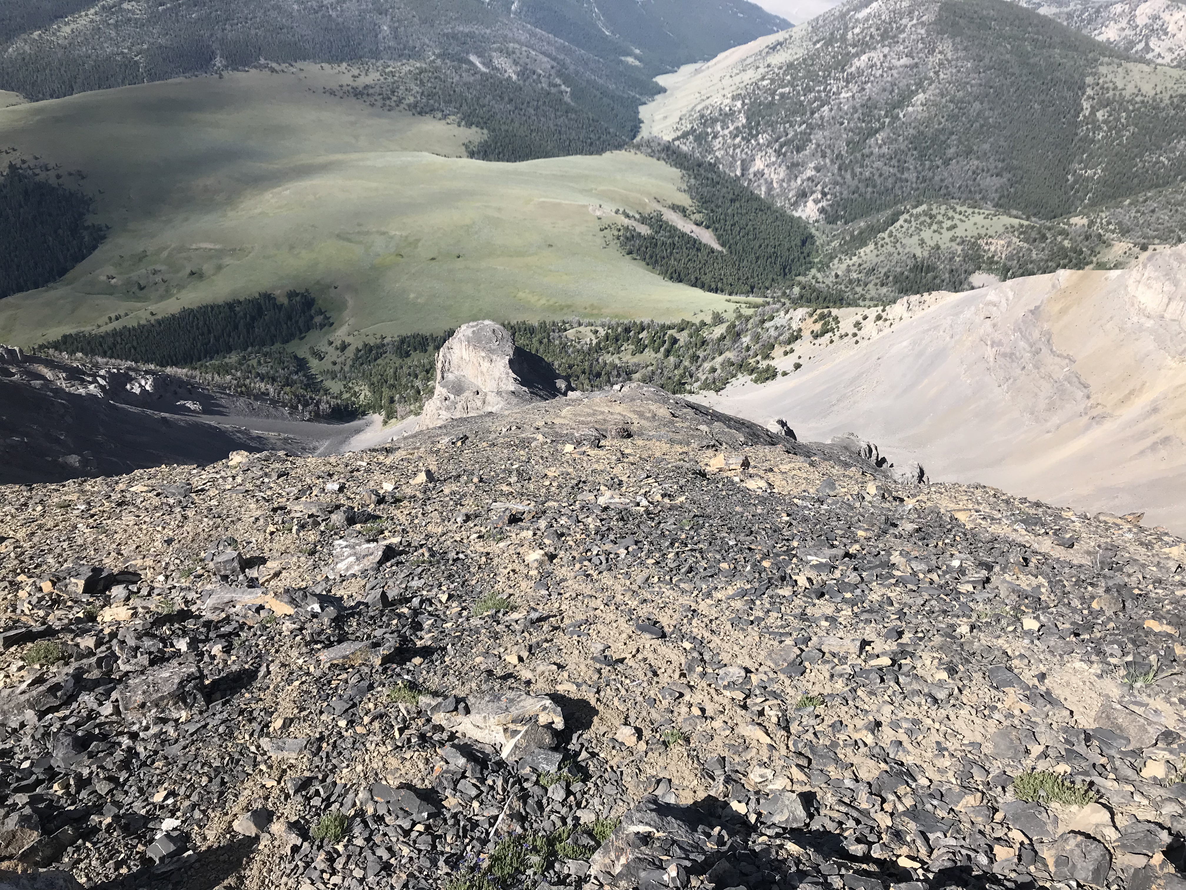
Looking down the Tower Rib. The large tower is just left of center. Scott Canyon is right of center at the top of the photo.
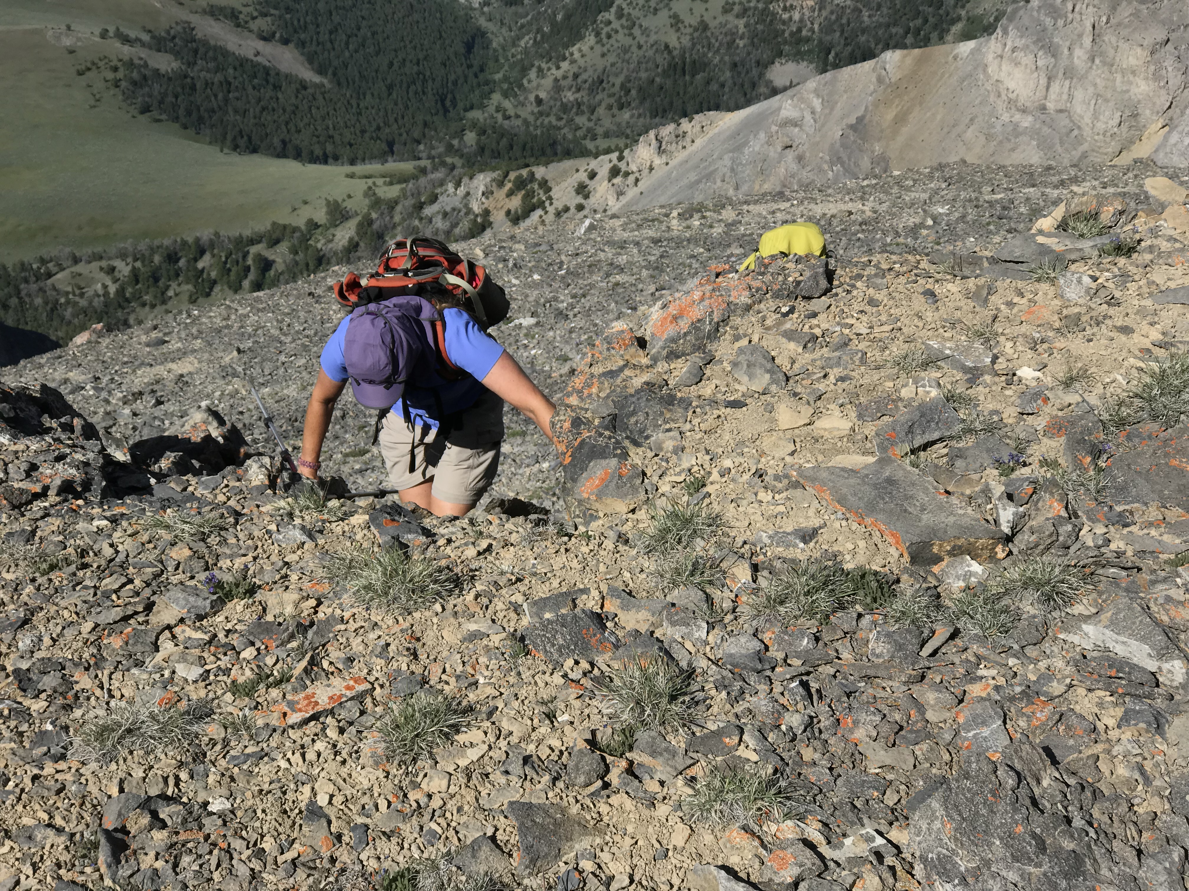
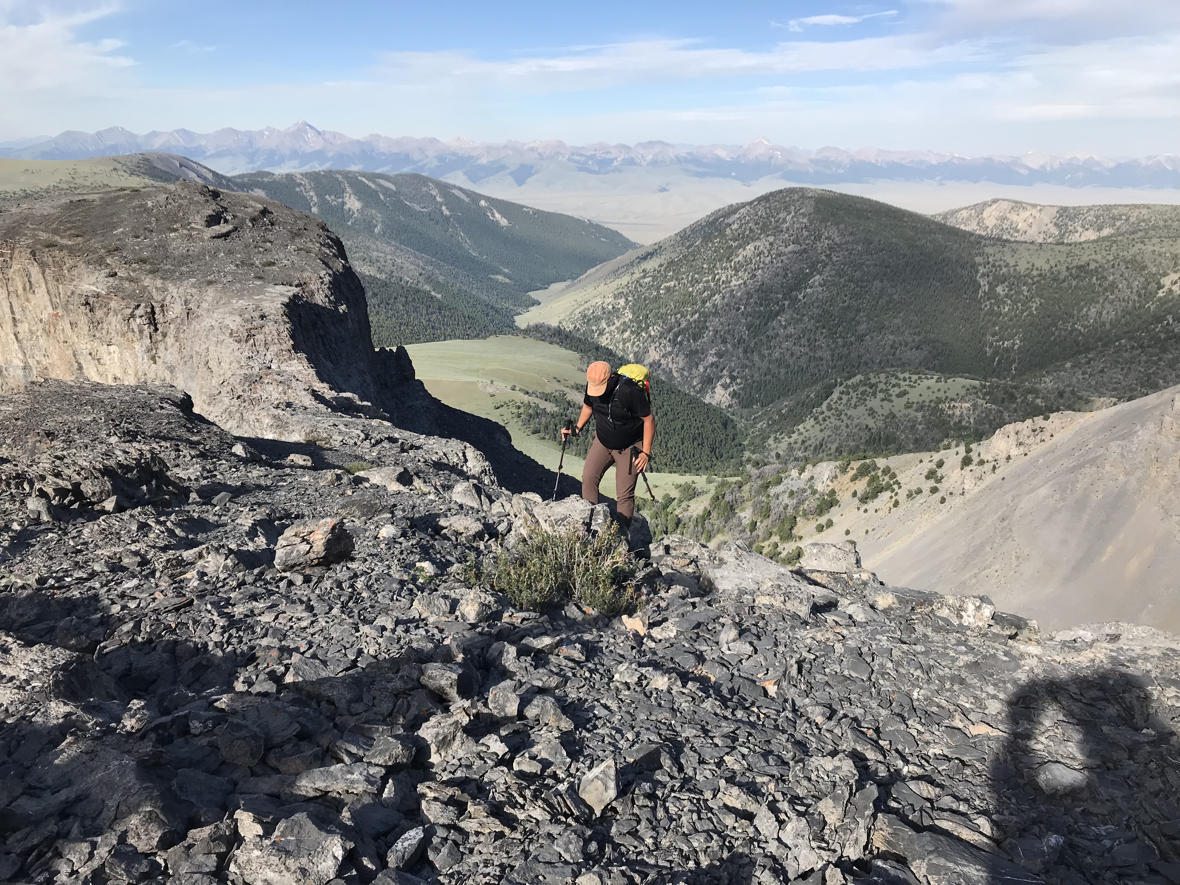
Terri Rowe and Mike Fox cresting at the top of the Tower Rib.
At the top of the rib, you are on the broad summit ridge. The summit is 2,000 feet to the north. Webber Peak and the Clark County High Point are to the south.
My GPS track for Scott Peak and Huhs Horn. Round trip stats: 8.8 miles with 4,315 feet of elevation gain.
For other takes on climbing this big peak, check out the trip reports from Rick Baugher, John Platt, Dan Robbins and Larry Prescott, all of which are linked below.
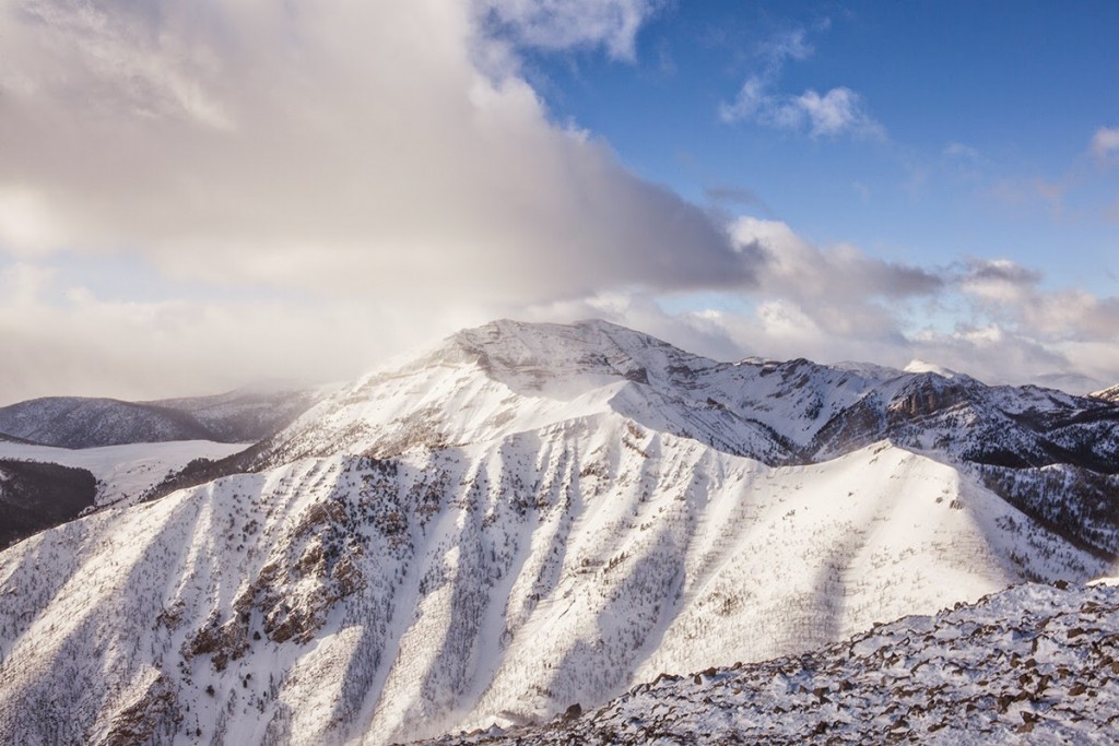
Scott Peak. Dan Robbins Photo
Scott Peak and Webber Peak as viewed from Heart Peak. Larry Prescott Photo
Additional Resources
Regions: Beaverhead Range->EASTERN IDAHO
Mountain Range: Beaverhead Range
Year Climbed: 2018
First Ascent Information:
- Other First Ascent: First reported Winter ascent
- Year: 2014
- Season: Winter
- Party: Larry Prescott, Kate Hill
Longitude: -112.82119 Latitude: 44.35379