The Clearwater Mountains are Idaho’s largest mountain group and cover most of North Central Idaho. These mountains are mostly Idaho Batholith granite and are covered in places with scattered deposits of older sedimentary and metamorphic rocks that have yet to erode away.
During the Pleistocene ice age, alpine glaciers carved cirques and lake basins into the sides of higher Clearwater peaks. The effects of the glaciers are most readily visible in the Mallard-Larkins and Selway Crags areas of the range. Although the Clearwater terrain is somewhat uniform in overall appearance, topographers consider several distinct ridges within the range as subranges. These include the Selway Crags, the Moose Mountains, the Sheep Mountain Range, and the Little Goat Mountains.
Fenn Mountain
The Clearwater Mountains fully encompass two great designated wildernesses: The Selway Bitterroot Wilderness and the Gospel-Hump Wilderness, and the northern portion of the Frank Church River of No Return Wilderness. In addition to these superb areas, the Mallard-Larkins Pioneer Area offers exceptional experiences. A lot of other smaller areas are wild and untouched. Find more information on Pages 59-81 of Idaho, A Climbing Guide.
Access Updates
Click on the following links for access updates to Elk City and the Magruder Corridor:
(F)(1) Elk City and Dixie Access
Magruder Corridor – Nez Perce Trail 2017
Southwest Clearwater Mountains Access Points
Gospel-Hump Wilderness
Access
Access to the Gospel-Hump Wilderness is via unpaved roads during the summer. These roads include: FS-444 and FS-444A from FS-221; the Salmon River Road/FS-1614 and Slate Creek Road/FS-354 that are accessed from US-95; the Sourdough Road/FS-492; the Orogrande Road/FS-233 accessed from ID-14; the Orogrande Road to Orogrande Summit; Orogrande Summit to Lake Creek and the Dixie Road, and FS-311 from Dixie.
See also Southwest Clearwater Mountains Access Points
The Wilderness
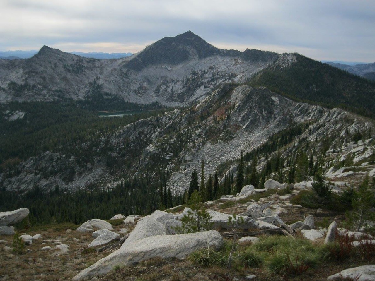
In 1978, Congress designated 206,053 acres east of Riggins, Idaho, and north of the Salmon River as the Gospel-Hump Wilderness. The terrain varies from moist and heavily-forested in the north to dry and sparsely vegetated in the south. A high, rugged, glaciated divide of peaks like Gospel Peak separate the two vegetation zones. Elevations vary from 1,970 feet at the Wind River Pack Bridge on the Salmon River to 8,940 feet at the summit of Buffalo Hump.
Buffalo Hump. Pete Zimowsky Photo
The Wilderness has significant interest to the Nez Perce Indian tribe. The Gospel Peak and Buffalo Hump areas were used by the Nez Perce Indians long before the arrival of settlers, possibly as much as 8,000 years ago for hunting elk, deer and bear, and to reach the Salmon River.
Prospectors flooded into the area after placer gold was discovered at Florence in 1861 for a short period until the deposits played out. A second wave of mining began in 1898 after a quartz vein was discovered at the base of Buffalo Hump. The discovery brought thousands of prospectors back into the area, but the rush quickly died out by 1903. Miners briefly returned during the Depression. Remnants of the mining booms are found in the wilderness including the ruins of abandoned boom towns.
Bruce Dreher Photo
Check out this fine article if you are contemplating a visit to this Wilderness: Seeking Solitude: 4 Ways to Explore Idaho’s Rugged Gospel-Hump Wilderness by Pete Zimowsky (2016).
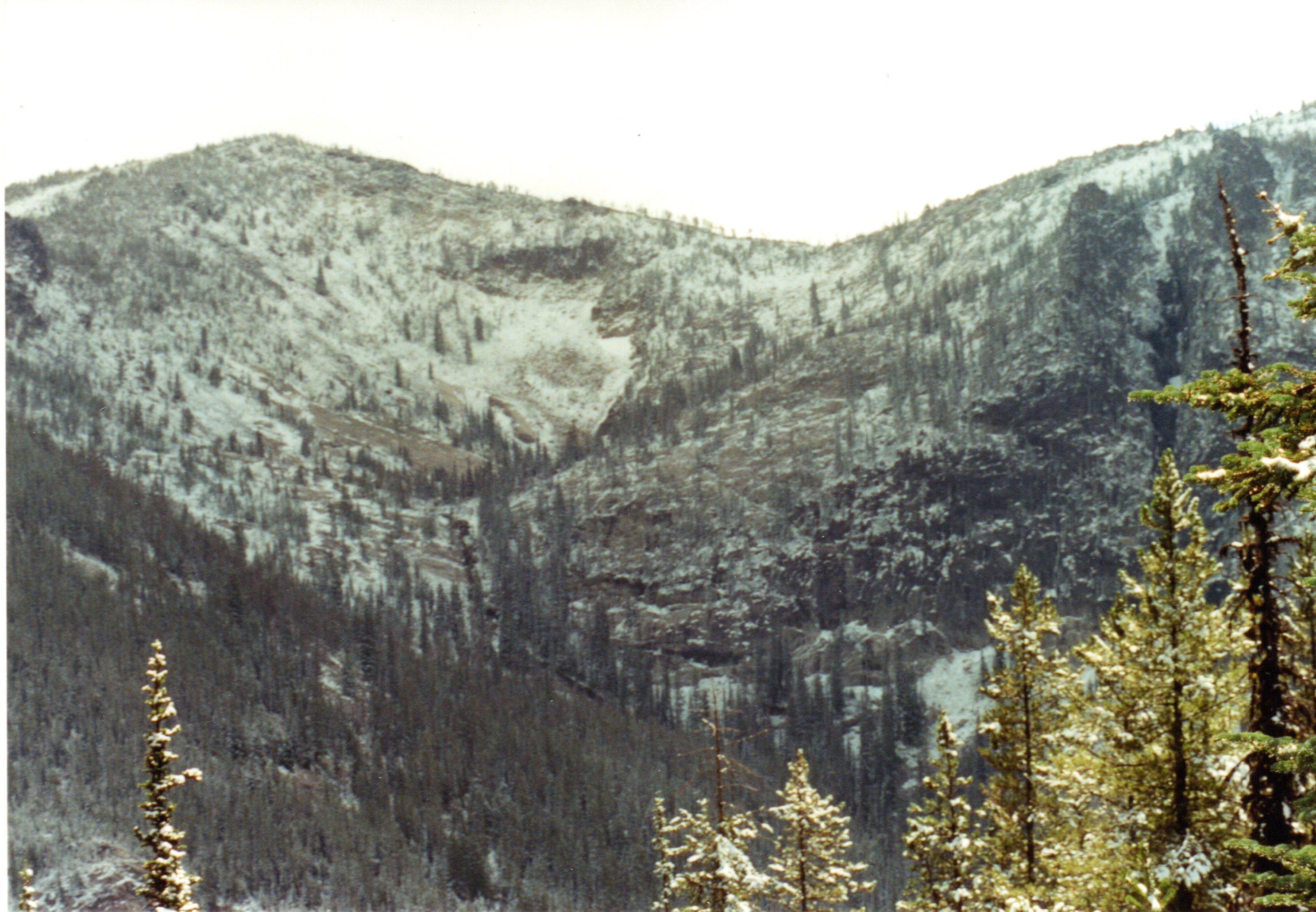
The Gospel-Hump Wilderness. Bruce Dreher Photo
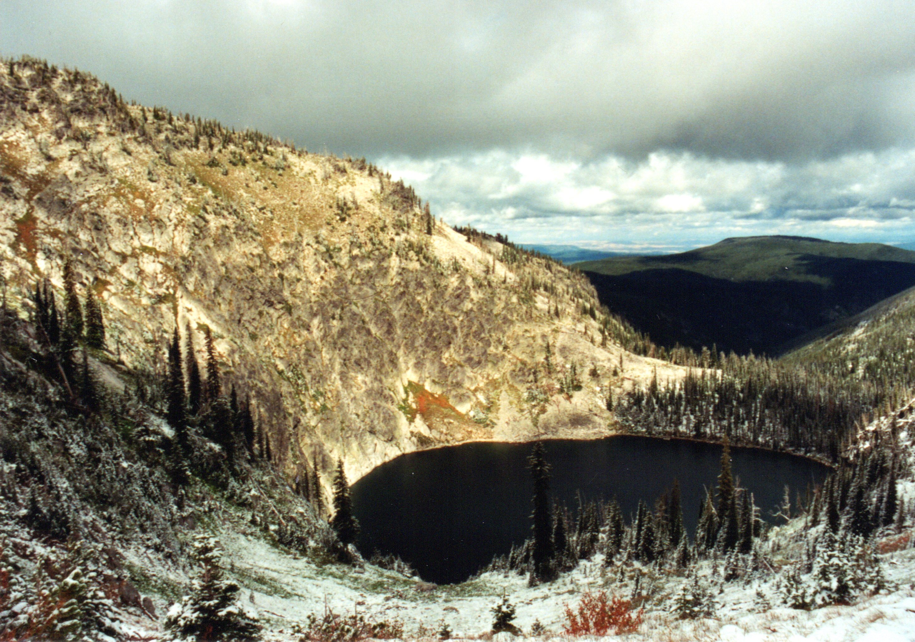
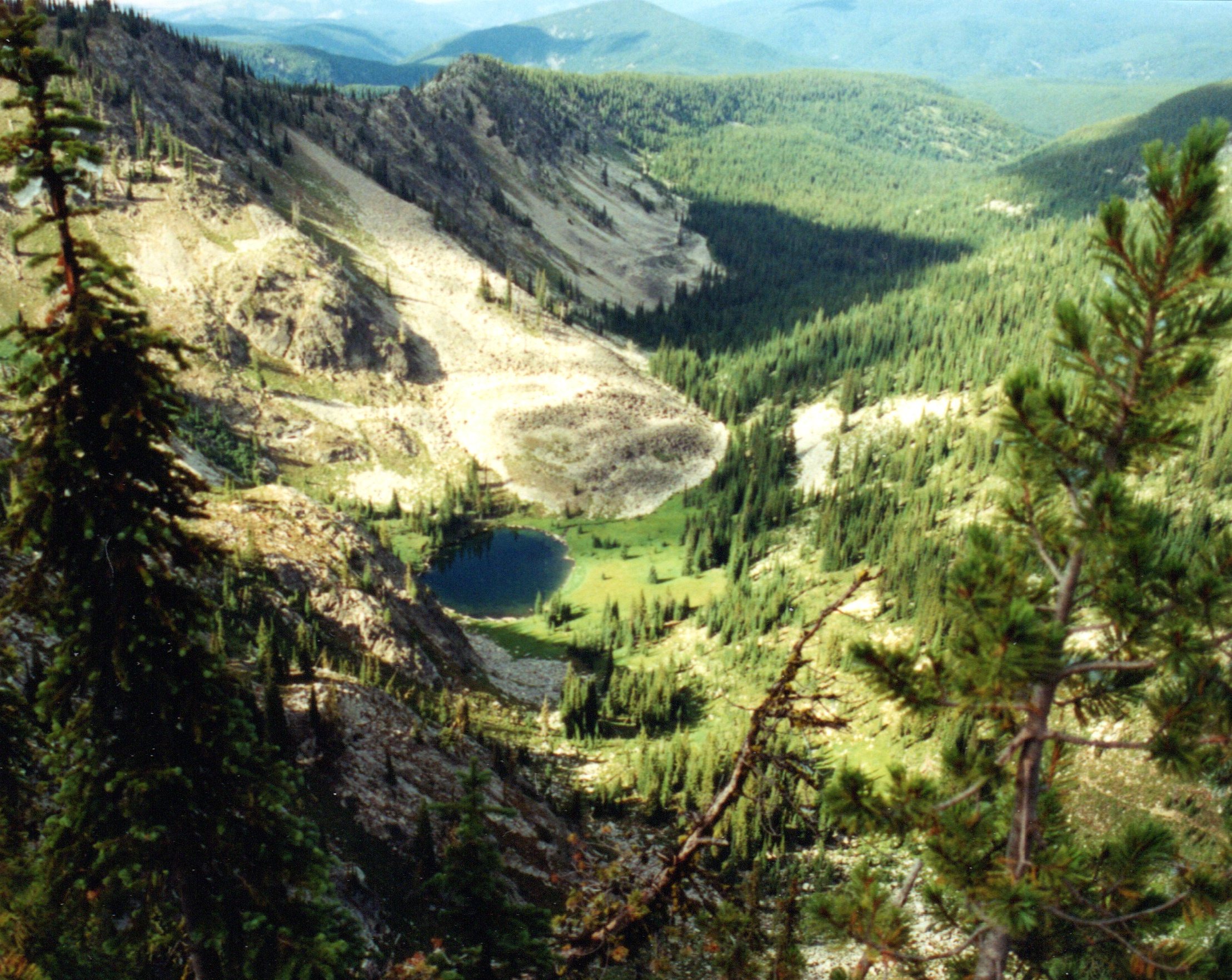
One of the lakes in the Gospel-Hump Wilderness. Bruce Dreher Photo
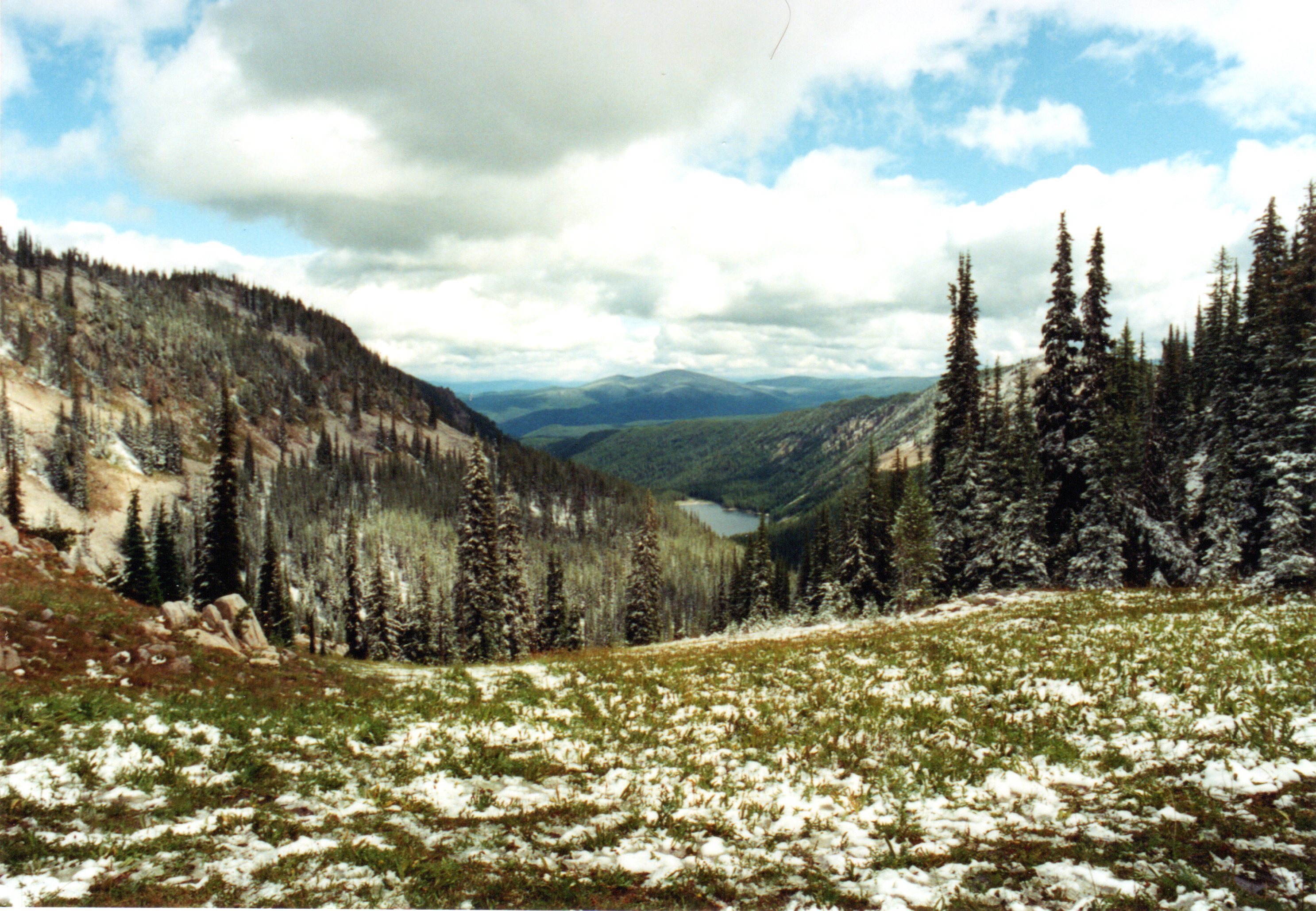
View from the Gospel-Hump Wilderness. Bruce Dreher Photo
Terrain in the Gospel-Hump Wilderness. Bruce Dreher Photo
Mallard-Larkins Pioneer Area, by Mike Hayes
The Mallard-Larkins Pioneer Area is a primitive area straddling the divide between the North Fork Clearwater River and the Little North Fork Clearwater River basins. This area is about 60 miles northeast of Orofino in North Central Idaho. The 30,000-acre area is the centerpiece of a larger 260,000-acre roadless area that has been under consideration for wilderness designation since the 1960s. The Forest Service has since recommended about 150,000 acres as designated wilderness, but it has yet to happen and probably never will due to political factors. However, the Forest Service manages much of the area as wilderness despite lacking the formal designation. The wilderness offers many interesting and unique features.
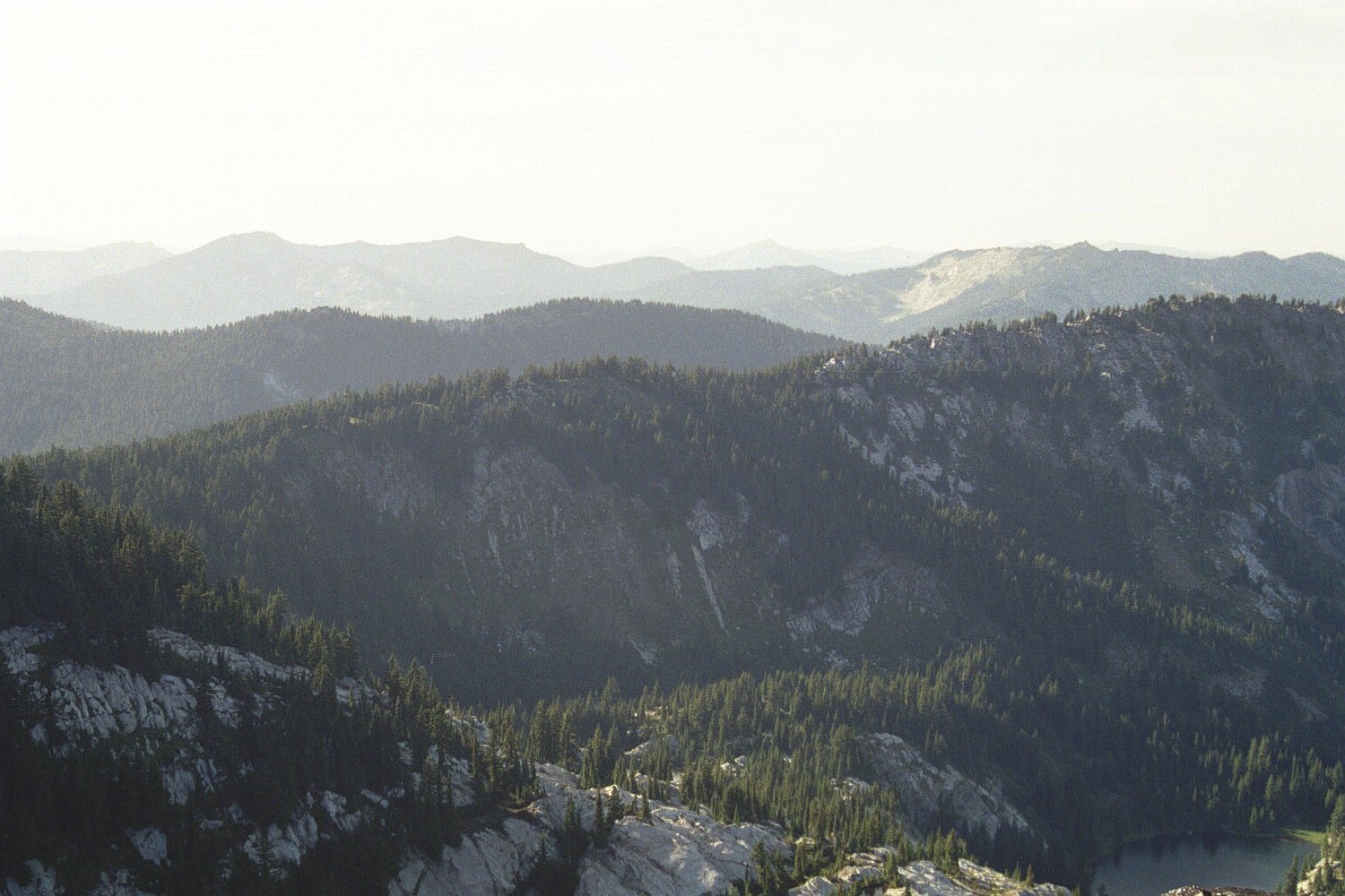
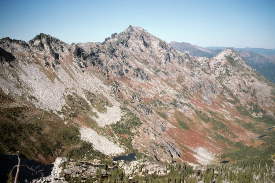
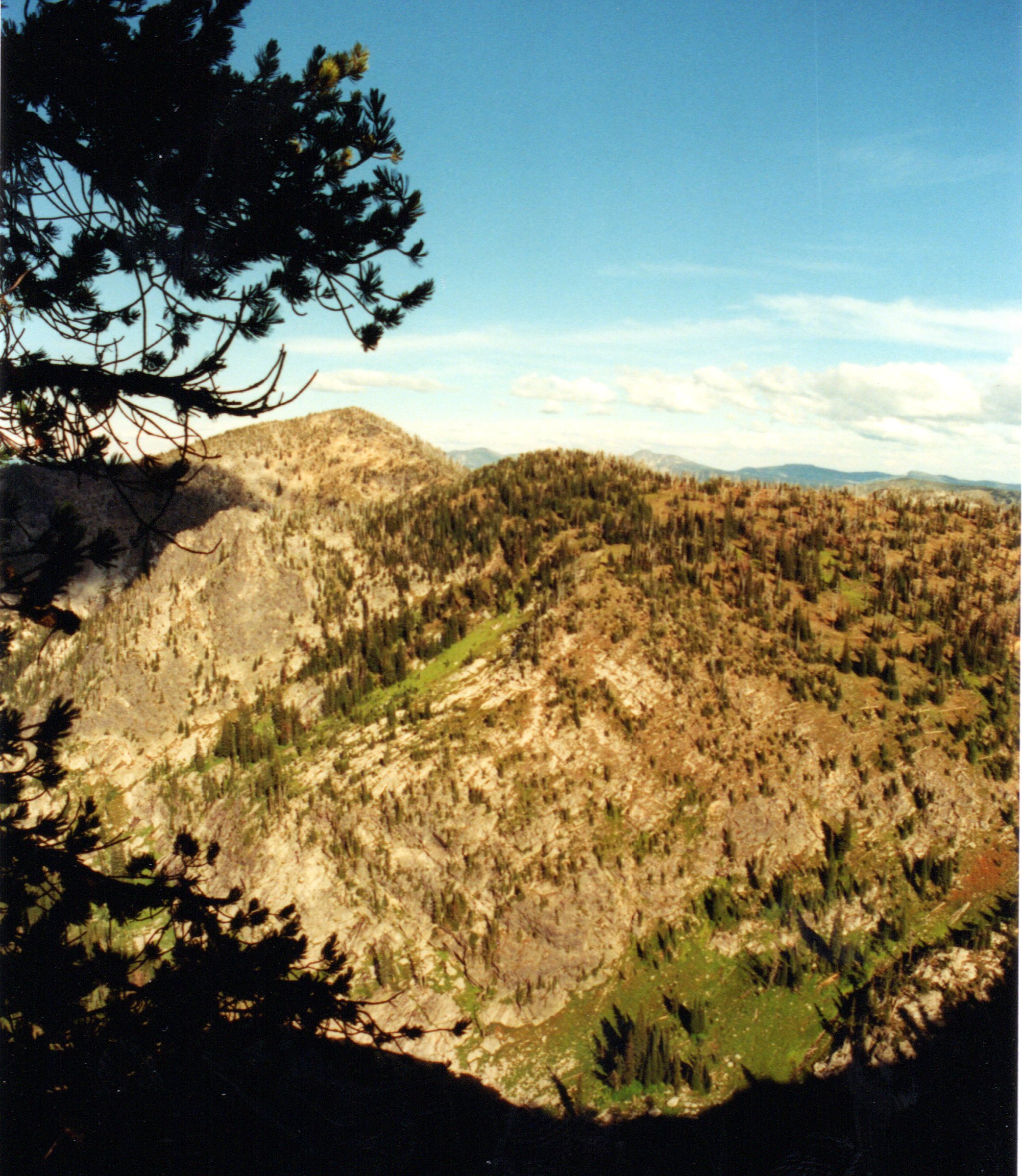
Looking northwest across Avalanche Ridge. The rounded summit on the left is Heart Peak. The peak with a rock face at right center is Mallard Peak. The pyramid barely visible near the center is Snow Peak. Cliff Lake is at lower right (August 2006). Mike Hays Photo
The Pioneer Area is roughly divided into western and eastern portions. The western portion includes the east-west running divide and the namesake peaks. The eastern portion, which is actually more southeast, centers on the Black Buttes and adjacent mountains. The eastern portion is slightly higher, rises more abruptly from the main river canyon, and get fewer visitors. The western area has a more glaciated terrain and supports more lakes. The rise from the main North Fork Canyon is generally over 5,000 feet in most areas on steep, but straight south slopes. Most glacial cirques and lakes are below the spectacular cliff faces and outcrops of the north aspects.
Terrain exists for technical climbing but little climbing occurs. Overall, recreationists and hunters heavily use the area’s steep mountain slopes, jagged ridges, and 38 subalpine lakes. 21 lakes are within the designated Pioneer Area. Biological diversity is very high resulting from abrupt elevation gains that range from low-elevation, coastal rainforest communities to the subalpine. In the high country, extensive lodgepole pine and mountain hemlock forests mingle with subalpine meadows, high mountain lakes, and craggy peaks. Impressive pockets of old growth western red cedar, grand fir, and western white pine, some quite massive, remain in the lower elevations. The Heritage Cedar Grove’s trees are up to 12 feet in diameter, over 150 feet tall, and several hundred years old. Some trees’ ages likely exceed 1,000 years.
For recent conditions and photos see Steven Palmer’s July 2019 Trip Report.
Other Sources
Check out the Hiking from Here website by Mary Aegerter for excellent information on many Clearwater Mountains destinations. If you are interested in visiting the Mallard-Larkins area, check out Mary’s page discussing the Mallard-Larkins Trails as it contains more recent information. Also, check out the History of Fire Lookouts on the Nez Perce National Forest.
Grave Peak as viewed from its long north ridge. Dan Saxton Photo