Elevation: 10,060 ft
Prominence: 1,040
Climbing and access information for Copperhead Peak is on Page 320 of the book. The additional route information found below was provided by Livingston Douglas and Judi Steciak and offers two takes on the Southwest Ridge Route which over the years has become the standard route. Jeff Hunteman provided a GPS track and additional comments on access based on his 2021 climb. Derek Percoski provided his route up the peak’s east ridge which definitely “the” climbers route for this beautiful peak.Updated December 2023
Copperhead Peak is one of the big peaks northeast of Salmon, Idaho. This country is not often visited by climbers. Copperhead Peak, Ajax Peak, Freeman Peak, and Monument Peak are all big peaks with lots of prominence. USGS Homer Youngs Peak
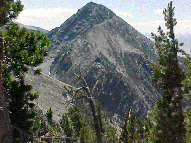
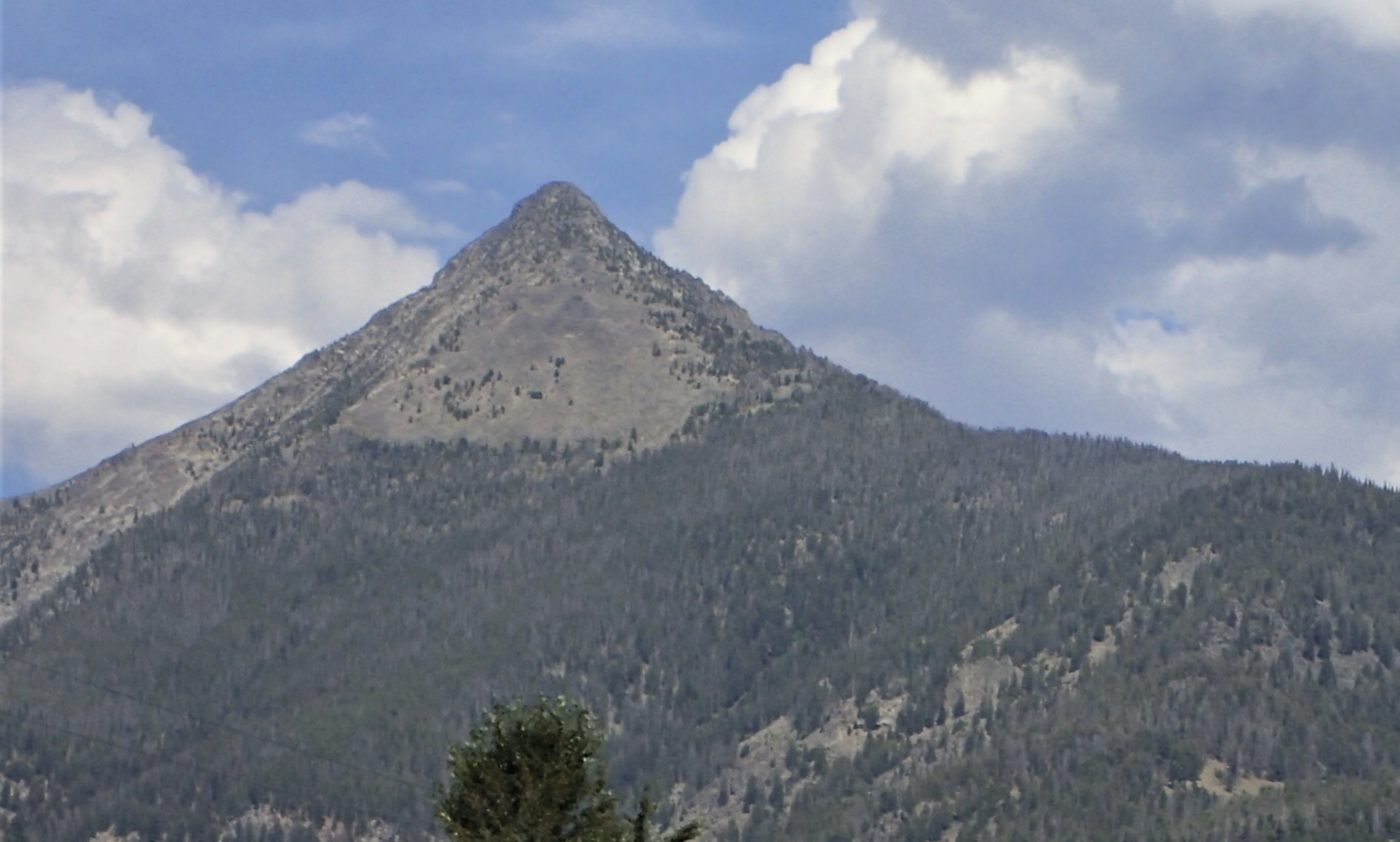
Copperhead Peak as viewed from Freeman Peak. Ajax Peak is in the upper right corner.
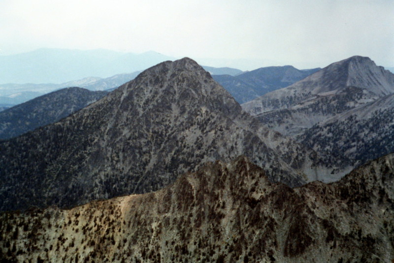
Copperhead Peak as viewed from the top of the ridge on Ajax Peak. This photo of Copperhead Peak was taken by the late Michael Darcy. Michael, an accomplished Montana peakbagger, spent a lot of time climbing in the Beaverheads and readily provided his knowledge to interested climbers. He was known to, and friends with, many Idaho mountaineers. His untimely death on Mount Darcy (formerly Gooseberry Peak) in 2012 shocked and saddened our climbing community. Michael Darcy Photo
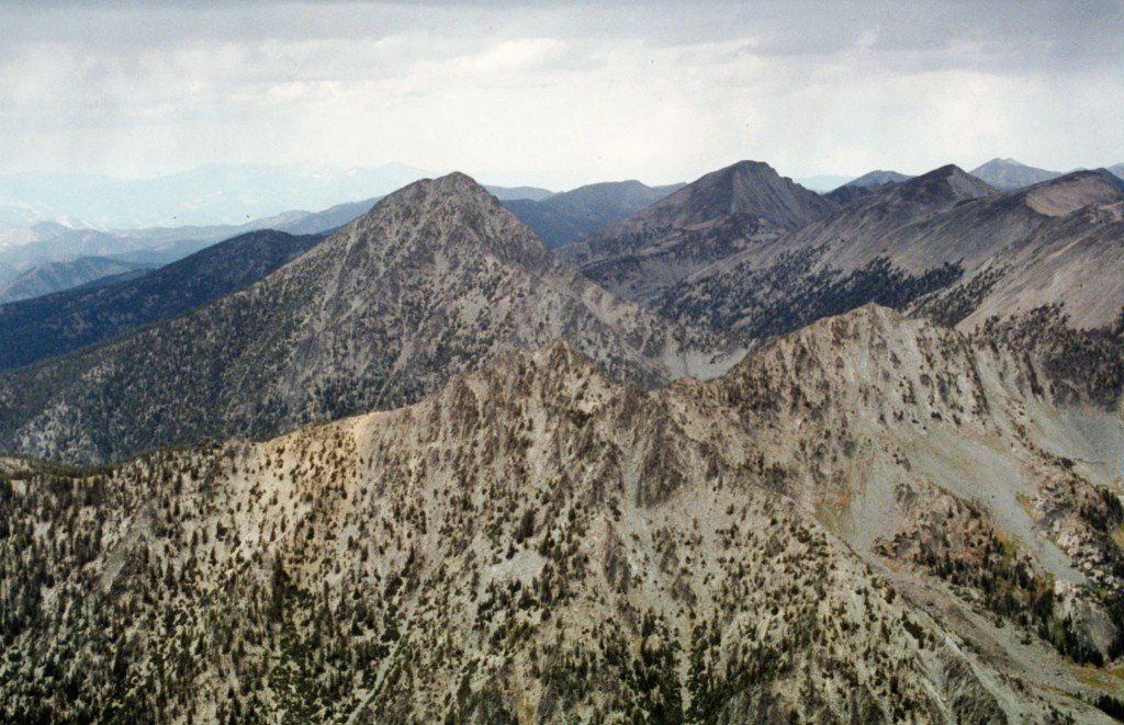
Copperhead Peak and the Northern Beaverhead Mountain Crest as viewed from Freeman Peak. Tom Lopez Photo
South Couloir to Southwest Ridge, Class 3+/4 by Livingston Douglas
Access
Freeman Creek [(A)(3.1) on Page 328 of the book].
The Approach
This route is a variation of Michael Darcy’s South Couloir Route. From the Freeman Creek Jeep Road, find your way into Golway Gulch via two left turns on jeep roads, the last of which is overgrown and not maintained (but is good for hiking). At the end of the Golway Gulch jeep road, bushwhack up the southeast side of Golway Creek. Stay above the thick, blowdown-strewn creek itself by scrambling up the talus/boulders and grassy fields on the right side of the gulch. At about 7,450 feet, you’ll reach a steep cliff band blocking easy access.
Cross to the west side of Golway creek here (at the base of a waterfall hidden in the thick forest surrounding the creek). A miserable bushwhack awaits across large fallen timber strewn every which-way. But soon you’ll reach the gentle grass on the west side of Golway Gulch. Bliss!! Hike up the grassy strip between the forested creek bed and the talus on the south side of Copperhead Peak. Beware of copperhead snakes in the grass here; I ran into one, coiled up, raised up, and hissing at me!
South Couloir
Finding Darcy’s South Couloir is the trick, but I can tell you how I stumbled on it. It is NOT marked with a cairn, and several steep couloirs on the south face of Copperhead Peak will confuse you. Find the correct couloir at 7,950 feet. It is a steep, narrow, brushy couloir (up Golway Gulch) that is immediately followed by a bare shoulder that comes off the south face of Copperhead Peak. The South Couloir initially heads northeast and shows up on the Homer Youngs Peak quadrangle as having a feeder stream in it. However, when I climbed it, there was nothing more than a few trickles of water here and there in the stream bed.
The initial section of this couloir is steep (Class 3+/4) and has some wet rock and vegetation to deal with. But, keep the faith, as the terrain gets easier. The couloir soon opens up and turns left/north. Here, it’s time to climb the now obvious couloir for several hundred feet, heading straight north
When I reached 9,075 feet, the couloir made a left/northwest turn, or so I thought. Straight ahead (north) was a 10- to 15-foot cliff band (Class 3+/4). This looks like the wrong way to go (though the map shows the couloir continuing with no interruptions all the way to the summit area). It turns out that Darcy’s route (and the South Couloir) actually DOES continue north right over the cliff band and opens up into a very wide gully/couloir above the band (which I discovered on my descent).
However, I took the left-ish turn and followed the left side of the cliff band, which guided me up a branch of the South Couloir. Unfortunately, this branch flames out and forced me to climb up face rock, cross the south arete into another gully, and confront an impassable cliff band at 9,800 feet. To avoid this band, I traversed west at the base of the cliff band and soon found myself on the Southwest Ridge! While it worked, it was not exactly my plan for the day, and I don’t recommend it.
Southwest Ridge
The Southwest Ridge got ugly quickly, so I moved east and back onto the South Face to find a way up this mountain. I climbed Class 3+ ledges and cracks on the South Face and found myself back on the Southwest Ridge above the cliff bands and ridge difficulties. From here, a straightforward Class 3 ridge climbs to a minor notch in the ridge (which is the top of Darcy’s South Couloir). From here, it is about 60 feet to the gentle, albeit small, summit of Copperhead Peak and its 6-foot tall summit cairn.
Immediately below the summit is Darcy’s South Couloir, steep and loose but wide and obvious. To the east is the rugged Southeast Ridge (that Darcy correctly rates as Class 3-4), which was Darcy’s ascent route. Darcy’s route didn’t encounter the deceiving cliff band I encountered at 9,075 feet that led me astray. When descending via the South Couloir, this cliff band is just a minor inconvenience in an otherwise obvious gully/couloir.
The Descent
I descended Darcy’s South Couloir Route. This route is initially very steep and loose, at least Class 3+ and arguably Class 4. It runs into the junction/cliff band where I went astray on my ascent. From here, I retraced my route back to the Freeman Creek jeep road. Thankfully, I encountered no lingering snow on the South Face (or South Couloir) of Copperhead Peak.
East ridge, Class 4 by Derek Percoski
Access
This route can be accessed from Freeman Creek [(A)(3.1) on Page 328 of the book] in the west or from Montana in the east which is the route I used to climb Copperhead and it’s neighbors (see the map below).
Route
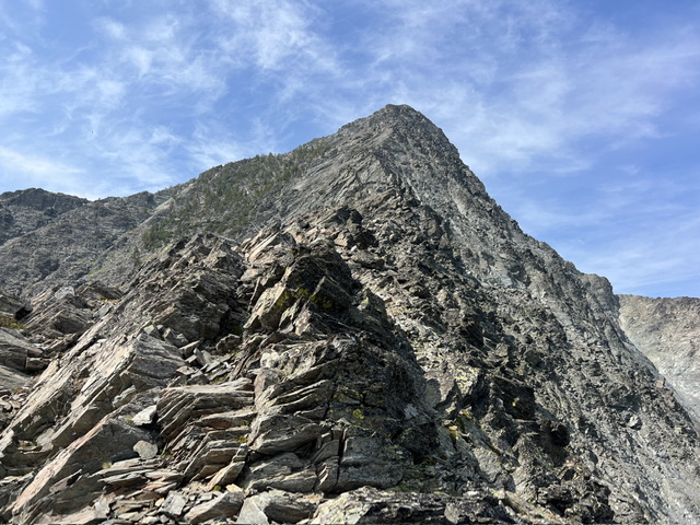
The east ridge of Copperhead climbs 1000’ from the saddle connecting it to the continental divide. It is an aesthetic arete that provides an incredible class-4 scrambling experience on solid rock. It has earned a spot in my favorite routes I’ve ever done. Some sections can be intimidating, but the large holds are always there. The crux comes about halfway up—a nose with a few vertical moves to get started. This point is the filter of whether you’ll finish the route or seek an alternative, because the east ridge is fairly committing. The northeast face is foreboding, and perhaps you could find a place to bail to the east face but you couldn’t weave in and out of it to avoid obstacles on the ridge. I did consider descending the east face, but in the end decided to go down the same way I went up. From the looks of it, the east face could even be the easiest route on the mountain.
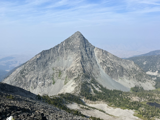
Copperhead’s east ridge (center) as seen from Peak 9945. Derek Percoski Photo
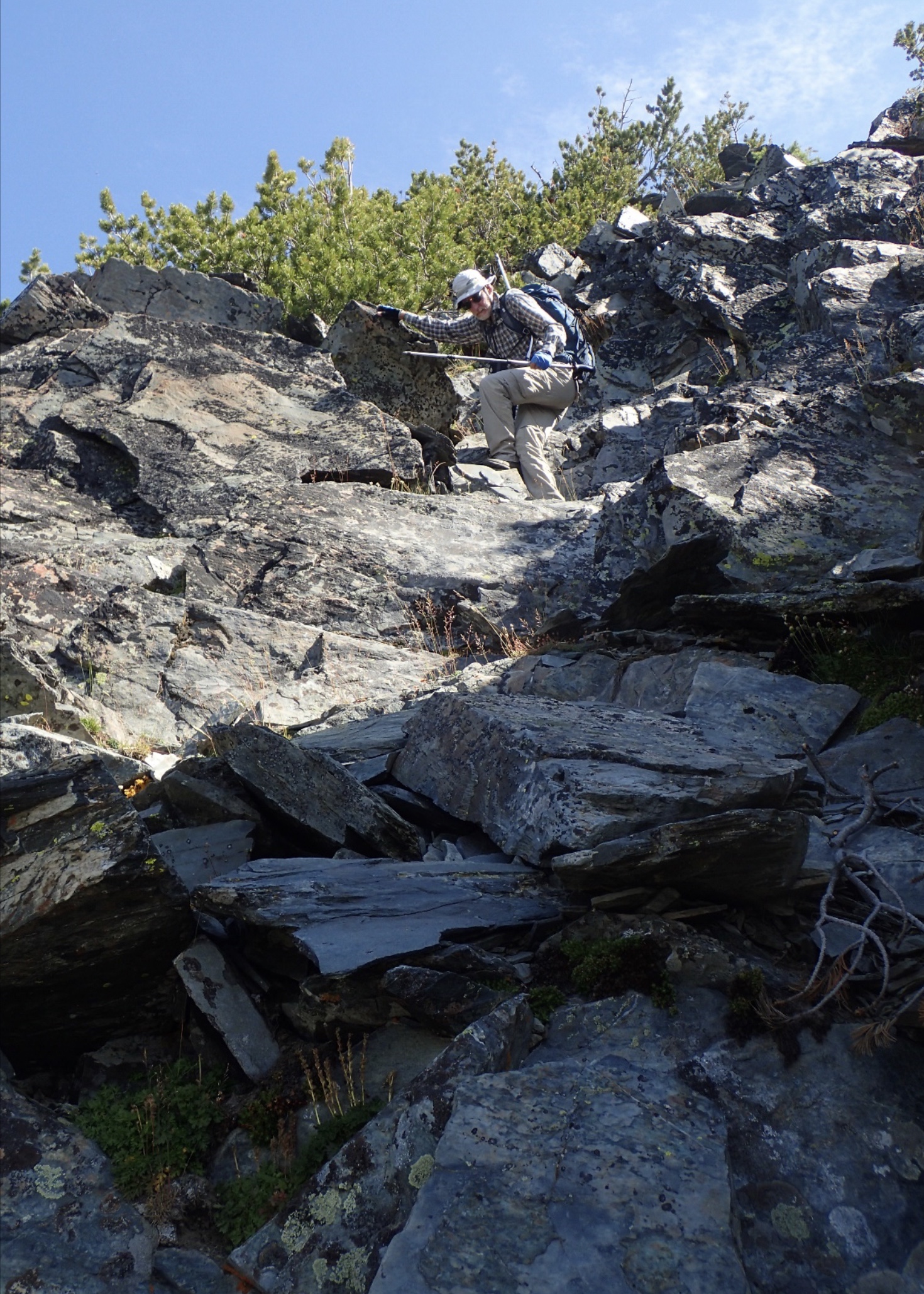
The start of the scrambling. Derek Percoski Photo
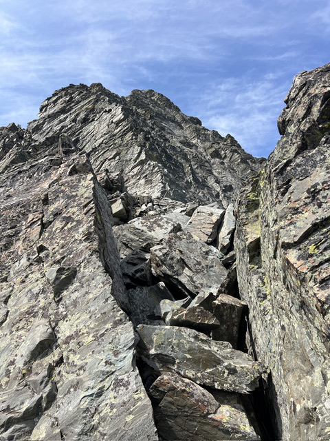
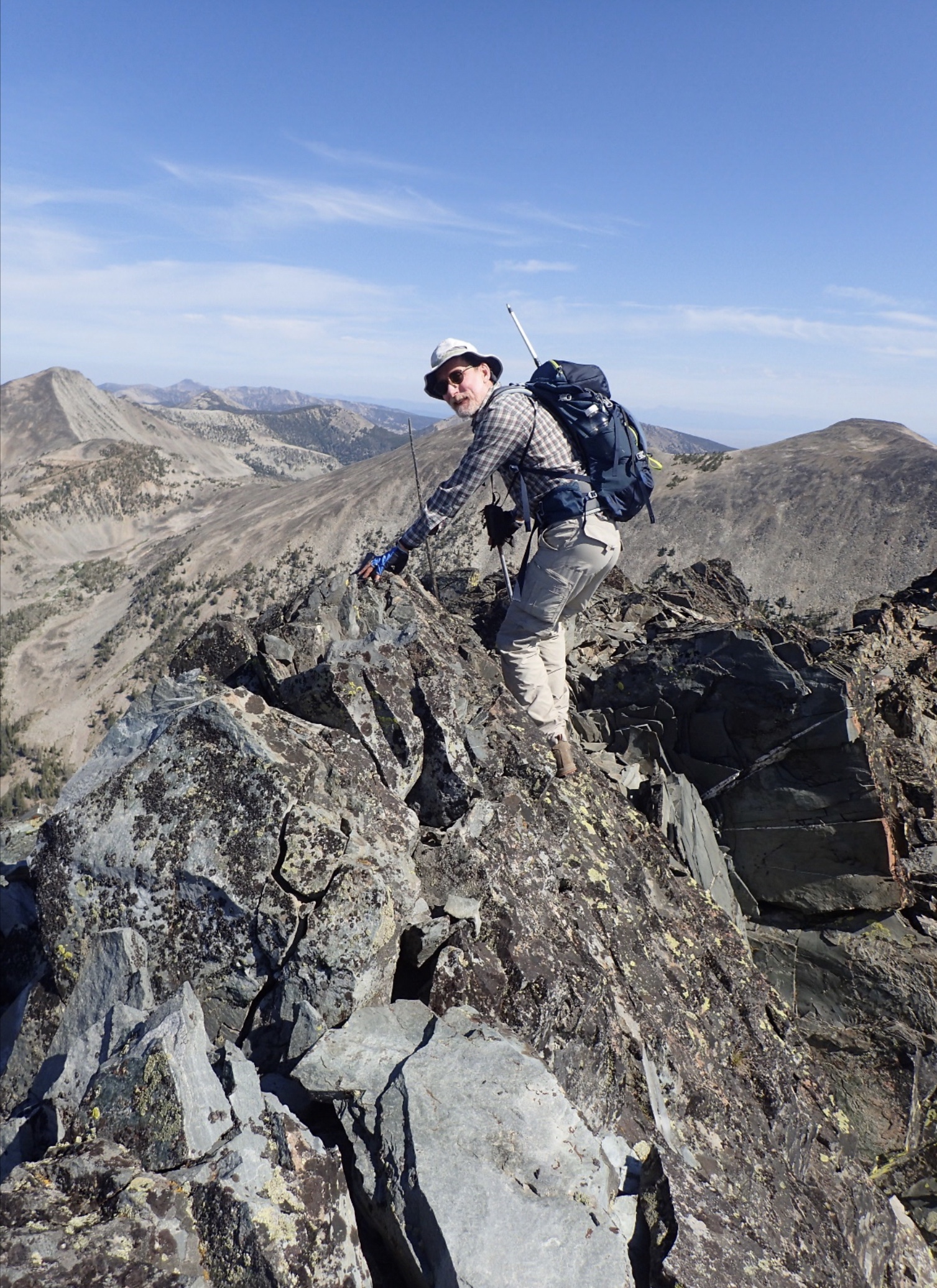
Midway up the route. Derek Percoski Photo
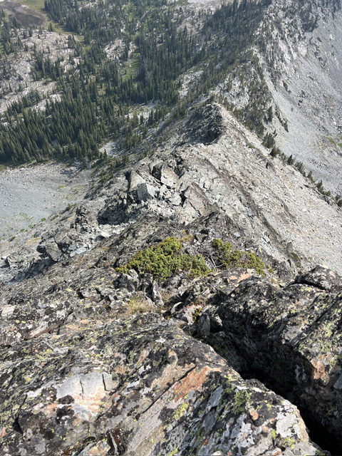
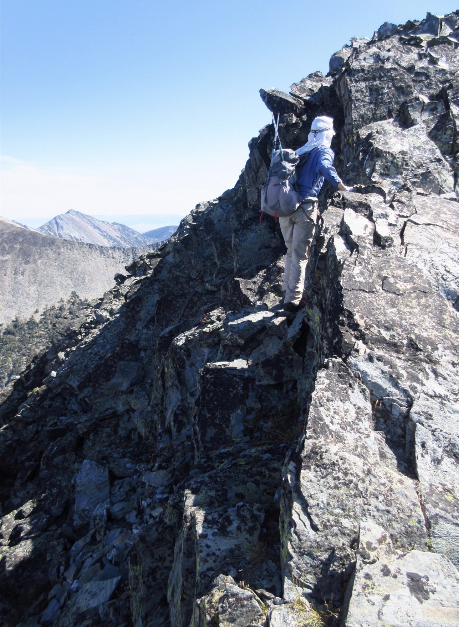
Looking down the ridge from around 2/3 of the way up. Derek Percoski Photo
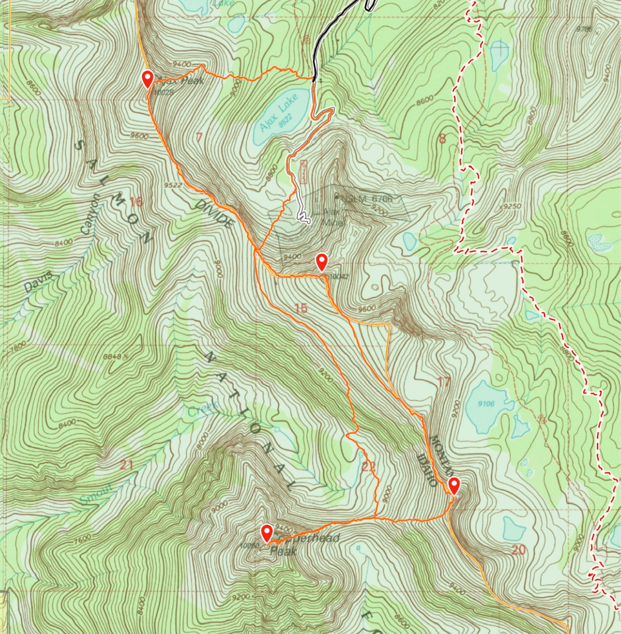
My GPS track for the Montana,access to Copperhead Peak and it’s neighbors.
Southwest Ridge, Class 3+ by Judi Steciak
Follow the directions to the Copperhead Peak Access [(A)(3.1.1) on Page 328]. Be aware that the road that branches off near 6,600 feet is FST-340 and is “open to vehicles less than 50 inches wide.” A flat area before this fork provides parking for full-sized vehicles and adds about a mile (round trip) to the total distance.
Continue on FST-340 until you reach a wide spot (about a ½ mile from the FST-340 intersection) near the creek that runs in Golway Gulch at about 6,700 feet. As you move to cross the creek, you may notice debris from a collapsed structure (tin roofing, logs, bricks) near the road.
Work your way up to the crest of the Southwest Ridge and follow it towards the summit on generally good footing, weaving around trees and blowdown. About 300 vertical feet (0.1 miles) before the summit, you encounter the narrow rocky outcropping that signals the start of scrambling. Gain the ridge crest via ledges in a broad chimney. Move to the N side and climb back up to the crest in a few places to minimize exposure. A short knife-edged section before the notch between summits has the most unavoidable exposure.
Copperhead Peak as viewed from Crimson Creek. The Southwest Ridge follows the right skyline. Judi Steciak Photo

The top of the Southwest Ridge. Judi Steciak Photo
The ledges in the broad chimney at the base of the summit ridge (picture taken on descent) that marks the start of scrambling. Judi Steciak Photo
The knife-edged false summit. Judi Steciak Photo
Minimizing exposure by moving to the North Side of the ridge in a few places. This picture is taken after the notch between the false summit and the true summit. Carl Hamke Photo
Southwest Ridge Addendum by Jeff Hunteman
This route is a nice way up Copperhead. All access routes are difficult down low due to blow down. This route is direct and fairly straight forward. However, the creek Crossing can be a challenge so choose your crossing wisely.
The access road (show on the map below) continues to deteriorate the farther your drive. There is a section that is steep and rugged along Freeman Creek. That brushy steep section requires a four-wheel-drive.
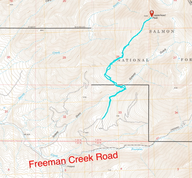
Jeff’s GPS track. He measured the climb at 6.0 miles with 3,287 feet of elevation gain round trip.
Additional Resources
Regions: Beaverhead Range->EASTERN IDAHO
Mountain Range: Beaverhead Range
Longitude: -113.7288 Latitude: 45.3038