Elevation: 10,995 ft
Prominence: 495

This peak is not in the book. Updated July 2020
Double U Peak is the 125th-highest peak in Idaho. It is one of the many peaks that surround the spectacular Lake Creek drainage and sits between Copper Basin Knob and just west of The Ramp. Climbing the peak from Lake Creek is the route detailed in the book. A shorter route is recommended. Climb The Ramp first and then traverse over from The Ramp. You can also climb the peak by traversing over from Smiley Mountain. USGS Smiley Mountain
Double U Peak as viewed from a point near Long Lake in the Lake Creek drainage.
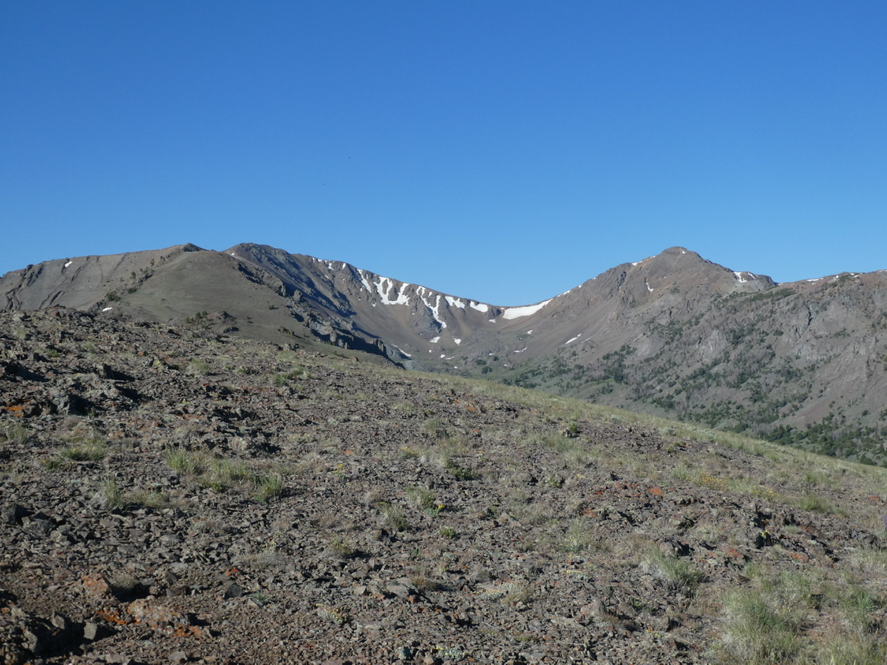
The Ramp on the right and Double U Peak on the left viewed from the Northeast Ridge.
Southeast Ridge from The Ramp, Class 2
Access
Access this route from Antelope Pass [(D) Page 260].
The Climb
Park on Antelope Pass. Cross the northeast ridge to the summit. The ridge is traversed much of the way by steep game trails. It is roughly 3.8 miles to the summit with 2,300 feet of elevation gain. From the summit of The Ramp descend its northwest ridge and then ascend Double U’s southeast ridge.
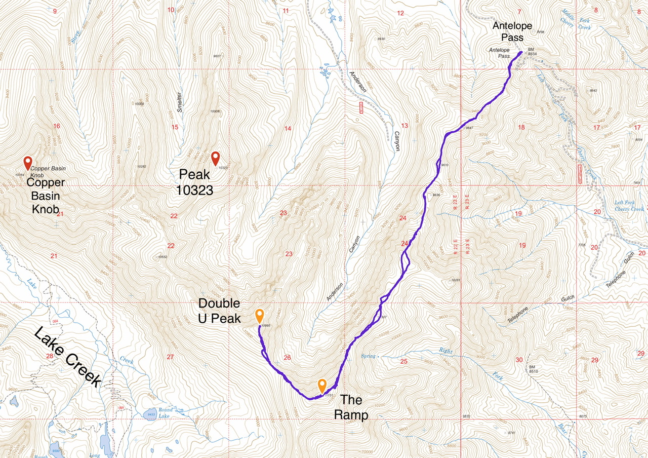
My GPS track for the Ramp and Double U. Round trip to Double U is 9.6 miles with 3,368 feet of elevation gain.
Southeast Ridge from Lake Creek, Class 2 by Livingston Douglas
Access
Lake Creek Trail/FST-064 [(C)(3)(d) on Page 260]
The Climb
Please refer to the North Ridge Route for Smiley Mountain for details on how to reach the upper basin ESE of Round Lake at 9,950 feet. From the upper basin, scramble NNE up Class 2 scree, finding an elk trail en route. Follow the elk trail up to the 10,500-foot saddle between Peak 10995 and Peak 11151. Plod up the easy scree/talus of the ridge to reach the summit of Peak 10995. You may be shocked at the exposure on the east and north sides of the summit, given how gentle the terrain is on the southwest side of the mountain.
Additional Resources
Regions: EASTERN IDAHO->Pioneer Mountains
Mountain Range: Pioneer Mountains
Year Climbed: 2020
Longitude: -113.80929 Latitude: 43.73719