Elevation: 4,375 ft
Prominence: 606
This peak is not in the book. Margo Mandella revised this page in January 2020. Livingston Douglas added two new routes in 2023. Updated November 2023
Peak 4375 is a small ranked peak northeast of Boise, Idaho. The peak’s accessibility, open slopes, relatively short hiking distance, elevation gain, and steepness make it a quick outing for active people and also a good “mountaineering” choice for beginners and adventurous children. The summit provides a 360-degree view that covers all of the Grand Slam Peaks. USGS Lucky Peak
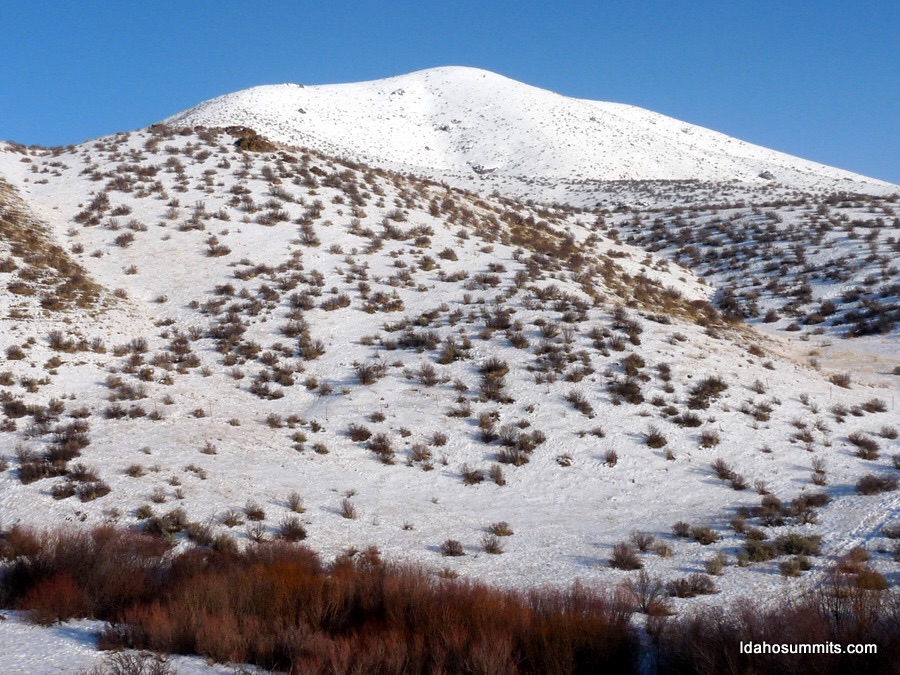
Kodiak Peak as viewed from the trailhead turnout on ID-21. The snow-covered trail to the peak’s base on its Southwest Side is visible. Steve Mandella Photo
Access
Take I-84 to Exit 57 (ID-21) and head north toward Idaho City. After you pass Lucky Peak Dam, pay attention to the east side of the road where there will be a few turnouts. Look for a large, paved turnout on the right/east side of the highway approximately 2.4 miles from Lucky Peak Dam. If you pass the Highland Valley Road junction on the left/west side of the highway you have gone to far. The view in the photo above is from the parking area.
Southwest Slopes, Class 2
A use trail leaves the parking area and drops down to a crossing of Sheep Creek. The trail then climbs up to a fence with a gate. Once through the gate you can climb the peak’ Southwest Face via numerous lines. Ascend whatever line suits you, or try the loop route shown on the track (below). It is barely over a mile to the summit with 882 feet of elevation gain. It is almost two miles for the entire climb on the loop route. Are you an avid peakbagger looking for a bigger day? Then get an early start and pair Kodiak Peak with nearby Shaw Mountain (Lucky Peak) and/or Cervidae Peak for a multiple-peak day!
West Face/Gully and North Face and Northwest Ridge/West Face Routes by Livingston Douglas
Access
Park at the junction of Highland Valley Road (signed) and ID-21 (2.4 miles north of Lucky Peak Dam). This junction is at 3,575 feet. These routes cross a short patch of private land that is not fenced or posted. These routes are probably the easiest, most direct lines to the summit.
West Face/Gully and North Face, Class 2
The Climb
From the road junction, cross to the east side of ID-21 and walk about 100 yards north up the highway to the top end of a concrete wall/guardrail. Leave the highway here and descend 40 vertical feet to cross a drainage at an easy stream crossing on a cattle trail in a short patch of willows. Unlike the entire drainage south of here, there is no marsh at this point so it is the optimal place to cross this [potentially] difficult, brushy drainage.
Once across the stream, scramble south briefly then east then southeast across a few grassy shoulders and dry gullies to reach the prominent west gully of Kodiak Peak. Scramble east up the main gully either all the way to the ridge crest or stop short of it (as I did) and scramble south up the STEEP grass of the north face to reach the summit. The summit of Kodiak Peak is small and has a torn-down cairn. It also has the base of a tree (cut to ground level). There is a magnificent view of both Lucky Peak (across the highway) and Lucky Peak Reservoir.
Northwest Ridge/West Face, Class 2
The Descent
From the summit, descend the easy, open grass of the northwest ridge then drop steeply into the west gully. Descend the west gully briefly then contour right/northwest across a shoulder and dry gully to reach the west face. Descend west on an easy shoulder down to the creek drainage just north of the highway departure point. Follow the creek drainage upstream a short distance to find the easy creek crossing that is hidden in the willows. Scramble 40 vertical feet back up to ID-21 then walk 100 yards south to the road junction and your parked vehicle.
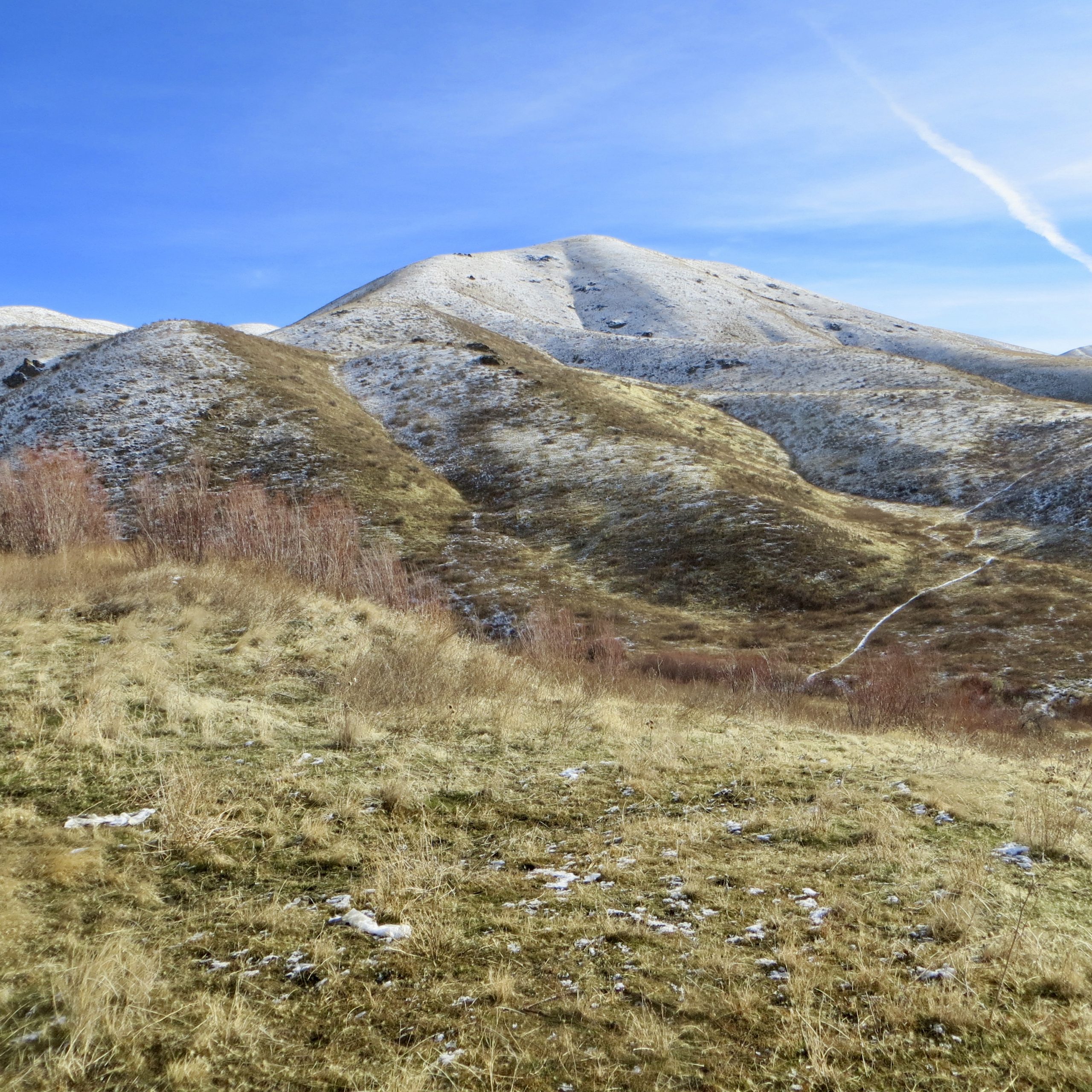
Kodiak Peak (hump in dead center) as viewed from ID-21 at Highland Valley Road. Livingston Douglas Photo
The summit of Kodiak Peak with Lucky Peak in the distance. Livingston Douglas Photo
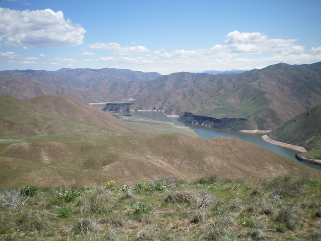
View of Lucky Peak Reservoir from the summit of Kodiak Peak. Livingston Douglas Photo
At the base of Kodiak Peak. Dan Robbins Photo
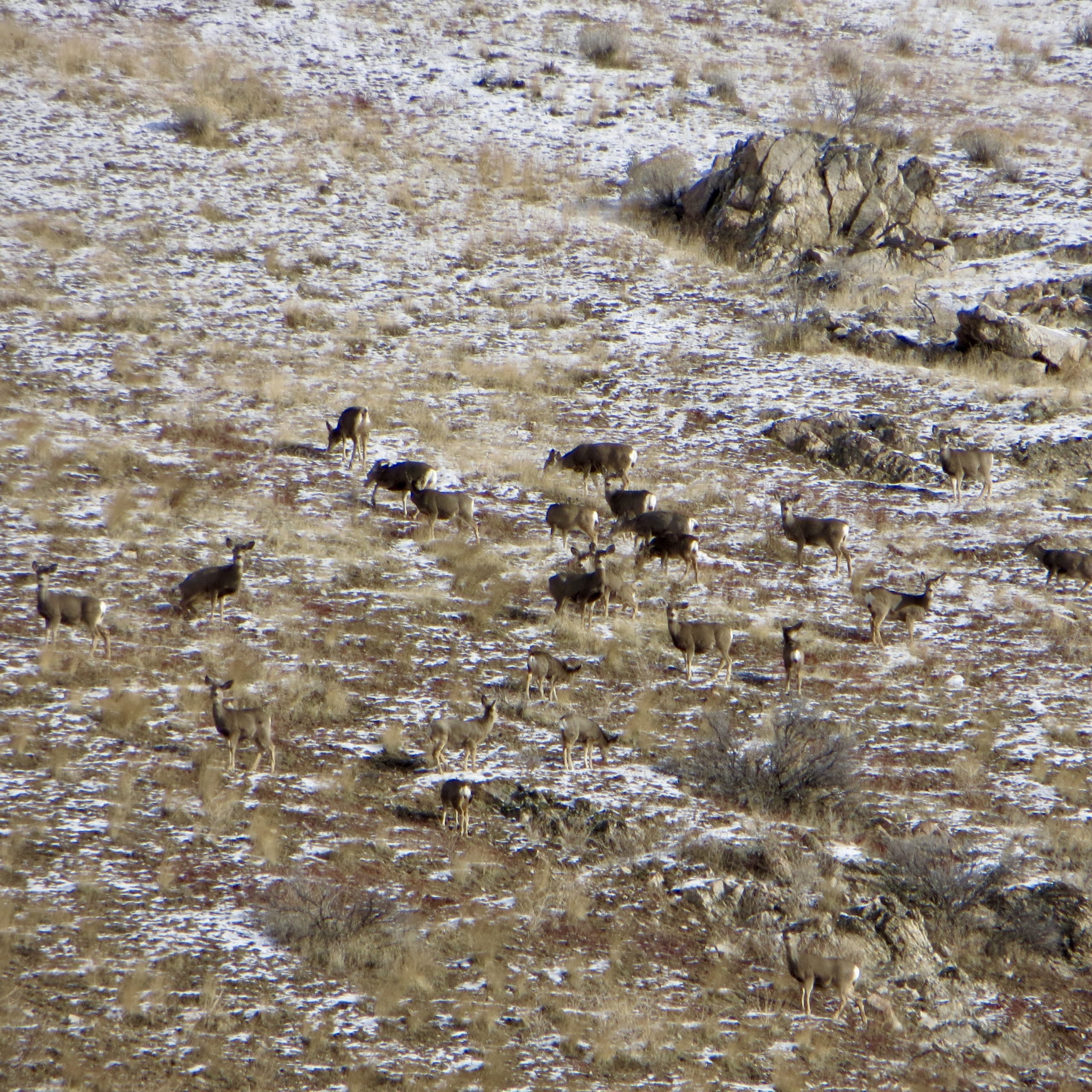
Deer herd near the summit of Kodiak Peak. Steve Mandella Photo
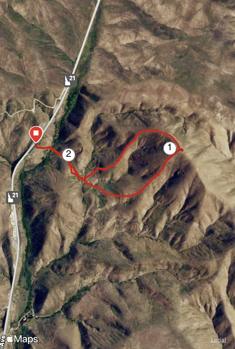
The loop route. 1 and 2 are GPS mile markings but, on this overcast day, the GPS device overestimated the distance. Margo Mandella track
Additional Resources
Regions: Boise Mountains->WESTERN IDAHO
Mountain Range: Boise Mountains
Year Climbed: 1998, 2020
Longitude: -116.0283 Latitude: 43.5563