Elevation: 5,140 ft
Prominence: 320
This peak is not in the book. Published December 2021
Peak 5140 is located on Cherry Ridge north of Emmett, Idaho at the southern end of the West Mountains. It is the highest point on Cherry Ridge between the Sehewoki’I Newenee’an Katete complex and Cherry Spring Benchmark. It has an amazing view of numerous areas including Sehewoki’I Newenee’an Katete, the Boise Mountains, the Cuddy Mountains and the West Mountains main crest and that range’s Willow Ridge.
This peak has access issues as it is blocked to both the east and west by private property. On the west side, the private property is just near Big Flat Road and it is possible there are other ways in from the northwest as there are ATV trails on the ridge. You could also cross Big Willow Creek off Big Flat Road from below the private property and traverse between private property on Idaho State Land. I chose to go from the south from the top of Peak 5894. USGS Squaw Butte
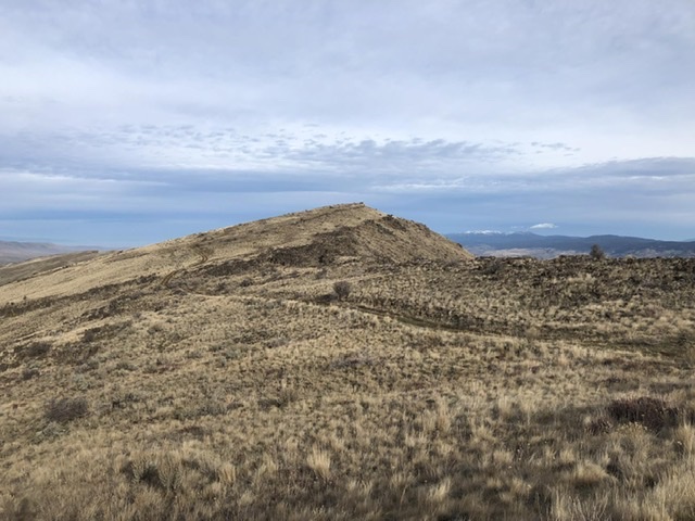
Peak 5140 as viewed from the south. Jason Floyd Photo
Access
From Emmett, drive north on Washington Avenue through town. This road eventually turns into Van Duesen Road. From this point, continue north roughly 3.5 miles and turn right onto Butte Road. There is a small fire station at the turnoff. Continue on Butte Road roughly 0.75 miles. Where Butte Road starts to make a right turn, there is a road on the left side with a cattle guard. Turn here. Follow this road up to the Sehewoki’I Newenee’an Katete crest and a saddle below the lookout. Park at the wide turnaround area by the next set of electronic towers. With high clearance and 4WD, you can continue past this spot for another 0.75 miles or so.
South Ridge, Class 2
From your parking spot on Peak 5894, follow the ridge or road north. The road can be quite muddy though in the Spring or after it rains. The road descends into a high Squaw Valley to the north. From this valley, aim for the long north/south-trending ridge which leads to Peak 5140. This ridge starts just to the northeast of your location. There is a small pond. If you hike north of the pond, you must cross a fence and a small creek. If you hike south of the pond, there is no creek to contend with.
Once you start climbing the ridge, you will find an occasional ATV trail. Stay on the ridge at all times as the ATV trails veer off into private property below the ridge. You will cross another fence on the ridge and eventually come to another ATV road that takes you the rest of the way to Peak 5140. To reach the actual high point, you must cross another fence. We placed a summit register just below the high point in an existing rock pile. Retrace your steps back. The crux of the hike is reclimbing Sehewoki’I Newenee’an Katete after a long hike. This journey covers 13.5 miles with 2000 feet of elevation gain.
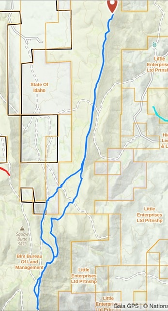
My GPS track
Additional Resources
Regions: West Mountains->WESTERN IDAHO
Mountain Range: West Mountains
Longitude: -116.37701 Latitude: 44.090301