Elevation: 6,934 ft
Prominence: 314
This peak is not in the book. Margo Mandella authored the original entry for this peak. Livingston Douglas provided routes for the peak’s west shoulder and north ridge/northwest spur. USGS Scott Butte. Updated December 2019
North Ridge by Margo Mandella
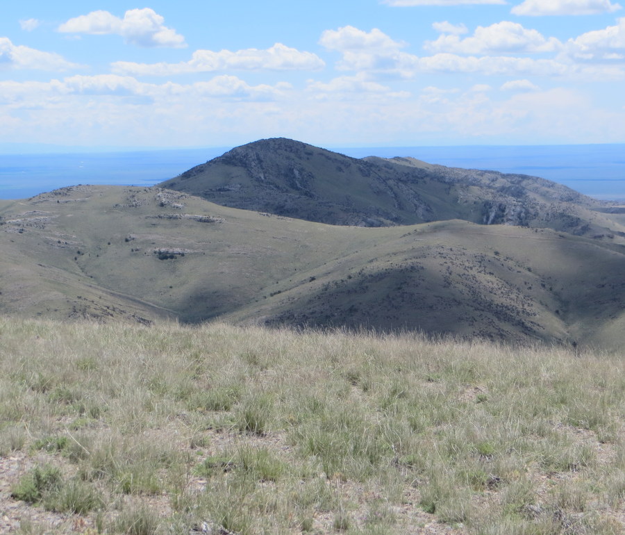
Peak 6934 is located just northeast of Scott Butte and southeast of Peak 6980 at the southwest end of the Beaverhead Mountains. Its accessibility and elevation provide great views of Birch Creek Valley and the east side of the Lemhi Range.
Access
Peak 6934. Steve Mandella Photo
The peak is located on public land managed by the Bureau of Land Management. The motorized use map (no longer available online [2017]) shows a couple of ways to reach Peterson Canyon. However, the most obvious on-the-ground access is via Scott Butte Road.
Stay east of the butte on this road and travel north-northeast to a junction with a sign that marks the entrance to Peterson Canyon. Here, an ATV track heads northeast before turning southeast and ascending to a saddle next to Point 6806. Either park near the junction or, if you have the appropriate vehicle, continue toward the saddle where you can pull over and park.
North Ridge, Class 2
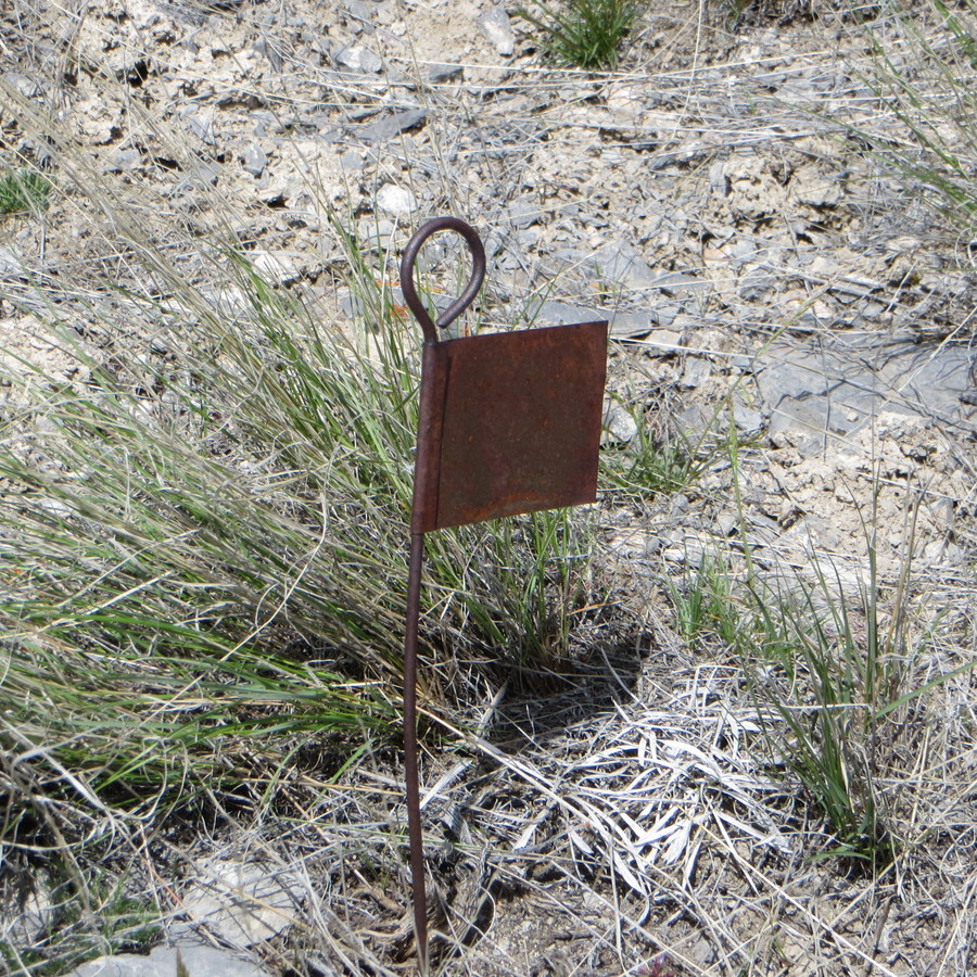
A summit marker on Peak 6934. Steve Mandella Photo.
Either hike the ATV trail to the point 6806 saddle or, if you can drive to this saddle, park just off the saddle. Then climb down a few feet before continuing across mellow terrain to the base of the rocky North Ridge of Peak 6934. A short scramble to the west of the rocks quickly brings you to the summit.
There is no official summit marker but there is an interesting metal marker near the highest point on the summit.
West Shoulder and North Ridge/Northwest Spur by Livingston Douglas
West Shoulder, Class 2
Access
Peterson Canyon Road leads to Scott Butte from ID-28 in the Birch Creek Valley. Contrary to the USGS topo map, there is no “Scott Butte Road”, so don’t look for it. It’s labeled “Peterson Canyon Road.” Peterson Canyon Road is signed and is located near the Mile Marker 36 on ID-28. It is exactly 5.4 miles north of the junction of ID-28/ID-22. It is exactly 7.9 miles south of the north entrance to Birch Creek Campground. Peterson Canyon Road is on the east side of ID-28.
Peterson Canyon Road approaches Scott Butte from its south side and bends left/north to get close to Scott Butte on its east side. Drive 2.4 miles on Peterson Canyon Road (a wide, good gravel/dirt road) to reach the northwest side of Scott Butte at a saddle area. Park here (5,860 feet).
The Climb
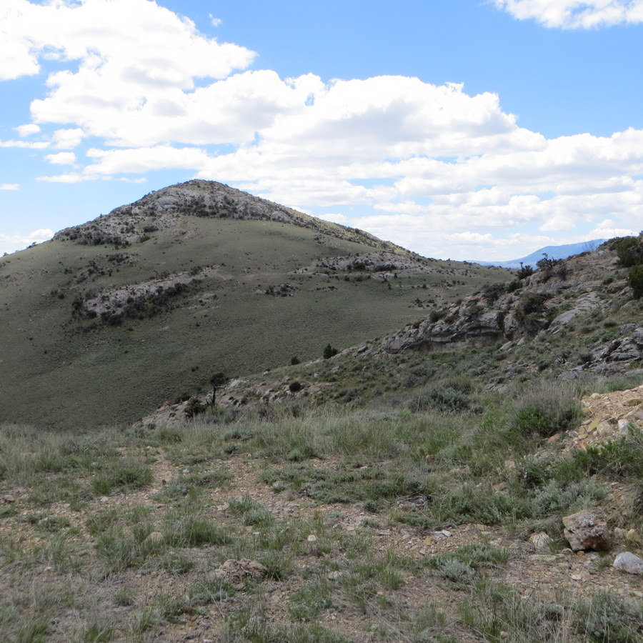
The west side of Peak 6934 is quite visible from Peterson Canyon Road at this flat, saddle-like area. The west side is a menagerie of multiple gullies and shoulders. There is no clean ridge or direct gully. There are hidden gullies and many of the shoulders bend and don’t go straight up the west face. It’s a mess. However, there is a shoulder in the center of the west face that ascends to the summit area.
From the saddle area along Peterson Canyon Road, identify the most obvious shoulder on the west face of Peak 6934. To reach the shoulder, you must do a cross-country scramble east through relatively easy scrub, crossing a few minor gullies on the way. Once on the shoulder, climb up the easy grass/scrub on its crest. Higher up, the shoulder reaches a large hidden gully.
Follow the shoulder as it moves right/south temporarily then curls left/north back to the center of the west face. The shoulder then rises directly east to the summit area, just right/south of the high point. Stroll a short distance left/north to the summit. The summit of Peak 6934 is relatively small and is covered with brush. There is no summit cairn (no loose talus/scree) and no open areas or summit boulders. The high point is a sagebrush bush.
North Ridge/Northwest Spur, Class 2
Access
Same as for the west shoulder. This is the first leg of a ridge traverse from Peak 6934 to Peak 6980.
The Descent
From the summit, descend north down easy scrub on an ill-defined ridge (more of a face) to reach a saddle. From the saddle, climb north over a lateral ridge. This requires 130 vertical feet of uphill. This ridge stands between you and the northwest spur. From the crest of this minor ridge, descend north briefly then northwest down a narrow spur ridge that leads you directly down to Peterson Canyon and a road junction. The northwest spur is a delightful scramble on short scrub and broken scree. It goes quickly.
Additional Resources
Regions: Beaverhead Range->EASTERN IDAHO
Mountain Range: Beaverhead Range
Longitude: -112.76679 Latitude: 44.07359