Elevation: 6,980 ft
Prominence: 320
This peak is not in the book. Margo Mandella published the first submission on this peak covering one of the peak’s two south ridges. Livingston Douglas provided route information for the peak’s second south ridge. Updated December 2019
Peak 6980 is located north-northeast of Scott Butte and northwest of Peak 6934 at the southwest end of the Beaverhead Mountains. Its accessibility and elevation provide great views of the Birch Creek Valley and the east side of the Lemhi Range. USGS Scott Butte
Access
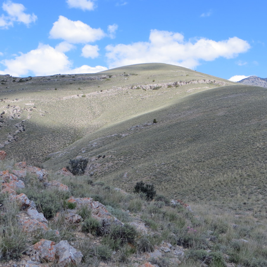
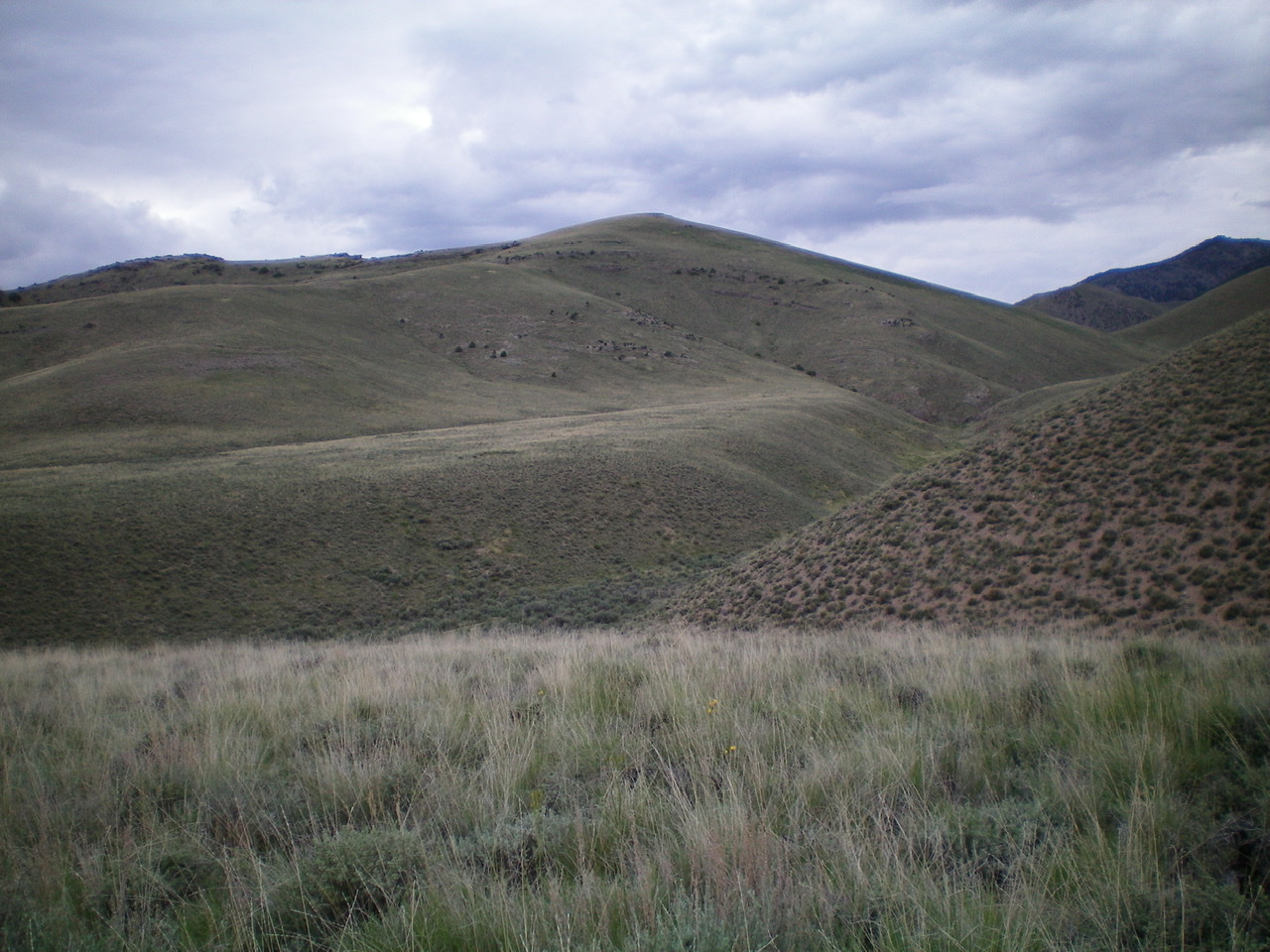
Mellow Peak 6980 (foreground) shows the peak’s South Ridges and ledges. Margo Mandella photo.
The peak is located on public land managed by the Bureau of Land Management. The motorized use map (no longer available online [2017]) shows a couple ways to reach Peterson Canyon. However, the most obvious on-the-ground access is by Scott Butte Road, staying east of the butte and travelling north-northeast to a junction marking the entrance to Peterson Canyon. Here, continue northeast toward an obvious mine excavation.
The mine area is private land but no signage restricts access to the peak from the road. Park at a point just off this road to access one of Peak 6980’s two south ridges.
South Ridge(s), Class 2 by Margo Mandella
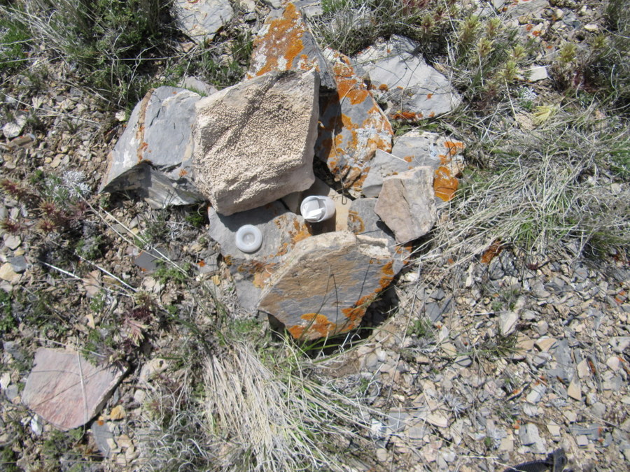
The summit marker atop Peak 6980. Margo Mandella Photo
Both south ridges provide easy travel to reach the summit. We used the western of the two ridges. This ridge ascends to and through a few rocky ledge bands. Though wide, the ledges are short and easy to pass through in a number of spots.
Alternatively, as seen in the photo, the ledges can be skirted entirely. Once through/around the ledges, continue upward until you reach the large, broad, flat summit of the peak. A small rock ring marks the summit.
South Ridge East, Class 2+ by Livingston Douglas
Access
Peterson Canyon Road leads to Scott Butte from ID-28 in the Birch Creek Valley. Contrary to the USGS topo map, there is no “Scott Butte Road”, so don’t look for it. It’s labeled “Peterson Canyon Road.” Peterson Canyon Road is signed and is located near the Mile Marker 36 on ID-28. It is exactly 5.4 miles north of the junction of ID-28/ID-22. It is exactly 7.9 miles south of the north entrance to Birch Creek Campground. Peterson Canyon Road is on the east side of ID-28.
Peterson Canyon Road approaches Scott Butte from its south side and bends left/north to get close to Scott Butte on its east side. Drive 2.4 miles on Peterson Canyon Road (a wide, good gravel/dirt road) to reach the northwest side of Scott Butte at a saddle area. Park here (5,860 feet). The route described for Peak 6980 is part of a loop route that climbs both Peak 6934 and Peak 6980 and returns to the aforementioned saddle area on the northwest side of Scott Butte.
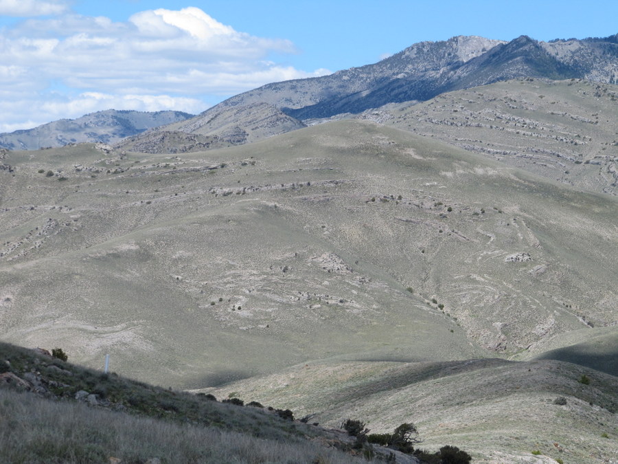
Peak 6980 as viewed from the northwest spur of Peak 6934. The south ridge—WEST is on the skyline (rising from lower right to upper left) and is rougher than the smoother, gentler south ridge—EAST which is in front of it, separated by a deep gully. The summit of Peak 6980 is the gentle hump right of center. Livingston Douglas Photo
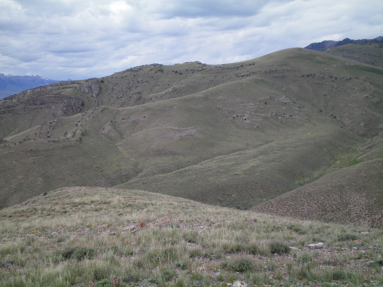
Peak 6980 as viewed from the northwest spur of Peak 6934. The summit is in dead center. Livingston Douglas Photo
The Climb
This climb is part of a ridge traverse from Peak 6934 to Peak 6980. It begins at the terminus of the north ridge/northwest spur route of Peak 6934. This terminus is in Peterson Canyon at a road junction that is due east of Point 6415. This climbing route intersects the south ridge—EAST of Peak 6980 just north of Point 6415. From Peterson Canyon, scramble northwest up easy, open scrub to reach the broad, rounded crest of the south ridge—EAST.
Follow the ridge to the summit on easy grass/scrub. The only fly in the ointment is a minor shale headwall that must be climbed higher up (Class 2+/3). The summit of Peak 6980 is a gentle hump of short scrub and broken scree. The high point had a very small cairn so I built it up with the few rocks I could find.
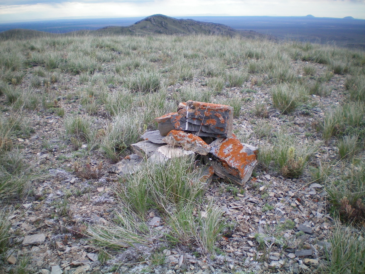
The small summit cairn atop peak 6980. Livingston Douglas Photo
Additional Resources
Regions: Beaverhead Range->EASTERN IDAHO
Mountain Range: Beaverhead Range
Longitude: -112.78249 Latitude: 44.09439