Elevation: 7,395 ft
Prominence: 335
This peak is not in the book. Livingston Douglas added a new descent route and photos. Updated November 2024
This peak is the lowest of the three ranked summits in the the Red Hills subrange of the Lost River Range. It is located southeast of Taylor Mountain, the highest peak in this small subrange. USGS Red Hills
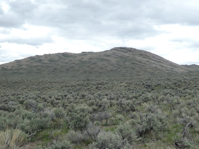
Peak 7395 as viewed from the west
Access
Primary access is from the Dry Creek Road [(A)(6) on Page 290]. The peak’s western slopes can be accessed from the 4WD road shown on the map below.
Western Slopes, Class 2
Follow the 4WD road toward the peak. Park when you are due west of the summit. cross the intervening sagebrush covered terrain to base of the peak’s west face. Climb the obvious line to the summit. My GPS recorded 1.2 miles with 365 feet of gain round trip.
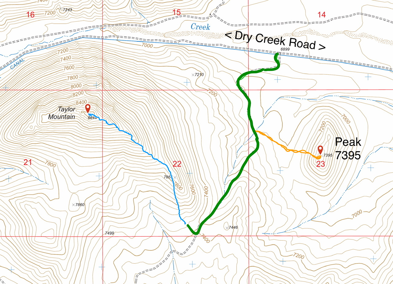
This map shows routes to Taylor Mountain and Peak 7395. The green line is the 4WD road.
Southwest Ridge by Livingston Douglas
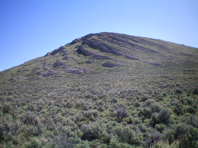
Peak 7395 and its southwest ridge. This was my descent route. Livingston Douglas Photo
Southwest Ridge (Class 2)
The Descent
The summit of Peak 7395 has three or four potential high points, not just the cairned high point. Stand atop all of them just to be sure. The cairned is probably, but not necessarily, the highest point. From the summit area, descend south then southwest on the rocky ridge crest. Downclimb a few rock strata to reach a wide, sagebrush area that is the saddle. It is not a well-defined saddle like most saddles. This is the low point and the connecting saddle with Taylor Mountain (8,644 feet). This is the first leg of a 2-peak adventure that includes Peak 7395 and Taylor Mountain. Taylor Mountain is up next.
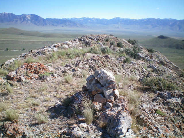
The summit of Peak 7395. Livingston Douglas Photo
Additional Resources
Regions: EASTERN IDAHO->Lost River Range->Red Hills
Mountain Range: Lost River Range
Year Climbed: 2020
Longitude: -113.44659 Latitude: 44.18339