Elevation: 7,768 ft
Prominence: 588
This peak is not in the book. Margo Mandella prepared the first edition of this page. Livingston Douglas submitted the new route description set forth down the page. Updated December 2019
Peak 7768 by Margo Mandella
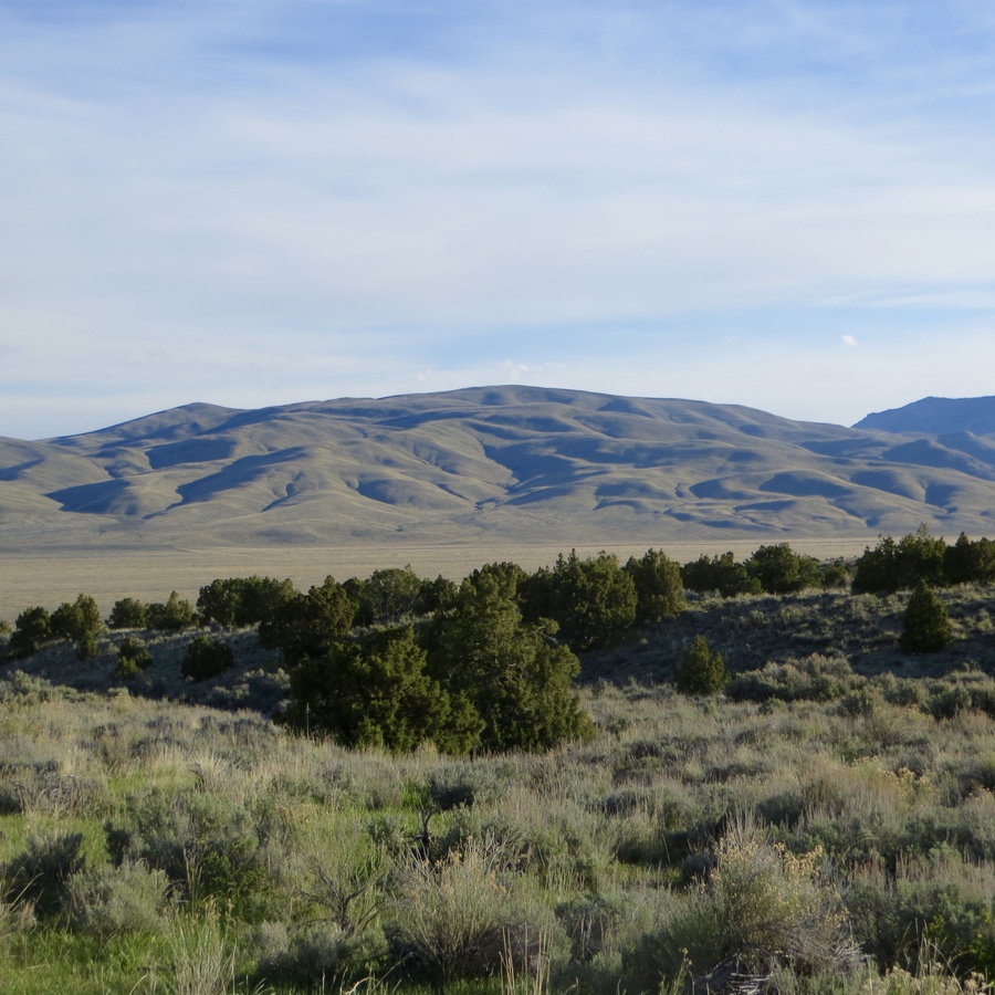
Peak 7768 is an unassuming ranked peak in the Lost River Range that lies between much taller King Mountain to the west and Jumpoff Peak to the east. Its large, mellow summit area is exposed to wind and weather, but it provides great views of surrounding peaks and the valley below. It’s a peak that we did “on the fly” while climbing other peaks in the area. USGS Arco Hills
The summit of Peak 7768 with snowy King Mountain (right) and North King Mountain (left) in the background. Steve Mandella Photo
Access
From Arco (ID), travel east on 2450 North until you reach Arco Pass Road. Follow Arco Pass Road as it heads north, then east, then northeast, and then north once more until it reaches the mouth of Wood Canyon. You’ve missed the canyon if you are still on Arco Pass Road when it turns due west.
Normally, you could continue on the dirt road farther into Wood Canyon. However, during winter of 2017-2018, a heavy rain event washed out many approach roads in the Jumpoff Peak/Arco Hills area. We found this ATV road impassable by 4WD without causing irresponsible resource damage on top of natural damage, so we parked and started our climb from here.
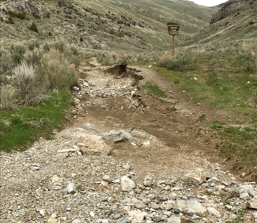
The trailhead for Peak 7768. Steve Mandella Photo
Route
Hike into Wood Canyon on the 4WD road. Pass the first 4WD spur on the left. This spur travels onto unmarked (as of May 2018) private land. Continue on the 4WD road until you reach the second unmarked spur, shown as Arco Pass Spur #1 on the GPS track below, which is on public land. Take this spur and follow the road. The track climbs quickly and steeply. Once on the east ridge, the track becomes gradual and it’s pleasant hiking from here to the summit.
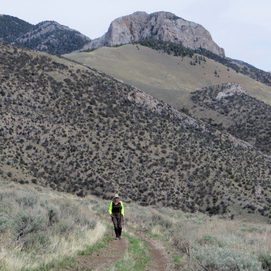
4WD trail to the summit of Peak 7768 with Peak 7820 in the background. Steve Mandella Photo
As we approached the high ridge where we could see the summit area, we surprised a large herd of elk. They quickly ran over the ridge to the southwest. We continued on to the summit and took photos.
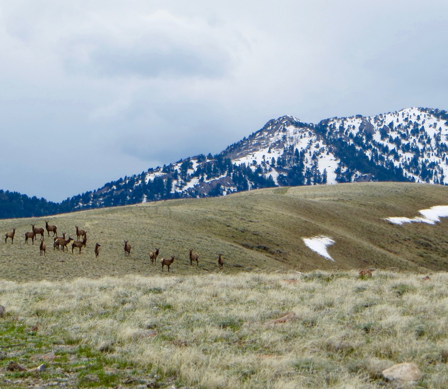
Elk herd as we approach the mellow summit of Peak 7768. Steve Mandella Photo
Private land lies due south of the summit. However, the land is fenced so stay on the public side to not trespass. As shown on the GPS track, below, we descended south along the public side of the fence line to make our outing a loop route. The fence follows all the way down to the mouth of the canyon to “our” trailhead, a fact we noticed when we started out. It’s a little more sporting descent route, so it may not save you any time. Additionally, there is no easy path to the east and back to the road if you change your mind along the way, so you need to fully commit to the south descent or just backtrack your approach on the 4WD road.
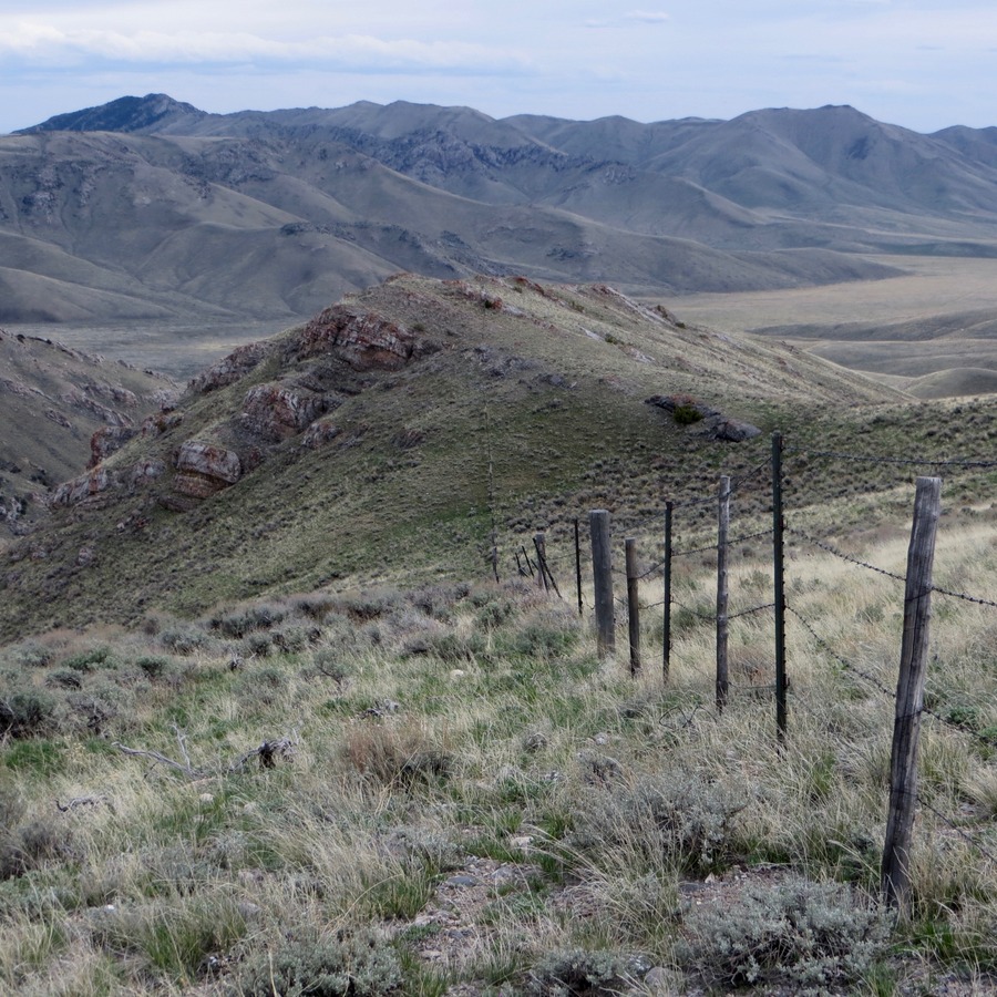
South descent off Peak 7768. Steve Mandella Photo
Our round-trip stats: 5.24 miles with 1,614 feet of elevation gain.
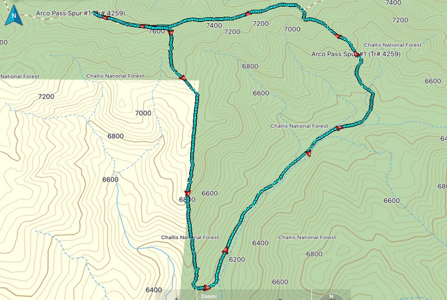
The loop route for Peak 7768. Margo Mandella GPS track
West Ridge and Southwest Ridge/Southwest Gully by Livingston Douglas
The final climb to the summit of Peak 7768. The west ridge is the right skyline. The west face is in the middle of the photo. Livingston Douglas Photo
West Ridge, Class 2
Access
At the south end of Arco (ID) along US-20/26, there is a frontage road (Highway Drive) on the east side of the highway. Just north of the Conoco gas station, look for the Lost River Motel on the right/east side of the highway. Find an access road here that goes east to intersect Highway Drive. There is a public park of sorts here with a picnic table. When you reach the “T” junction with [signed] Highway Drive, turn right/south and drive 0.3 miles to a [signed] junction. Go left/east here onto 2450N. This junction is directly east of the Conoco gas station.
Drive 1.0 mile on 2450N to a signed road junction. Go left/north here. This is the start of Arco Pass Road. Reset your odometer here. At 3.6 miles, the road turns right/east at a corral. At 4.8 miles, you reach a signed road junction. Go left/north here for Arco Pass. At 7.1 miles, reach a key road junction. Go right onto a narrow rough road for Arco Pass. At 8.1 miles, park alongside the road as it is about to get very steep and badly rutted. The elevation here is 6,135 feet.
The Climb
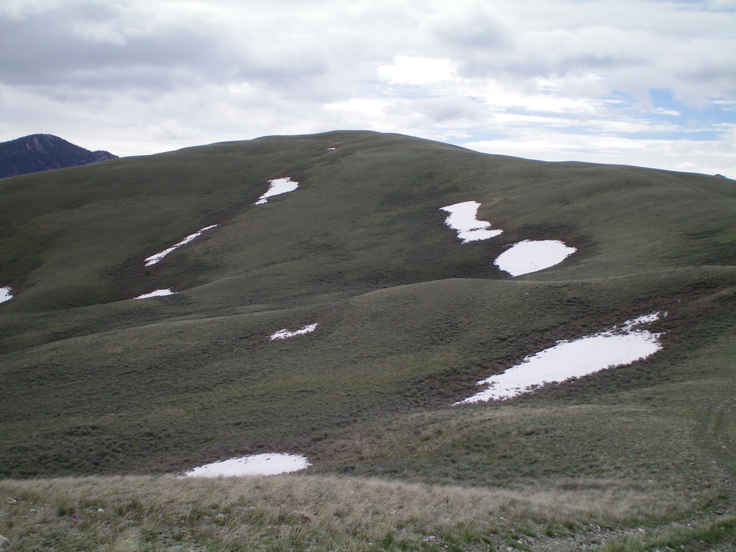
From the parking pullout, hike up the muddy, rutted road to Arco Pass for 2.0 miles to a flat saddle area at 7,000 feet. Do NOT go all the way to Arco Pass. Leave the road here and scramble east up a relatively easy mix of sagebrush and grass. You soon reach Point 7535 (large cairn here). Follow a 2-track jeep road southeast then east to the summit of Peak 7768. The summit of Peak 7768 has a large cairn. I stuck a post in the cairn and took a photo of it. Peak 7768 is just another grassy hump and nothing more.
Southwest Ridge/Southwest Gully, Class 2
Access
Same as for the west ridge
The Descent
From the summit, descend west on the 2-track road briefly to reach the southwest ridge. Leave the jeep road here and descend the crest of the southwest ridge. The terrain on the southwest ridge is easy open scrub/grass. The ridge soon bends right/west and drops 600 vertical feet to a gully. Descend the narrow gully (using a cattle trail) to intercept Arco Pass Road. You must cross a stiff cattle fence a little ways above the road. Follow the road back to your parked vehicle.
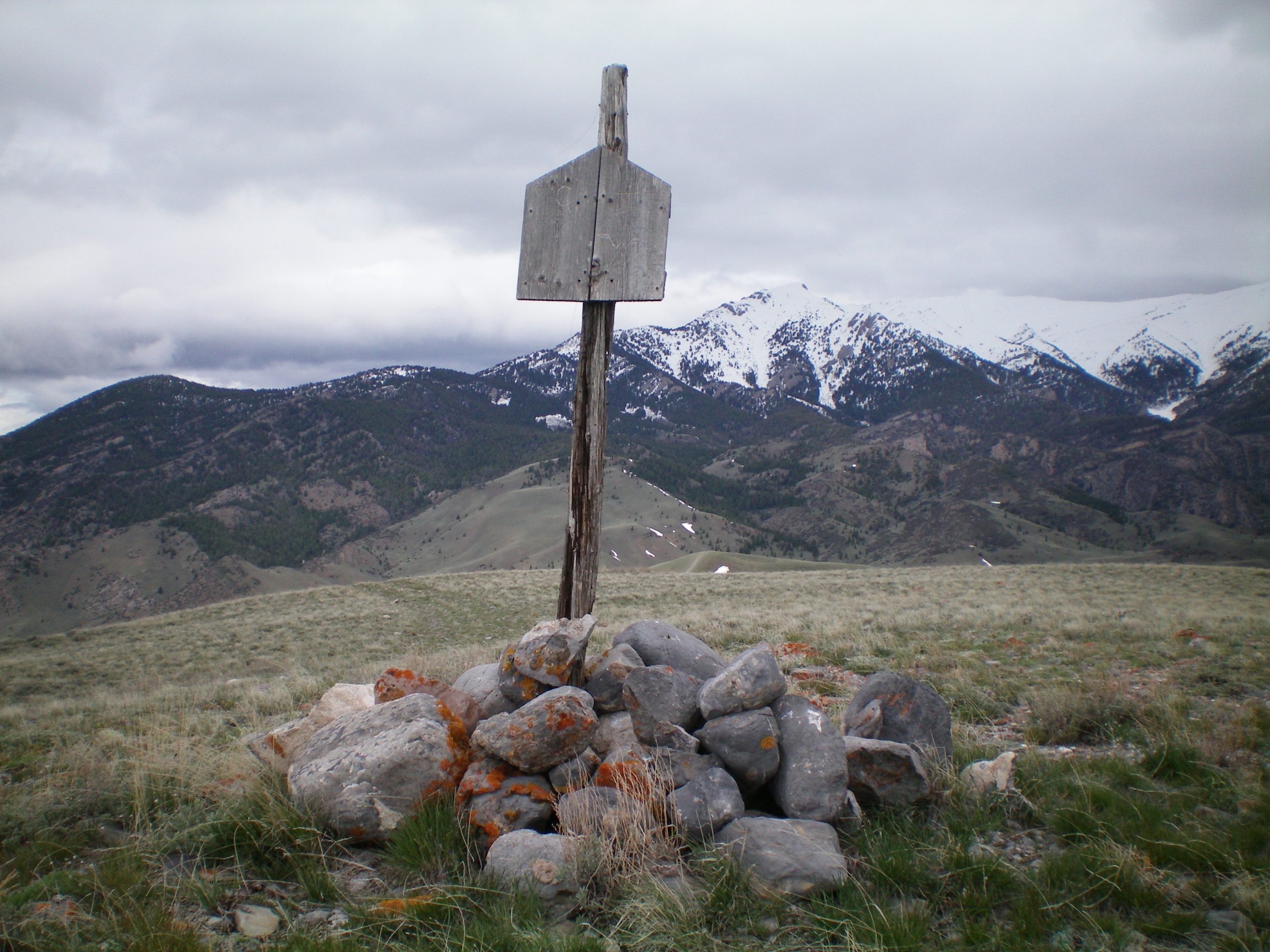
The summit cairn atop Peak 7768. It now sports a NFS post, thanks to yours truly. Livingston Douglas Photo
Additional Resources
Regions: EASTERN IDAHO->Lost River Range
Mountain Range: Lost River Range
Longitude: -113.18919 Latitude: 43.74601