Elevation: 8,613 ft
Prominence: 313
This peak is not in the book. Published November 2020
Peak 8613 is one of four peaks on the south side of Webber Creek (Peak 8613, Peak 9381, Peak 9499, and Peak 9700) that make for a good loop route. This adventure covers 11.5 miles with 5,375 feet of elevation gain round trip from the Webber Creek trailhead so it is not for the faint of heart. It is almost entirely ridge climbing and bushwhacking with very little trail hiking. You’re not likely to encounter anyone on any of these peaks. USGS Heart Mountain
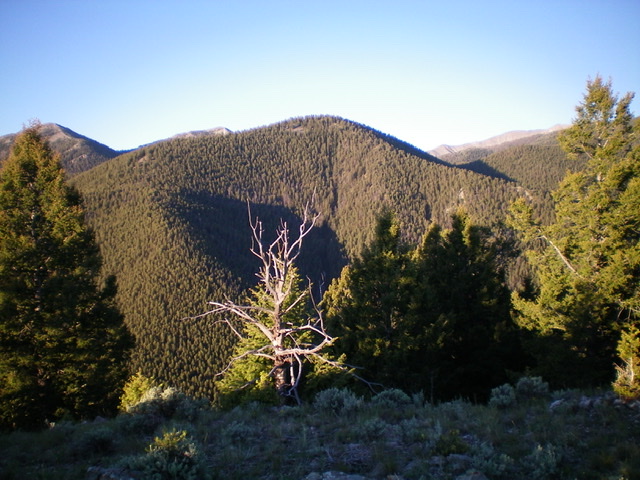
Peak 8613 (dead center) as viewed from the north. Livingston Douglas Photo
Access
The Webber Creek Trailhead is located 4.8 miles up Webber Creek Road/FSR-196 from a signed junction with Medicine Lodge Road to its east. The elevation at the trailhead is 6,850 feet.
Northeast Ridge, Class 2
The Climb
Hike about 100 yards up Webber Creek Trail/FST-111 to an unsigned junction with the old Webber Creek Trail (which crossed Webber Creek twice early on). That old trail is now used by horses since the new trail is quite rocky in the section that avoids the double creek crossing. The old footbridge is in tatters (for the first crossing of Webber Creek) but there is a massive fallen tree close by that makes crossing [sizable] Webber Creek a breeze.
After crossing to the south side of Webber Creek, follow the old trail to the second crossing of Webber Creek. Do not cross the creek here. Leave the trail here and bushwhack steeply southwest up onto a forested ridge. The first 200 vertical feet or so is thick with brush/blowdown but it soon thins out and becomes a pleasant pine forest climb up the ridge. The pine forest is initially dense with young, thin pines with lots of dead branches strewn on the ground. But this soon gives way to a mature, open pine forest with broken branches on the ground but not much treefall.
There is a short section of talus scrambling up a face section of the ridge about two-thirds of the way up the ridge. Aside from that, it’s just a pleasant scramble to reach the summit of Peak 8613. The summit area is a semi-open, flat area without much visibility. The high point is about 100 yards southwest of where I found a small summit cairn.
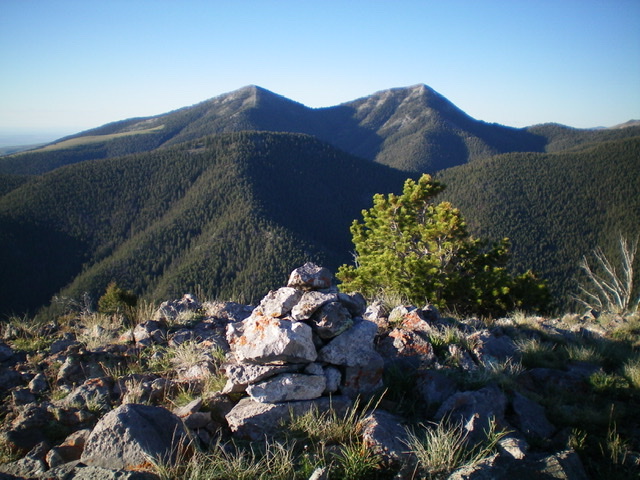
Peak 8613 (mid-ground, left of center) and its northeast ridge as viewed from the summit of Peak 8773 to the north. Livingston Douglas Photo
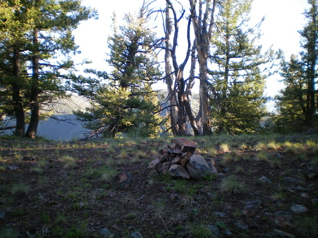
The summit cairn atop Peak 8613, but this isn’t quite the high point. Livingston Douglas Photo
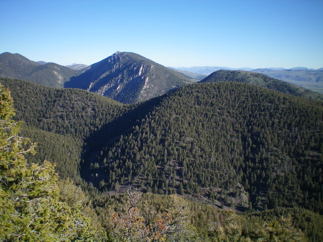
Peak 8613 (mid-ground, forested hump right of center) and its northeast ridge (just left of center). Livingston Douglas Photo
South Face, Class 2
The Descent
From the summit, head southwest along the flat summit ridge and find a ridge (of sorts) heading south then southeast down to McNeary Creek. The forested, rounded ridge/face has more talus/scree in its base as you approach the creek and the amount of blowdown increases as well. Finish the descent by following a dry gully of loose scree to the creek drainage below and a minor “saddle” of sorts. This concludes the first leg of today’s journey. Peak 9381 is up next.
Additional Resources
Regions: Beaverhead Range->EASTERN IDAHO
Mountain Range: Beaverhead Range
Longitude: -112.70839 Latitude: 44.35159