Elevation: 9,700 ft
Prominence: 480
This peak is not in the book. Published November 2020
Peak 9700 is the final peak of four peaks on the south side of Webber Creek (Peak 8613, Peak 9381, Peak 9499, and Peak 9700) that make for a good loop route. This journey entails 11.5 miles and 5,375 feet of elevation gain from the Webber Creek Trailhead so it is not for the faint of heart. It is almost entirely ridge climbing and bushwhacking with very little trail hiking. Peak 9700 is most easily reached from the Myers Creek ATV Trail/FST-191 to the south. USGS Heart Mountain
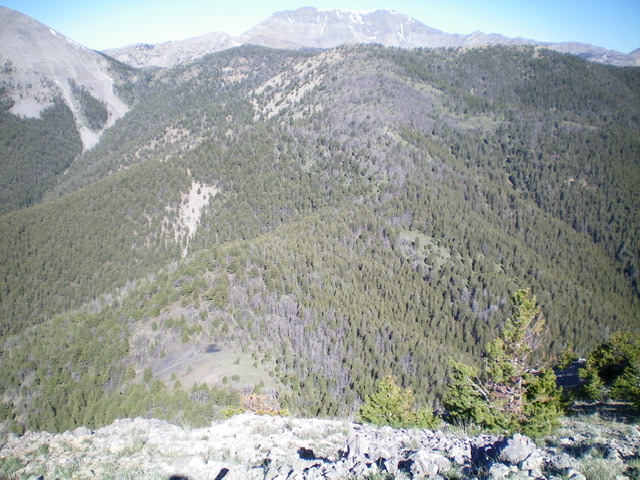
The east ridge of Peak 9700 (dead center) as viewed from Peak 9499 to its east. Livingston Douglas Photo
Access
Same as for Peak 8613. This is the final leg of a four-peak adventure.
East Ridge, Class 2
The Climb
From the 8,700-foot connecting saddle with Peak 9499, bushwhack northwest then west through open pine forest then through a combination of scattered trees/blowdown and field grass (game trail on and off here) to reach the south summit hump (Point 9634). From this hump of short scrub and broken scree, descend north to a minor saddle and continue north to the gentle, open summit of Peak 9700. There is a modest cairn on top.
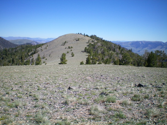
The summit hump of Peak 9700 as viewed from Point 9634 to the south. Livingston Douglas Photo
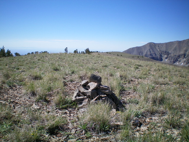
The gentle summit area of Peak 9700, looking south. Livingston Douglas Photo
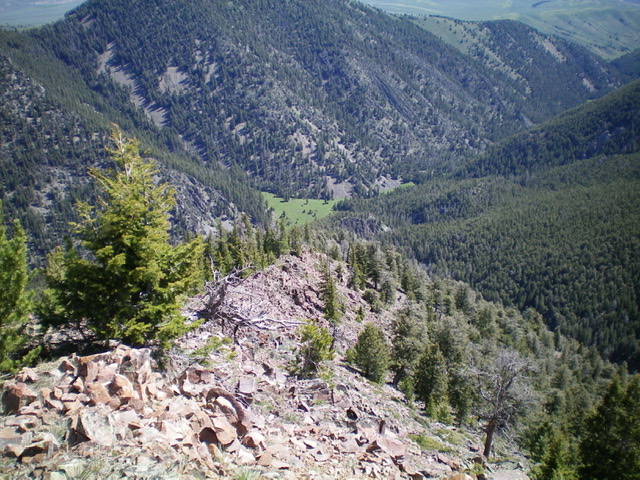
Looking down the rocky northeast ridge of Peak 9700 with a green meadow in the Webber Creek drainage (dead center) at the base of the ridge. Livingston Douglas Photo
Northeast Ridge, Class 2
The Descent
From the summit, descend north on rocky terrain into a pine forest and bend right/northeast to scramble up forested Point 9544. From Point 9544, follow the ridge northeast on narrow, rocky terrain (not forested as the USGS map suggests) to eventually reach forested and less rocky terrain lower down with smoother sailing. The ridge crest has a lot of ridge trees/blowdown and rocky outcrops to work through. As you near the valley floor, leave the ridge and descend right/east down a dry gully to reach the main side drainage that leads to Webber Creek.
This side drainage heads northeast then north. It is a difficult bushwhack with LARGE downed trees and lots of veg/brush, but it goes and is the only viable alternative to the impossible cliffs at the base of the northeast ridge. When you reach the open meadow at the base of the northeast ridge, follow Webber Creek downstream a short distance to find a suitable log crossing. Cross the creek and quickly reach the Webber Creek Trail on the north side of the creek. Follow the trail about 1.5 miles down to the trailhead.
Additional Resources
Regions: Beaverhead Range->EASTERN IDAHO
Mountain Range: Beaverhead Range
Longitude: -112.73749 Latitude: 44.34169