Elevation: 12,023 ft
Prominence: 323
Climbing and access information for this peak is on Page 278 of the book.
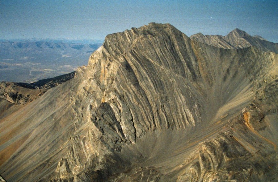
Donaldson Peak is the 8th-highest peak in Idaho and is located in the Lost River Mountain Range. It is one of the nine Idaho 12ers. It is an impressive summit with a long approach and a steep, rotten headwall to climb.
I recently climbed the peak a second time. The traditional approach has been via Jones Creek [(B)(10) on Page 292]. Jones Creek is a rugged, unstable drainage, which seems to change each year as the Spring runoff and healthy vegetation constantly change the stream bottom and erode the climber’s trail.Recently, climbers have established a new approach in the next drainage to the north, which is sometimes referred to as North Fork Jones Creek. Donaldson is most often climbed in combination with an ascent of Mount Church.
In 2006, a fatality occurred during the ascent of the traditional standard route. As the alternative approach becomes more popular and becomes the new standard route, as I believe it will, it is less likely that this particular accident will happen to anyone else. However, it’s more important to note that the accident resulted from a combination of (in)experience and decision making in unfamiliar terrain. Thus, the lessons that can be learned from this tragedy may be applied to any mountain ascent and is worth the time to read. USGS Leatherman Peak
Donaldson Peak as viewed from Mount Brietenbach.
North Fork Jones Creek Approach
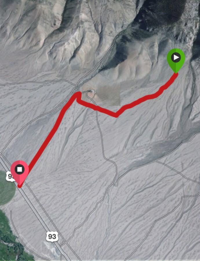
The road approach to North Fork Jones Creek. Follow the Lone Cedar Creek Road to a ranch, turn right, and follow the two-track to its end.
This approach is reached via Lone Cedar Creek Road [(B)(9) on Page 292]; also see the track below. From the end of the road, a good trail leads toward the mouth of the canyon. Once in the canyon, the trail is marked and, for the most part, is easy to follow. Occasionally, the trail crosses the intermittent stream and at these spots you might need to look for a cairn to get back on the trail. Once you get above treeline, the choice of which way to proceed is up to you. The route to the pond at the base of the headwall is obvious.
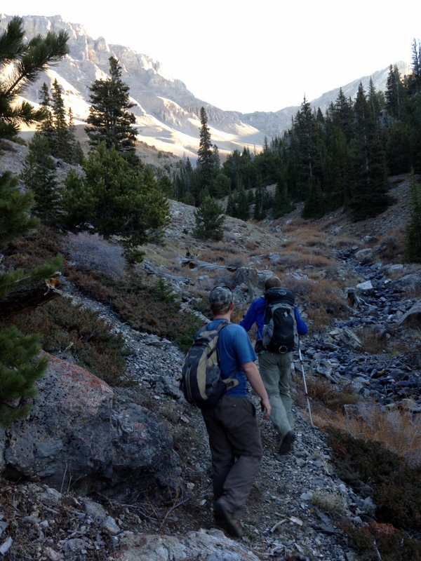
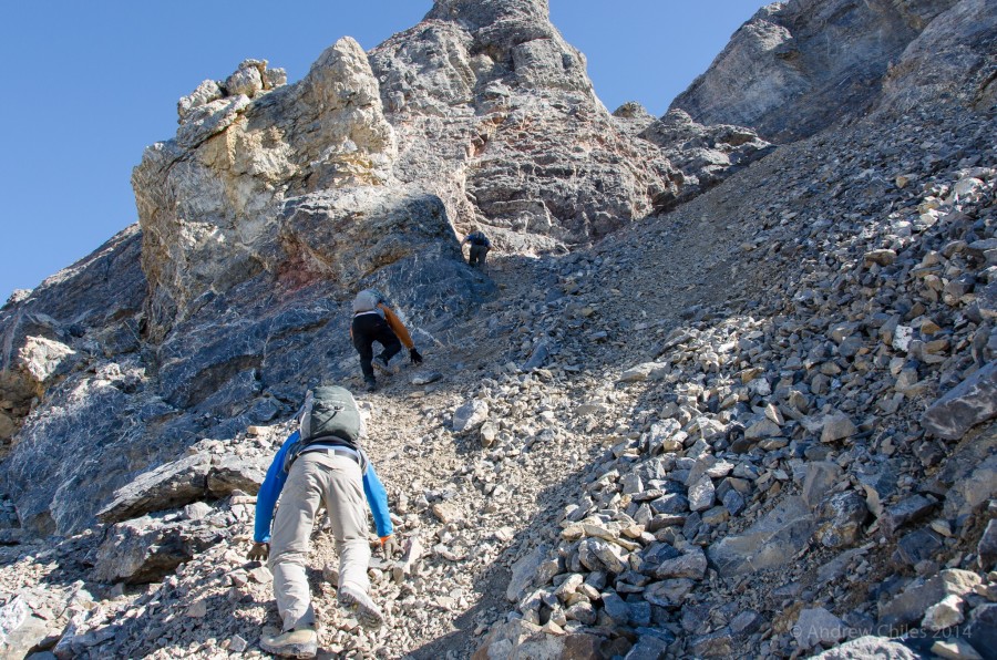
Mark Jones and Dan Paulson are simply running up the trail on an early October morning.
The lower sections of the North Fork Jones Creek are covered by a thick forest. As you ascend, the drainage opens up and the trees thin out. The trail is good most of the way.
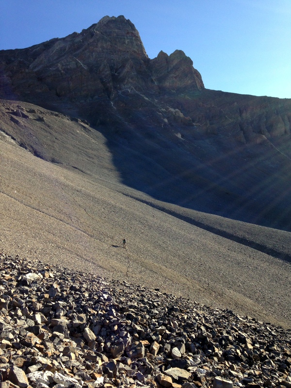
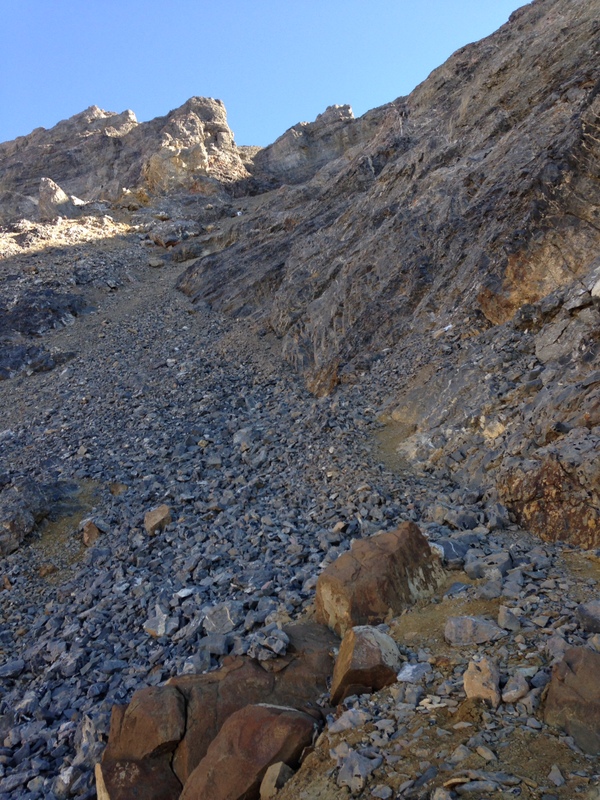
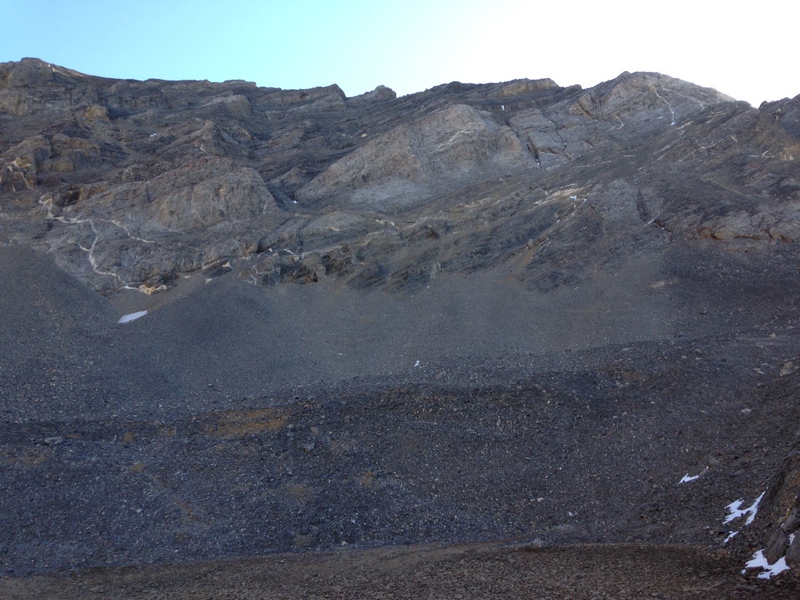
Giant talus slopes on the way to Donaldson Peak.
Above treeline, you find giant talus slopes to ascend. You can find good footing most of the way on these slopes and any number of lines to climb to the tarn at the base of the headwall.
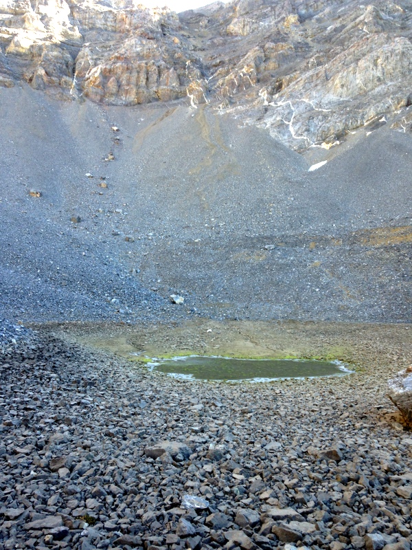
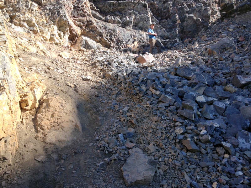
This pond is a good point to take a break.
After climbing over the talus and up a steep and usually dry waterfall, you reach this pond. This is a good place to take a break, fuel up, and observe the next part of the climb: the headwall.
The headwall is a formidable-looking collection of cliffs and talus chutes above the pond. However, from the pond, there are two good lines that lead through the headwall features to the Church/Donaldson Ridge.
The traditional approach is shown on the left, in blue. This route climbs a steep talus pile and then follows a rubble-covered shelf up and to the right. The approach on the right (shown in red), follows steeper and more exposed ledges. However, both routes meet above the first series of cliffs, about midway up the headwall.
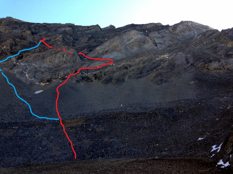
The two approaches that lead up the lower half of the headwall from the pond.
The ledge on the red approach.
The red route climbs talus to the snow patch shown in the prior photo and then climbs this ledge.
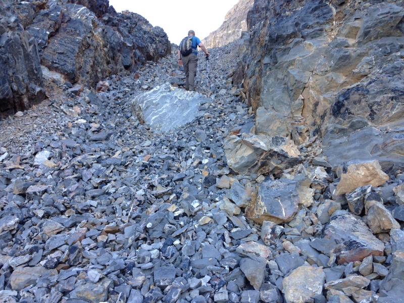
The talus chute.
From the top of the ledge in the prior photo, the red route turns hard left and climbs a shorter ledge that ends at the top of this talus chute.
The point where the red and blue routes meet.
This photo is taken from the point the two routes up the lower headwall meet. From here, the route continues up the base of the line where hard rock and talus meet in this photo from lower right to upper left.
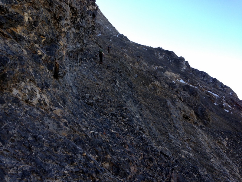
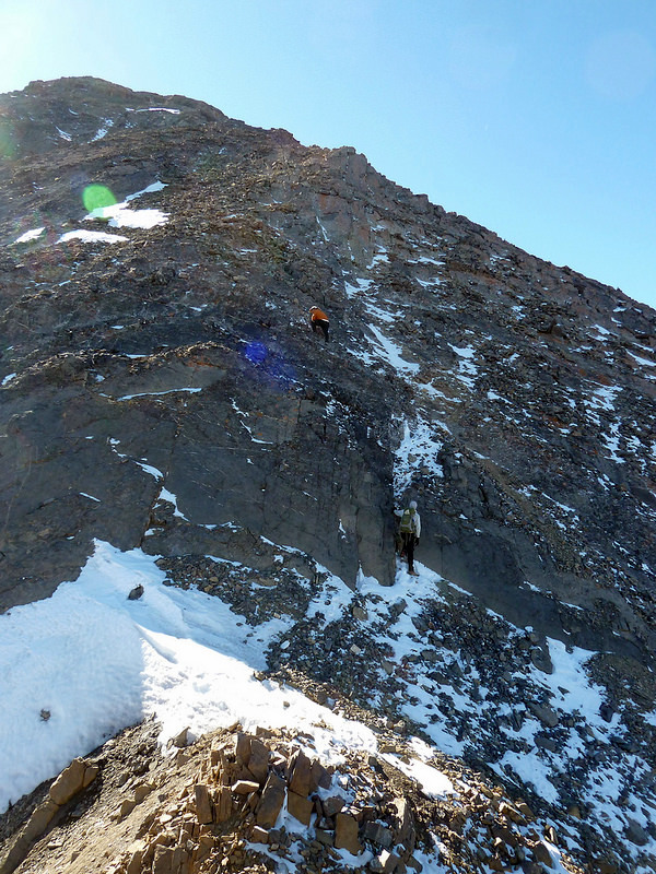
The higher you go, the steeper it gets. Andrew Chiles Photo
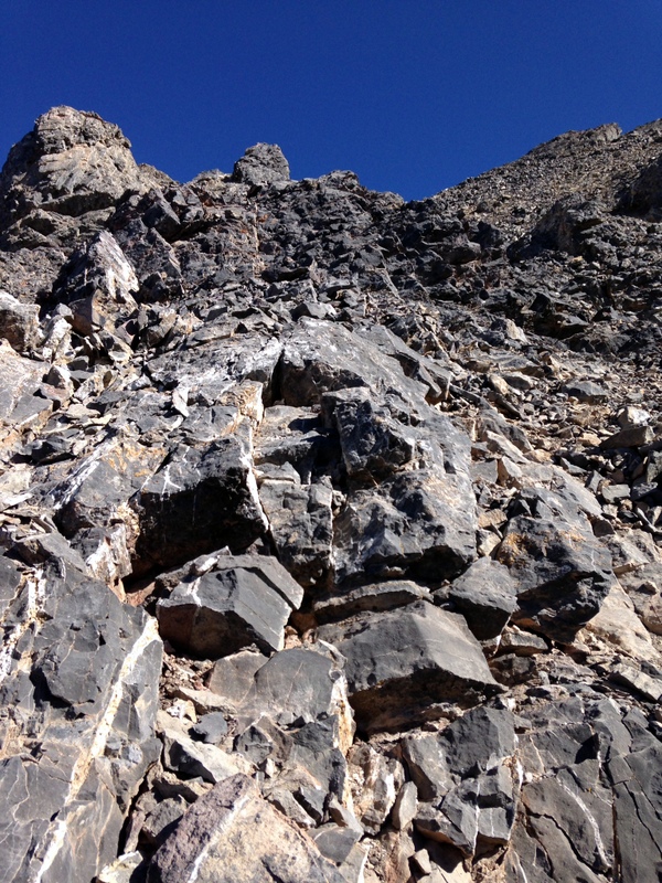
When climbing the upper half of the headwall, you find several alternative routes. I do not think one is better than the other.
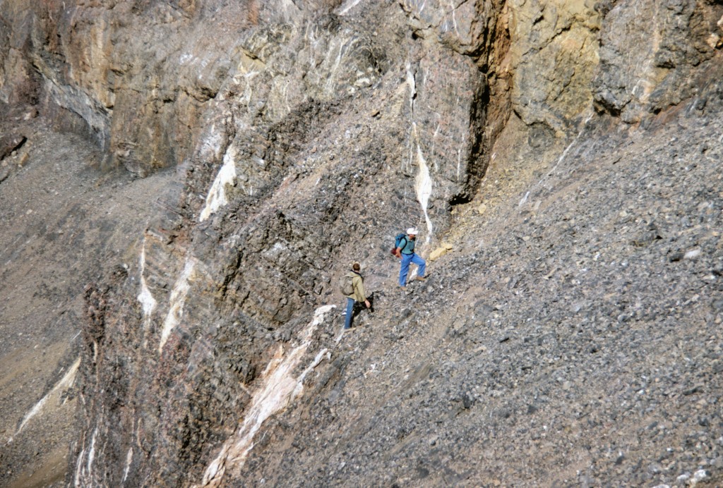
The upper half of the headwall.
Steep and loose footing all the way.
In addition to being steep, the entire headwall is very loose. Care needs to be taken the entire way.
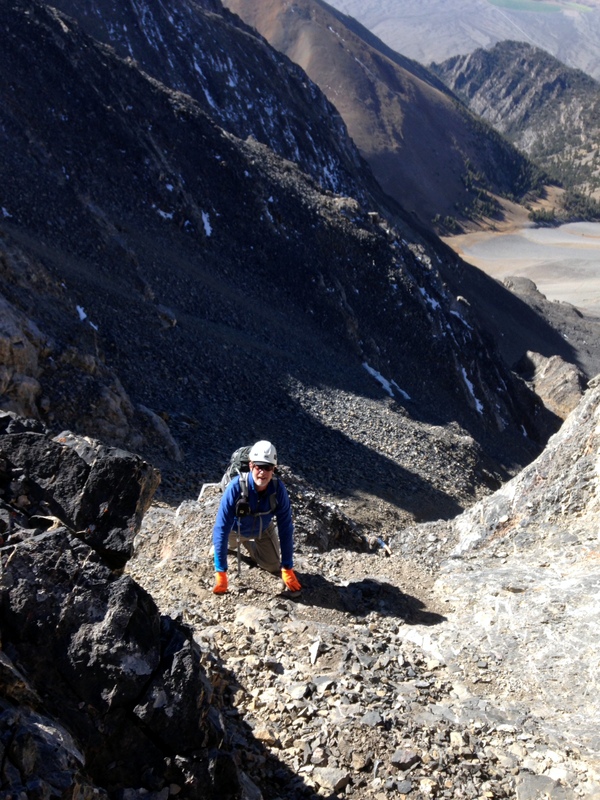
Dan Paulson showing a good deal of common sense by wearing a helmet.
Helmets should be considered a necessity on a lot of Lost River Range peaks, including this one.
A more solid rock rib.
My choice is to avoid the talus whenever possible. I scrambled up this rock rib for the final push up to the Church/Donaldson Ridge.
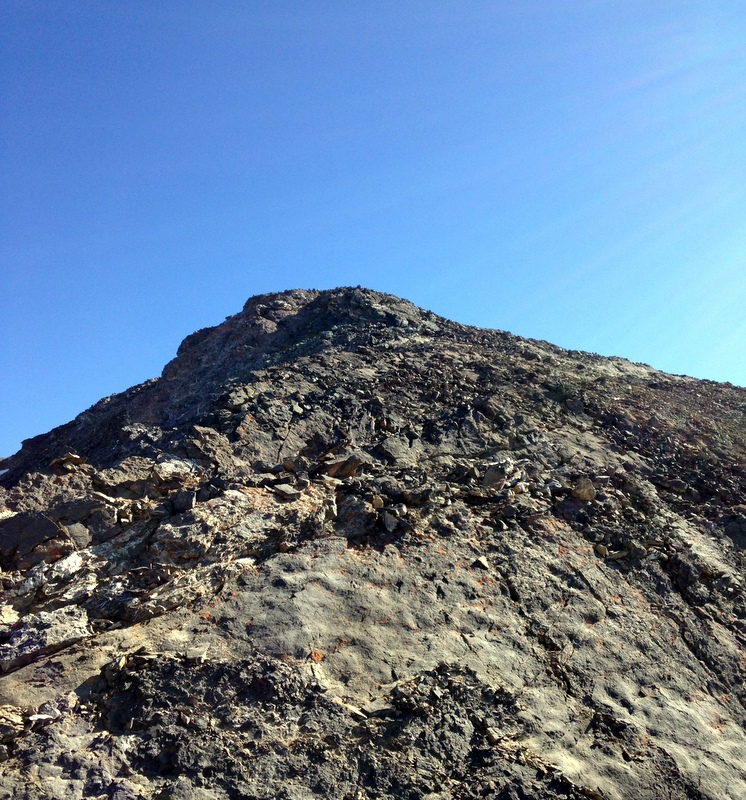
The summit finally comes into view and it is close once you reach the ridge crest. You find that you are well above the low point of the Church/Donaldson Ridge.
The summit of Donaldson Peak.
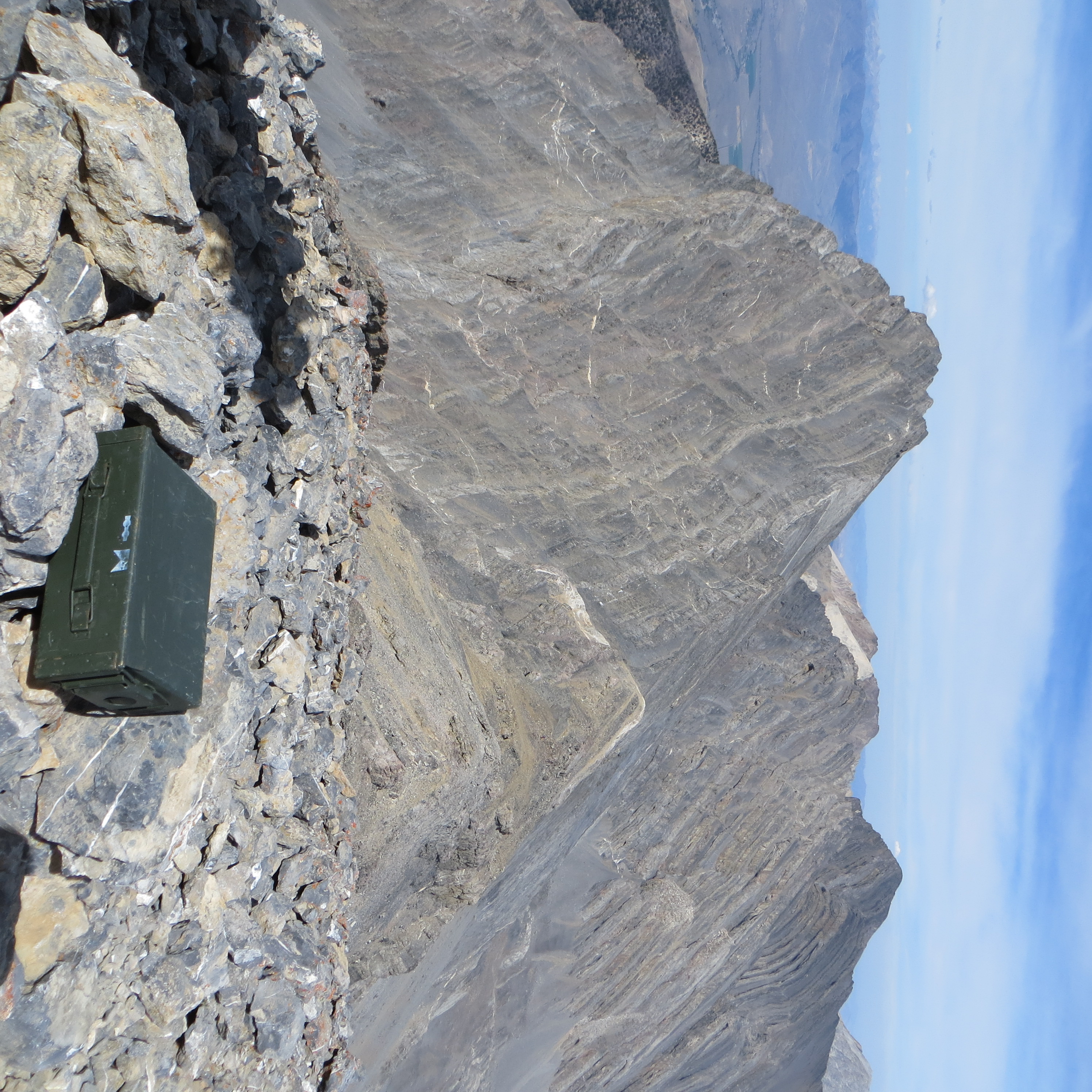
The summit of Donaldson Peak with Mount Church in the background. Steve Mandella Photo
Donaldson Peak is most often climbed via the Church/Donaldson headwall but can also be climbed via the ridges connecting it with its two neighbors, Mount Church and No Regret Peak.
North East Ridge Route, Class 3
Donaldson’s Northeast Ridge climbs 400 feet of steep terrain from the ridge connecting the peak to No Regret Peak. I descended and then climbed this ridge with Andrew Chiles and Mark Jones while attempting to traverse over to No Regret. The ridge is composed of steep slabs (mostly covered with loose scree) and it takes a little time to navigate the lower sections.
Climbing the Northeast Ridge of Donaldson Peak. Mark Jones Photo
Return to the Idaho 12ers Page.
Additional Resources
Regions: EASTERN IDAHO->Lost River Range
Mountain Range: Lost River Range
Year Climbed: 1987, 2014
First Ascent Information:
- Other First Ascent: First Winter ascent via west face and south ridge.
- Year: 1975
- Season: Winter
- Party: W. March and R. Albano
Pingback: From Diamond Peak to Hyndman Peak: Kelly Lance’s 12er Traverse by Tom Lopez - IDAHO: A Climbing Guide