Elevation: 10,100 ft
Prominence: 320
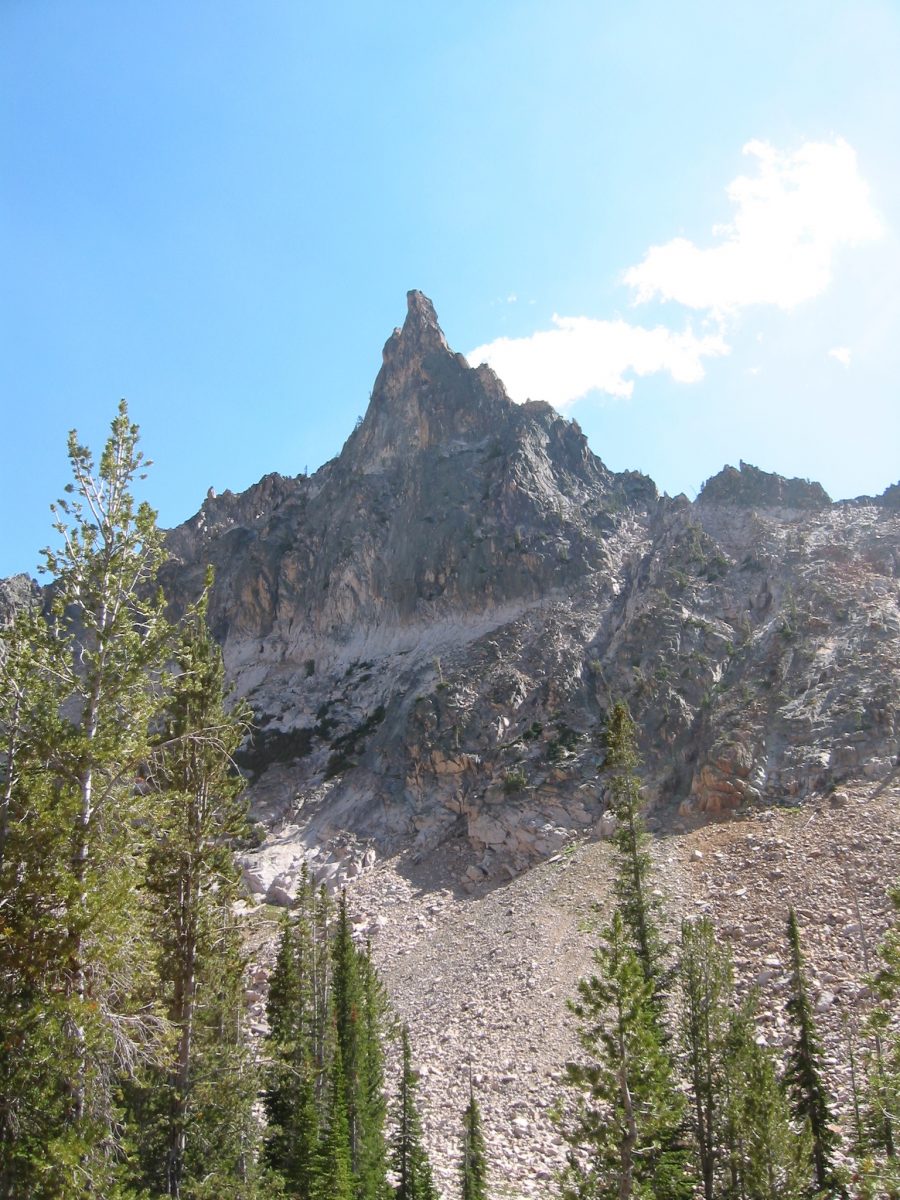
Climbing and access information for this peak is on Page 196 of the book. The peak is misnamed in the book as Mayan Temple. Ray Brooks explained the confusion has extended since 1972. Ray reports “ In Sept. 1972, we did make a nice first ascent of a pinnacle on the ridgeline just north of Japan Peak. We named the pinnacle the Mayan Temple. When we ran into Sawtooth legend Louie Stur on our way out and told him what we had been up to. He misunderstood us came to believe that Japan Peak was our Mayan Temple.” From that point on both names have been used by climbers. As things would happen when I interviewed Louis Stur while writing the first edition of the book he told me Japan Peak was Mayan Temple. As things would happen Off Belay Magazine used Louis Stur for a source for a 1975 article on the Sawtooth Range and the article misidentified Japan Peak as Mayan Temple. From that point on both names have been used by climbers. Thanks to Ray we know the location of the “real” Mayan Temple. Hopefully, now the matter is set. Japan Peak was the original and correct name and Mayan Temple is properly located.
There are five routes listed in the book. The “East Ridge” route is the standard route. Pat McGrane provided a detailed description of this route which is set out below. Pat has pointed out that the “East Ridge” is more appropriately identified as the “Southeast Ridge.” Updated December 2023
Japan Peak is located northwest of Packrat Peak. This peak is seldom climbed due to its remote location and the proximity of a bigger prize, Warbonnet Peak. USGS Warbonnet Peak
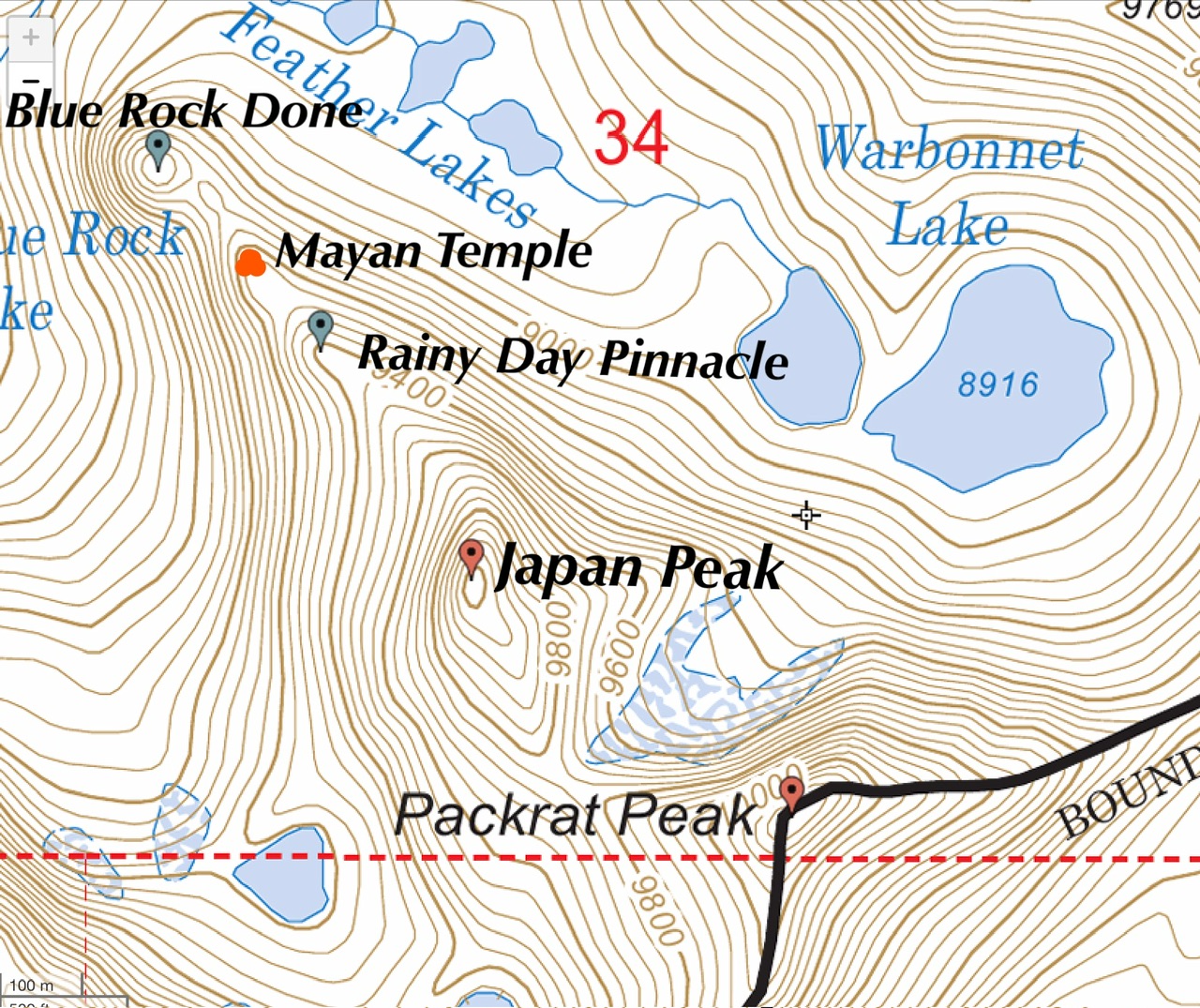
The Mayan Temple sits between Blue Rock Done and Rainy Day Pinnacle.
John Platt remembers “Tom McLeod and I ‘accidentally’ climbed [Japan Peak], trying to climb Warbonnet. It was not difficult but, without a rope, was exposed Class 4 or 5. Tom, being way faster than me in such terrain, was well ahead when I heard ‘Oh, F***!’ from above me. Not knowing if he had fallen, I continued on. I recall a somewhat broad summit consisting entirely of loose boulders. As I gingerly picked my way up through that, there was Tom, pointing and exclaiming, ‘There’s Warbonnet over there!’”

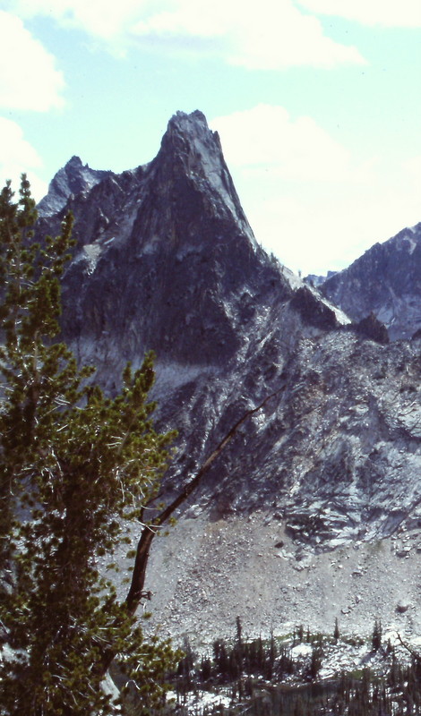
Mayan Temple. John Platt Photo
Access
Access the formation from Warbonnett Lakes. [(A)(6)(c.3) Page 207]
Southeast Ridge, Class 4
Access
The route starts on the Japan Peak-Packrat saddle. The saddle can be accessed in three ways:
1. Scramble up boulders and horribly steep talus from Warbonnet Lake (unaesthetic but quick).
2. Make three 30 meter rappels down the south and west side of Packrat Peak and traverse over on easy terrain.
3. Hike from Warbonnet Lake around Blue Rock Dome to Lake 9352. Don’t drop down to Blue Rock Lake, instead stay just below the dome on an awesome rock slab. Upon reaching Lake 9352 scramble due north on easy talus (very aesthetic)
The Route
From the Japan Peak-Packrat saddle gradually scramble towards an area of vertical cracks in the middle of the south face. These cracks would probably go at middle 5th class. Instead, follow a steep ramp to the right and scrabble 200 feet to the top. There is one short section which requires traversing into the top of a wide chimney which is scary Class 4. A fall here would likely be fatal, so bring a rope. The summit is not far beyond. To return, you can reverse your route or rappel down the south face from a bolt and a fixed stopper (bring some new sling!). We used two 60 meter ropes. It may be possible with a single 70 meter rope, but I can’t guarantee it.
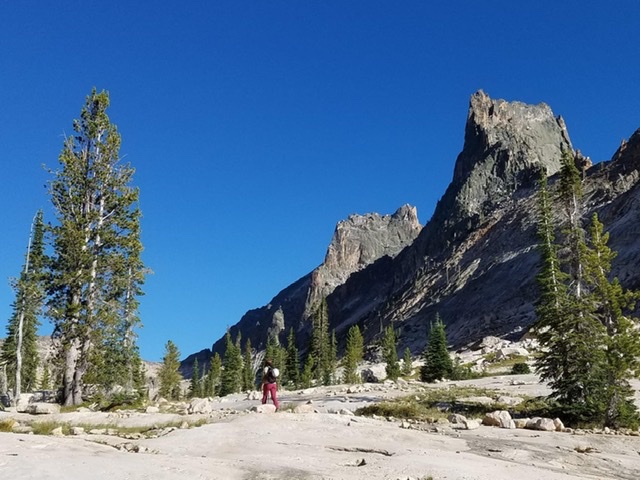
Mariah Smith with Packrat Peak (left) and the Japan Peak (right). Pat McGrane Photo
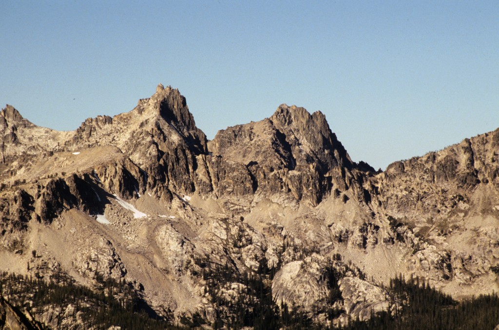
Packrat and Japan Peak as viewed from Elephants Perch.
The Japan Peak at its most spectacular as viewed from the col above Bead Lake.
Additional Resources
Mountain Range: Sawtooth Range
First Ascent Information:
- Other First Ascent: Northwest Ridge
- Year: 1978
- Season: Summer
- Party: Kirk Bachman, J. Splitgerber and A. Dzmura
- Other First Ascent: Northeast Ridge
- Year:
- Season: Summer
- Party: Kirk Bachman
- Other First Ascent: West Face
- Year:
- Season: Summer
- Party: Jeff and kelly Rhoads.
Longitude: -115.04816 Latitude: 44.061053