Elevation: 9,495 ft
Prominence: 755
This peak is not in the book. Published November 2022
Peak 9495 is the high point on a ridgeline that separates Frenchman Creek from Smiley Creek in the Sawtooth Range south of Stanley. It sits northeast of the old townsite of Vienna. Peak 9495 can be climbed either from the end of Frenchman Creek Road or from Smiley Creek Road just before its bridge crossing of Smiley Creek and before reaching the Vienna townsite. USGS Frenchman Creek
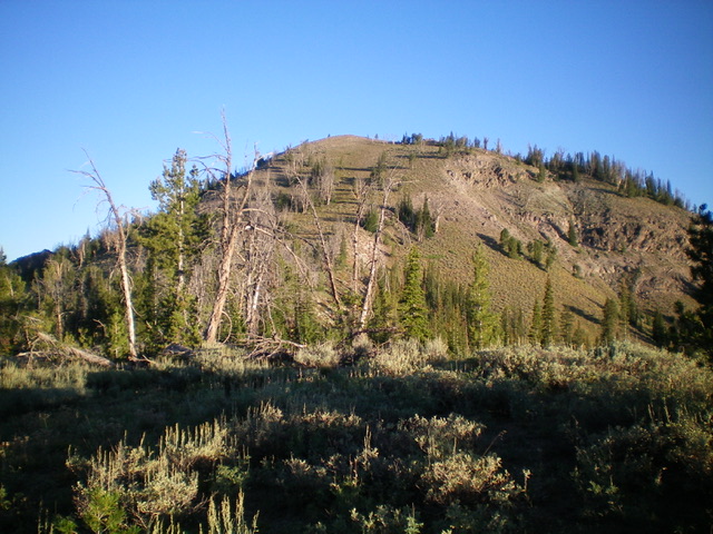
Peak 9495 as viewed from the north. Livingston Douglas Photo
Map Errors
The USGS map incorrectly shows Frenchman Creek Road as continuing south (and then switchbacking west up onto a ridge) much farther than it exists. The road is completely gone after the road’s end/road closure. There isn’t even a footpath after that point. There are some old, overgrown mining roads not shown on the USGS map that are still in this area.
Access
From ID-75, turn left/south onto poorly-signed Frenchman Creek Road/FSR-195 (this turnoff is 0.3 miles west of the [signed] Salmon River Road turnoff). Reset your odometer at the start of Frenchman Creek Road. At 1.0 mile, go right at an unsigned junction. At 5.1 miles, reach the end of the road and a dispersed campsite on the left side of the road just before the road blockage. There isn’t much parking space at the road’s end, so the campsite makes for a good, safe place to park (7,865 feet). GPS coordinates: 43⁰49’00”N, 114⁰47’36”W. This is the first leg of a 5-peak adventure that includes Peak 9495, Peak 9303, Peak 9599, Peak 9540, and Peak 9818.
East Face/Southeast Ridge, Class 2
The Climb
From the campsite, cross to the west side of Frenchman Creek Road and scramble west up a steep, open slope of scrub, gravel, and scattered pines (not too loose) to reach semi-forested Point 9027, crossing an old mining road twice on the way. From Point 9027, descend north down through an easy pine forest, dropping 50 feet to find a semi-open saddle and a narrow ridge that heads northwest to Peak 9495. The climb up from the saddle is in open scrub and loose gravel. Stay to the right/northeast of the face near the edge of the ridge for best traction. Peak 9495 is a ridgeline summit with a decent cairn.
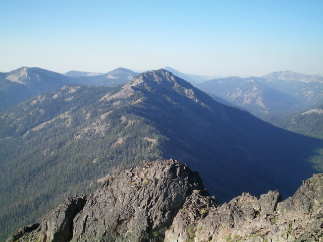
The summit hump of Peak 9495 as viewed from high on the southeast ridge. Livingston Douglas Photo
South Ridge, Class 2
The Descent
From the summit, return to Point 9027 then head south in mostly open scrub/gravel down to a semi-forested saddle at 8,700 feet. This is the connecting saddle with Peak 9303 and concludes the first leg of today’s 5-peak adventure. Peak 9303 is up next.
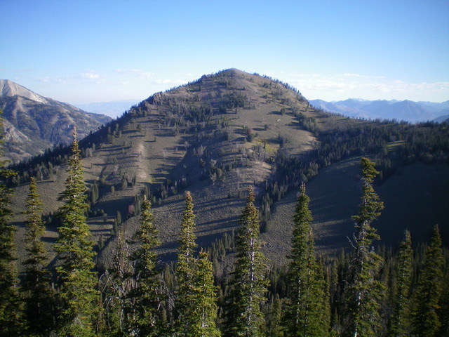
Peak 9495 as viewed from Peak 9367 to its north. Livingston Douglas Photo
Additional Resources
Mountain Range: Sawtooth Range
Longitude: -114.80969 Latitude: 43.82409