The Peale Mountains are associated with the Basin and Range faulting and the over thrust belt. The block faulting is not as pronounced as ranges farther west. Meade Peak is the range high point at 9,957 feet. There are a lot of great peaks in this mountain group. Check out Hawks Peak and Mount Mansfield for starters.
The range receives little more than 24 inches of precipitation per year and, consequently, is somewhat dry in appearance. Large stands of pine and fir are interspersed with thick aspen stands, while thick brush fills many creek bottoms. The high ridges are bare of trees. Valley-to-summit elevation differences can be substantial and sections of the range are quite rugged. This mountain group is made up of eight subranges and ridges: Aspen Range, Dry Ridge, Freeman Ridge, Grays Range, Pruess Range, Schmid Ridge, Webster Range and Wooley Range.
Rick Baugher has extensively explored the Peale Mountains and climbed most of its peaks. He notes that the section of the Peale Mountains is “hand shaped.” Rick relates that Georgetown Saddle forms the hand’s “Wrist.” He states from “the ‘wrist’ the subranges and ridges spread out like fingers.” The fingers from west to east are the Aspen Range, the Schmid Ridge, Dry Ridge and Freeman Ridge.
The Peale Mountains are covered in the book on pages 367 to 369. All Peale Mountains peaks included in the book can be found at this link: Peale Mountains Peaks
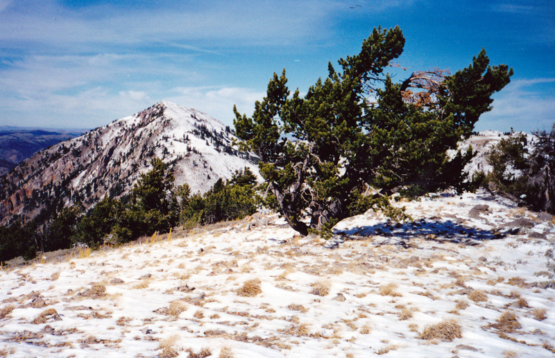
The summit of Mount Mansfield looking toward Meade Peak (10/26/01). Rick Baugher Photo
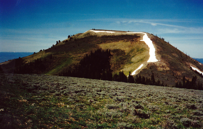
Yet another Idaho peak named Bald Mountain! This one is located in the Pruess Range northeast of Montpelier, Idaho. This view is west from the Home Canyon/Bennington Canyon Divide (5/30/01). Rick Baugher Photo
Wilson and Pelican Ridges by Rick Baugher
The geologist/geographer George Rogers Mansfield called the mountains bordering the north shore of Blackfoot Reservoir the “Wilson and Pelican Ridges.” He identified this 12-mile long topographically prominent grouping under the catch-all heading “Independent Features.” Surrounded by stream bottoms and a lava field, these ridges don’t connect to other mountains. This area can be considered a northwest outlier of the Peale Mountains since the Peale Mountains is a grouping of related features in this part of Idaho.
Although not particularly noticeable from most directions, Wilson Pass divides the two ridges. The two-track road through this pass, which connects Grays Lake and Blackfoot Reservoir, was constructed in 1858. This was part of the Lander Cutoff of the Oregon Trail, a federal emigrant road that went from South Pass to Fort Hall.
There are 5 ranked peaks here. Limerock Peak (7,488 feet elevation; 838 feet of prominence) is the high point of the Wilson Ridge section. Camp Peak (7,726 feet elevation; 1,271 feet of prominence) on Pelican Ridge is the overall high point. Both of these summits were used for triangulation by the USGS in 1915, the year Blackfoot Reservoir became operational.
Most of Wilson and Pelican Ridges is on a contiguous block of State land. Sheep grazing is a predominant activity on the brushy southwest-facing slopes. Best access is on the southwest side. From paved ID-34 at Henry, drive the graded North Shore Blackfoot Reservoir Road to any desired point to begin a hike.
Regions: Peale Mountains->SOUTHERN IDAHO
Mountain Range: Peale Mountains