There were three writeups for the Splinters from 1948: 1) Ralph Widrig in The Mountaineer (Seattle), Vol. 39, No. 14 (1948), 2) W.V. Graham Mathews in Appalachia, Vol. 47 (1948), and 3) Fred Beckey’s AAJ, Vol. 7, No. 2 (1949).
Between the three writeups the following can be derived; a) the Splinter Towers “guard one of the ridges from Mt. Heyburn which runs west and south toward Alpine Lake”, b) Thimble was the “first” or lowest if coming from Heyburn area, c) Thimble had 200 feet of “high angle slab” requiring at least two pitons for last 40 feet, d) started on north side of Steeple then moved to the west ridge on a friction slab with no pitons needed and a very small summit, and e) Splinter Tower was the highest at “10,200” and was climbed via a fourth class route on the south face over six or seven leads.
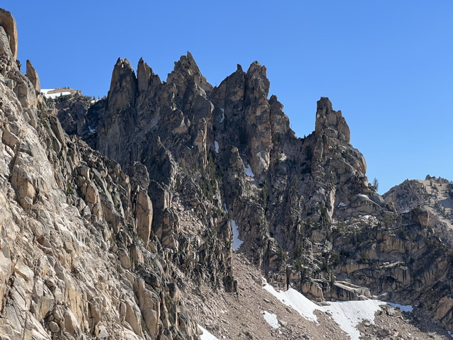
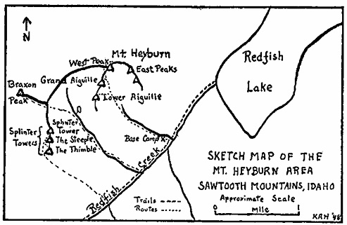
From these descriptions, the map and poor photo (see below) from Mathews, and a photo (also below) from Derek: I am fairly certain of the location of the Splinters now. Its interesting to note that similar features appear on both Mathews’ photo and Derek’s albeit slightly off due to location.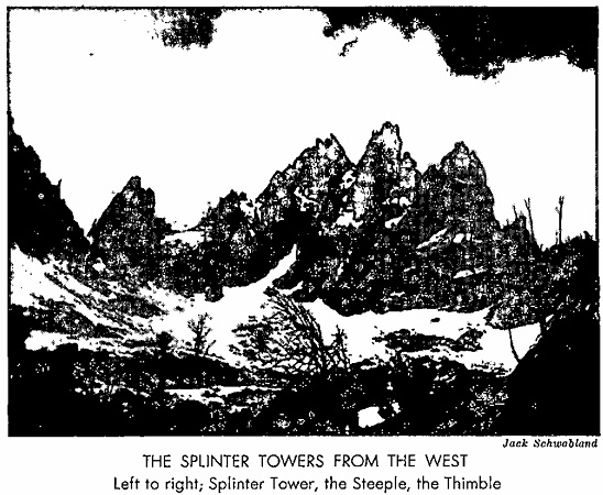
Splinter Towers. Derek Percoski Photo